While growing up, my father would often load our large family into the car and go on a drive. These drives would often involve dirt roads and somewhere along the way, a rickety wooden bridge. We explored just about every road we could in Laurens County, sometimes extending to the surrounding counties. I think it was these early experiences that gave me my love of cruising around, and now taking photographs of the rural areas that are now vanishing at an alarming rate. Such tiny roads are now near impossible to find in the sprawl of Greenville County.
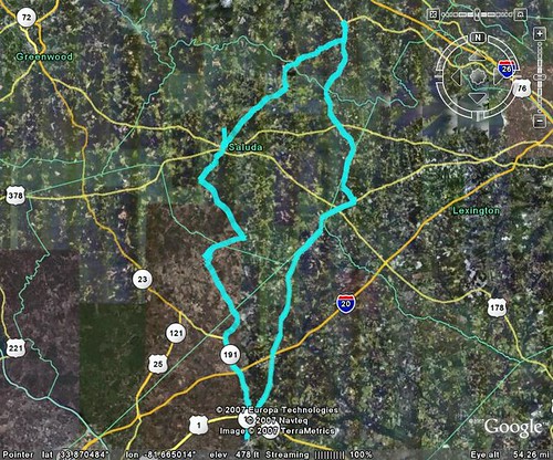
Over the years my dad and I have had a standing engagement at the Southern Home and Garden Show. This year I decided that it was too nice outside, and that what we really needed was another one of our explorations. I picked up my father and mother at their Prosperity home, and we headed south over roads I’d never driven before.
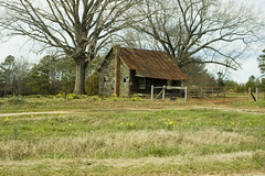
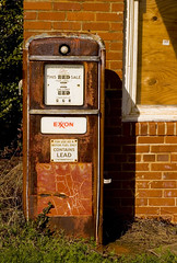
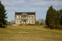
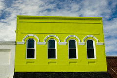
As we drove southward, noticed lots of daffodils in bloom. It was easy to spot the old homeplaces, even when the houses were long gone, as these would be surrounded by daffodils and usually large trees. We would stop to take pictures of old buildings and unusual items.
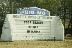
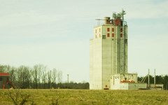
Our route took us across Lake Murray, and into the town of Batesburg-Leesville (map). I’m not sure which was Batesburg, and which was Leesville, and I guess it doesn’t matter anymore. From there, we headed southwest, aiming toward Aiken. We passed large fields of peach trees, grain elevators (which I didn’t know we had in South Carolina), and several smaller communities. In the community of Moneta (map), we even found a drive-in theater that was still in operation.
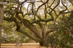
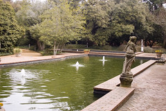
Finally, we entered the city of Aiken. The central portion of the town features incredibly wide streets with a broad median separated the opposing lanes. This is the case for almost all of the streets, not just the main street. We road through the neighborhoods and eventually made our way to Hopeland Gardens (map). There we took a few minutes to wander among the live oaks and camelias.

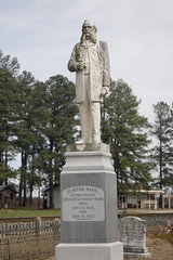
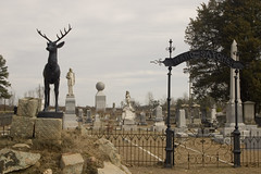
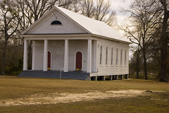
We had lunch in Aiken, then headed north toward Johnston, SC (map). From there, we made our way to Saluda, SC, then to the community of Ward. We had been joking that Ward (map) was our ultimate destination, since it appeared as just a spot on the map. It turned out to be a fascinating little community. Spann Methodist Church is on the Historical Register of Places, and is a little white frame building in Greek Revival style. The cemetery has some unusual statuary, including the imposing figure of Clinton Ward, complete with a most amazing moustache.
Finally, we made our way back to Prosperty, pausing to take some more shots along the way. Back at the house, I used Robogeo for the first time to match the photos we took with our GPS track. Along the way we managed to hit one dirt road, but no rickety bridges this time.