This is Part Two of a three-part post…
After our marvelous breakfast at Howard’s in Moncks Corner, our group of adventurers from Lowcountry Unfiltered set forth for more exploration. Our target was the Bonneau Ferry Wildlife Management Area, which has only recently been opened to the public. Weather was rolling in quickly, and severe thunderstorms were already hitting the upstate. We had a finite window of opportunity.
Bonneau Ferry WMA encompasses 10,700 acres of pine savannahs, bottomland hardwoods, wildlife openings, wetlands and reservoirs along the banks of the Cooper River and East Branch of the Cooper. The eponymous ferry is actually on the southern part of the WMA, along the banks of the East Branch. Our target was the western portion of the tract, along the banks of the main branch of the river. We would start at Strawberry Chapel and explore the area around Comingtee Plantation.
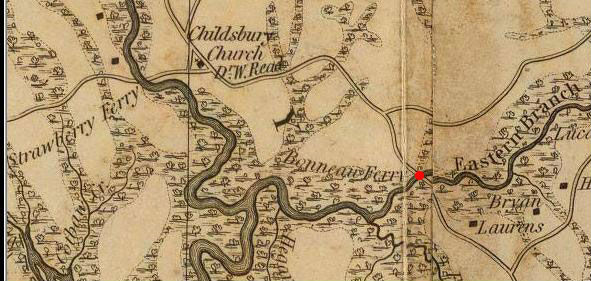
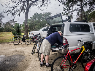
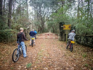
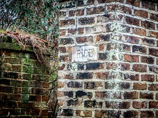
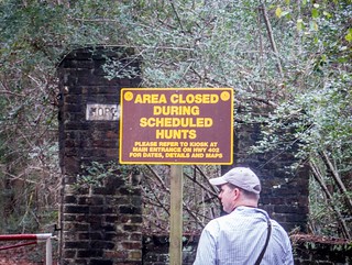
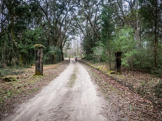
After a couple of missteps, our caravan eventually made it to Strawberry Chapel and the Childsbury Heritage Preserve. We unloaded our bicycles and the six of us headed out, initially heading back toward the main road. We turned down the paved Dr. Evans Road, which ended at a barricade and brick pilasters with the words “Rice” and “Hope” embedded on them. A hard-packed dirt road continued past the barricade, and non-motorized traffic only was permitted further.
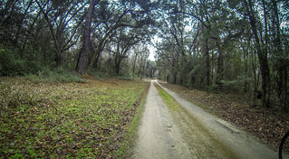
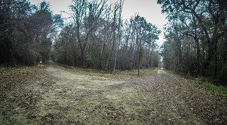
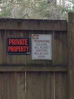
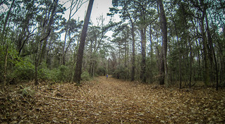
As we traveled down the road, side roads ventured off to the east. Some of these connected with ponds and other landmarks within the WMA. To the west there were some private homes lining the river. Having explored the area by car last summer, I knew that there were some lovely homes right at the water’s edge, but those closer in were a bit…sketchy. Some of these didn’t seem to be happy about having public access lands so close to their property.
It turned out to be a relatively short ride to our first target. I had marked the location in Google Earth, but had forgotten to upload the coordinates to my GPS.
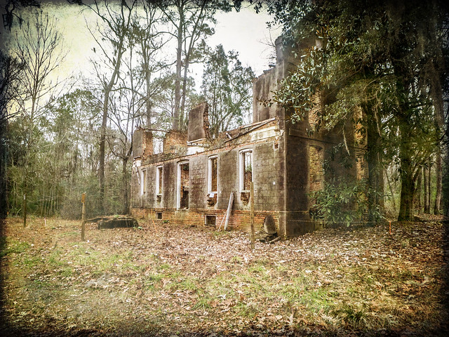
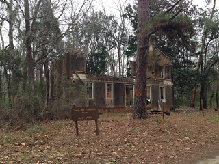
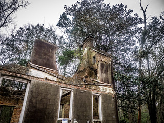
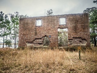
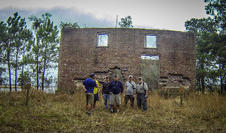
Turns out I didn’t need to worry. Two small brick columns marked the entrance to the plantation. The old Comingtee Plantation House ruins were right on the road, just to the left. There was no way to miss them.
According to the South Carolina Plantations website, the plantation got its name from one Captain John Coming, who settled the area possibly as early as 1669. Coming’s land was at the confluence of the Cooper River and East Branch of the Cooper, forming something of a “T” intersection on the waterways. The region became known as “Coming’s T”, and later “Coming Tee” or “Comingtee.”
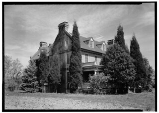
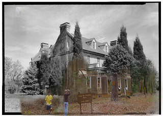
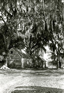
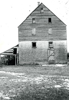
The land was passed down to Coming’s half-great-nephew, Elias Ball, in 1698, and it remained in the Ball family for over 200 years. The current house was constructed in 1738, with extensive reconstruction after storm damage in 1893. As late as the 1940’s the house was still an impressive structure, as seen in this photo by Fred D. Nichols found in the Library of Congress archives:
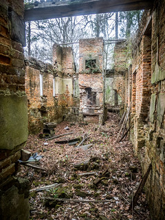
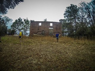
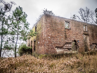
Signs are posted to prevent climbing on the fragile structure and collection of bricks and other artifacts. We walked around the structure, taking photos along the way.
Toward the rear of the house I spotted an addition and trenched area that we suspected was the kitchen because of the way it projected from the main structure. The photo fro 1940 shows that it was a wing, and not just a kitchen. Reading about the history of the house, this wing was the original wooden home build in 1738. The main brick house was added later.
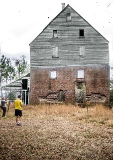
I created a composite shot in Photoshop showing the 1940 image with the ruins as we found them:
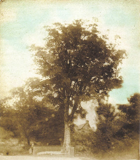
While the ruins were spectacular, there was something else in the area we wanted to find. The book Weird Carolinas describes the “Robintation Tree”, a supposedly cursed tree located near the Comingtee house. According to the book, the tree is growing from a slab boulder which was the grave of an Indian chief (but of course, don’t all cursed trees do that?) “A ghost lived in the tree, they [the plantation residents and slaves] claimed, and as long as the tree stood untouched, no serious harm could ever come to those who lived in the house or on the property.” Supposedly root doctors were taking pieces of the slab and leaves from the tree to the extent that the Ball family had to erect a fence around it.
Of course, the original curse, “those that live in this house should be protected as long as this house is untouched,” somehow got warped into “anyone that touches the tree will die.” Here’s some more information about the tree from a 1909 recollection by Anne Simons Deas:
Proceeding up the road towards the dwelling-house, we first notice, on the left, some low ground leading down to the mill-pond, with two pretty oaks beyond. This is “Cuffee’s Dam.” “Missis’ Groun'” lay to the right. A little further on we come to the “Robintation Tree,” a tall and once extremely handsome live-oak standing on the edge of the right-hand side of the road. The great bough on the east was cut down by the negroes [sic] about thirty years ago to get the honey from a hive of wild bees that had unfortunately setted [sic] in it; but the other half remained “a thing of beauty” until the great storm of 1893 robbed it of its last claim to special attractiveness.
The “Robintation,” we must explain, was a ghost of a style peculiar, apparently, to the Ball negroes or the Ball habitat, as the only similar one that I ever heard of haunted the road near Kensington and was known as the “Somet’ing in Kins’ton Path.” The Robintation appeared first as a small animal, like a cat or a dog crossing the road at this point ; it grew, as you looked, into something as large as a hog; and then into something as large as a calf. What it became after that no one could ever tell — for no one ever stopped long enough to see.
Opposite the Robintation Tree, at some little distance, is the negro burying ground, a grove of tall hickories, white oaks, etc. Shade and silence reign there, and under the carpet of fallen leaves lie generation upon generation of a simple people, who were, in the main and according to their lights, faithful and attached to their masters.
Here’s another image of the Robintation Tree from the College of Charleston’s Lowcountry Digital Library collection:
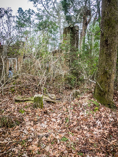
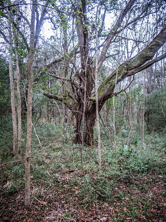
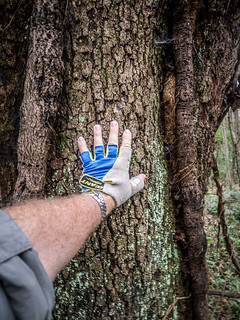
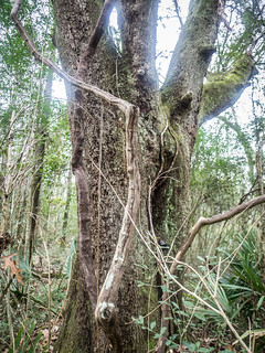
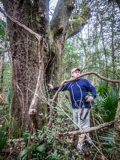
Cursed or not, we had to try find this tree. Using the image from Weird Carolinas as a point of reference, we tried to match the view with candidate trees in the forest across the road from the house. Soon we found an old live old that matched the roofline and looked like a possibility. We declared it to be the tree, and those brave enough or skeptical enough reached out to touch it.
Google Earth had indicated another set of ruins nearby. Having braved the curse, we set off to find the ruins of the old rice mill on the banks of the river. Just back down the road another path branched off toward the river. The Lowcountry Digital Library imagery indicated that this road was once lined with slave cabins, tucked in under the Spanish moss and live oaks.
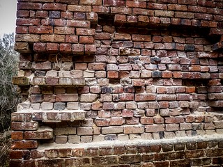
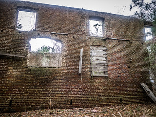
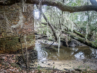
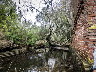
The Stoke Rice Mill was an impressive brick structure right on the banks of the Cooper River. The same warning signs we had seen at Comingtee House were present here. We carefully walked around the structure taking photos from just about every angle. It appears that the river is slowly eating away at the bricks as the path of the river meanders toward the structure.
As with the Comingtee House, the original structure was much more imposing. The remaining brick portions were just a tiny part of the overall building. A wooden superstructure extended upward for two more floors and an attic.
I created another composite showing the complete image above superimposed on the ruins that we found.
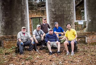
We posed for a brief group photo, then mounted back up on our bikes.
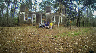
The guys decided that we really needed one more group photo in front of the Comingtee House. We headed back that way and stopped on the steps for another shot.
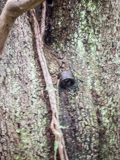
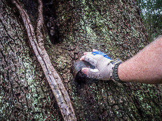
While there, we decided to double-check the Robintation Tree. As we were rambling around, Matt found another candidate. He was more convinced of this one because an iron ring was embedded in it, as if it had been part of a fence. However, the angle wasn’t the same as the photo from Weird Carolinas. At this point, who is to say which of these trees is haunted. If one is, most likely they all are. We touched this tree, too, just make sure our bases were covered.
By this time it was getting to be lunch time, and the weather continued to look iffy. We headed on back down Comingtee Road back toward Strawberry Chapel and our vehicles.
Next up, we visit several sacred locations along the Cooper River to purge the curse from our hands.
Here’s a link to my notes about the area with some links, and here’s a map of those locations:
View Comingtee Plantation in a larger map
One final note: It looks like there is lots more to explore in the Bonneau Ferry. I’d love to come back with the bikes and ride some more. There are lakes and other views of the river. There may also be some kayaking opportunities along here.

Beautiful pictures & haunting history, a magical combination. I love your posts.
We walked around Comingtee for about 5 hours today on both sides of the road all over the woods. I was comparing the trees that you guys found to the one from Weird Carolinas and I don’t think it is either of those. The last one you found with the iron ring on it would definitely not be it because no one would have ever touched it to put the ring on it. Both tree trunks look too “stumpy” while the one in Weird Carolinas is taller and more of a stretch up to the branches. Of qaaaaaaaaaaaaaaaaaaaaaaaaaaaaaawI know 200 years can change a tree but it’s just my opinion. We found two trees that we compared to the proximity of the house in the ‘Weird’ photo and both could be a match as far as looks. One of the trees had an iron post very close to it that could have been part of the fence. Both ground areas had grown up so the stone the tree grew out of would have been covered.. Matt told me to walk directly across the road from the house steps which is what I did initially. Our second attempt we went a little left of that. We searched the woods all the way back to the road on the other side. We will definitely be going back. I think we also found the slave burying ground.
My cat typed the “qaaaaaaaaaaaaaaaaaaaaaaaaaaaaaawI” It was supposed to say “Of course I”
Hi Pam,
You found the burial ground? Cool! I feel pretty good about locating the tree…but we never even attempted to find the slave cemetery. It had already been a long day and a mighty storm was upon us. Since a number of us had touched the tree it is probably best we didn’t risk any hain’ts in that place!
As my name implies, I’m a former resident of Rice Hope. I came across this post by chance when reading your articles about the lakes.
I’m actually surprised you didn’t mention Rice Hope Plantation, which is just up the rode from the location in this post. (It’s now a B&B.) I grew up on Rice Hope Dr., which is just a stones throw away from where you are standing in these pics, so I know of all of these legends you spoke of.
I must say you tell them beautifully!
However, you left out on the more obscure legends that surround that area. According to local legend, one of the local Plantation owners ( I cant remember if they were from Comingtee or Rice Hope because it’s been soooooooo long) but the owner hid their most valuable gold and jewels under the old rice mill during the civil war to keep it safe from the Yankees.
Rumor has it these items have never been found.
Maybe you should go back and try and find them! I’m just joking, but in all honesty, I looked at your pics and my eyes watered because of all the memories I have of Strawberry Chapel, Rice Hope, and that whole area.
So thank you for putting these pics up for the world to see.
However, it makes me sad too.
I, myself, visited the place a few years ago, and i just shook my head at all the changes I saw. The closed off, boarded up houses you saw on your trip belonged to the parents of friends of mine, and the local ramp (which was open to the public) was now closed off because of ‘divers’. My friends that lived along the river were forced out of their homes and off their land for the sake of history.
It’s a shame really, but what can be done now?
Anyway, thank you for putting your experiences out there for us to read. I really am thankful to be able to visit your blog, and see this place where I grew up.
Signed,
A Former Resident that lived at Rice Hope in the 80’s.
Thank you so much for the additional information! Rice Hope sounds like an interesting place, and we’ll certainly have to check it out the next time we are down that way.
The silver was actually found in the 1940s by Martha and Grover Sullivan. Martha and Grover are actually my great-great aunt and uncle. I asked her yesterday when she had found it. She said she couldn’t quite remember, she thinks it was 1946. The silver belonged to Srawberry Chapel and Biggins Church. After they found it, they gave it back to Strawberry Chapel since Biggins is only ruins. It can now be found Downtown in the Loebelein Gallery in the Charleston Museum. Its really a great story!
I
Dear Former Resident,
I stumbled on this post as well. While the post of the bike riding explores was interesting, your comments as one who actually lived in the area, carried a greater potency. I too was saddened by your reference to the friends and family that were forced to move in the name of ‘history’ – would it be any less historical if those people were allowed to stay? Do you know what became of them?
I hope all is well with you, continued blessings.
I just spent the day working at Richmond Plantation (which is being restored) and came straight home to research the area. I am eager to get back to explore. Thank you for your post as we must certainly bring our bikes. I actually painted an enormous mural of historic sites in Berkley County but have never seen them in person. I can’t wait to follow in your footsteps.
Hello. Interesting information on this site regarding the plantations. Can anyone provide me with detailed driving directions to Comingtee Plantation ruins? I have read everything I can get my hands on, as well looked at Map Quest, Google Maps, and Google Earth to no avail. Local people told me I could not “get there from here” kind of thing. Very frustrated. It seems like a very difficult place to find. Any help would be greatly appreciated. I am driving up Hwy 52 from Summerville, South Carolina, about 25 miles south of Monks Corner. Thank you.
Bob Sminkey
I’m sure ms sulivans ruby broach that matches the Ruby’s that were dug out of Elias balls cousin peyre gaillards treasure. I doubt they hid this treasure for the civil war. It was the revolutionary war. Read peyre gaillards treasure look who bid on the jewels. Find the princess of Austria and compare Ruby’s, with ms Sullivan . I believe they found it all. Then gave the church it’s relics back