Today was Pioneer Day in the little community of Owings in upper Laurens County, sponsored by the Gray Court-Owings Historical Society. I hadn’t been back to my old stomping grounds in quite awhile, so I figure this would be a good excuse to head down and take some photographs.
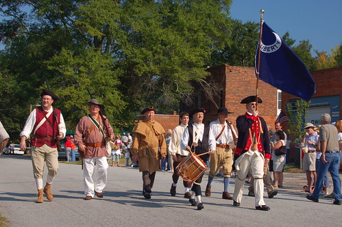
A parade was to begin at 10:00 AM. I arrived about twenty minutes early, but parking was already at a premium. Even this early, turnout was quite good. I watched most of the parade participants walk down the main street so that they could line up for the parade. In fact, I thought it had already started and that I was late. I learned, however, that it was the parade that was late getting started. Soon various historic regiments, horse-drawn carriages, antique cars, and antique tractors processed down the street. The parade took about thirty minutes.
In an open space across from the town several exhibition areas had been set up. There were booths for the Historical Society, and demonstrations of arts and crafts. There were a couple of blacksmiths, someone carving wooden bowls with hand tools, a demonstration of colonial surveying techniques, and cooking demonstrations. The Sons of the Confederacy were out in force, with at least two booths and lots of rebel flags everywhere. Wandering among the booths, I saw many community people I recognized, and some I knew from my time teaching at Gray Court-Owings School.
I wandered into the little museum that the Society maintains and was amazed at how many artifacts I recognized without even having to look at the labels. There were items from Gray Court-Owings School, as well as from the local stores. I saw some goods and fixtures from the old Bryson and Stoddard General Store. When I visited the store as a child, Mr. Stoddard was already 93 years old, and the store was a step back in time.