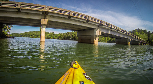
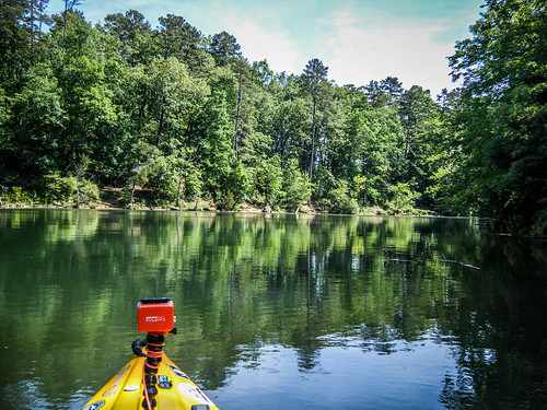
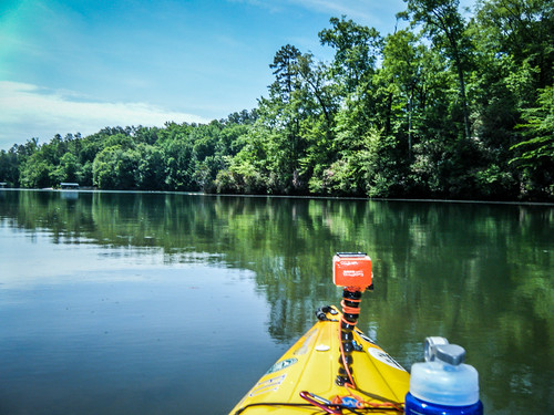
I really wanted to get out on the water. It was a beautiful day, but storms were predicted for the afternoon, so a morning paddle would have to do. That meant selecting from one of the many short-paddle options nearby. I had been threatening to introduce Ken Cothran to kayaking, so I decided to pick him up and head to Lake Hartwell. Specifically, we would be launching from Lawrence Bridge on the Keowee River branch of the lake and exploring some of the coves nearby.
Lawrence Bridge is located on one of the upper reaches of Lake Hartwell. From this point we would have a several options. We could head southward and explore the cove heading toward the Issaqueena Dam. We could stay on the main route and explore upstream on the Keowee River. Or, we could take the Little River spur and head toward the town of Newry. I’d made that last trip once before with Houston, and I thought it would probably be out of reach for us today.
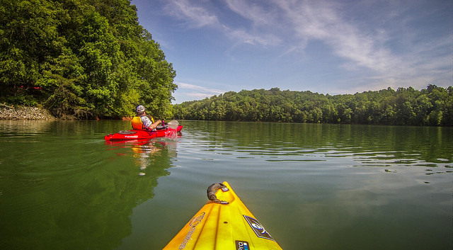
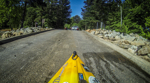
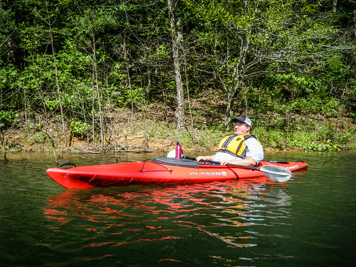
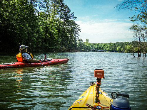
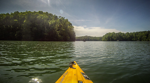
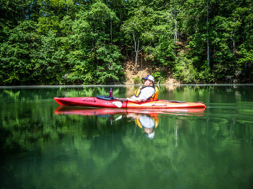
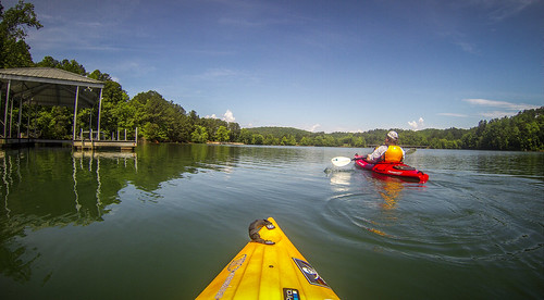
When we arrived we had the boat ramp to ourselves. We unloaded the boats and parked the truck. As we were getting ready to launch, a bass boat arrived, ready to take out. I gave Ken some preliminary instructions, he made an awkward entry into the kayak, and I pushed him out and got him underway quicker than I might have liked.
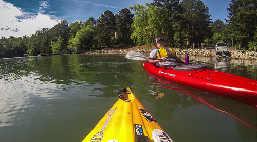
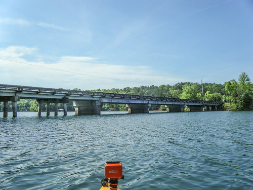
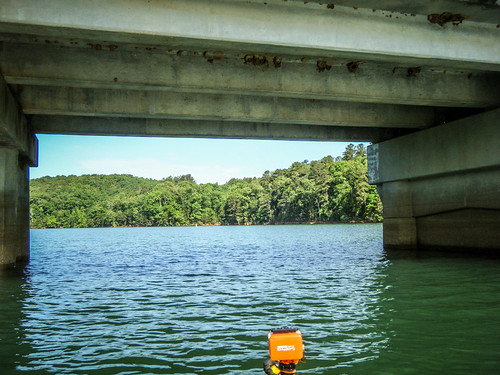
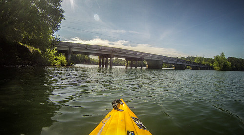
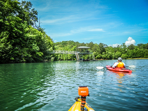
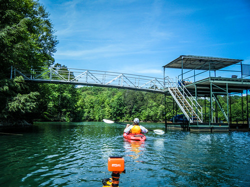
We stayed off to the side, for two reasons. First, so that Ken could get accustomed to controlling to the kayak, but mainly so that the bass boat would clear. We headed toward the eponymous bridge and crossed underneath. From there we headed to a small cove on the far bank.
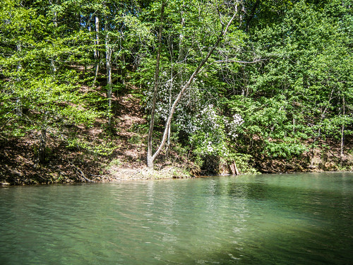
We explored the little cove a bit, admiring the mountain laurel in bloom on the banks. It looked like the cove might have been fed by a stream. However, there was too much debris for us to explore further.
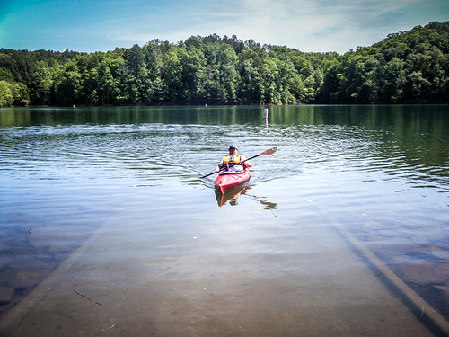
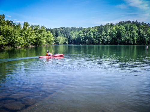
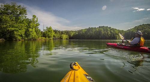
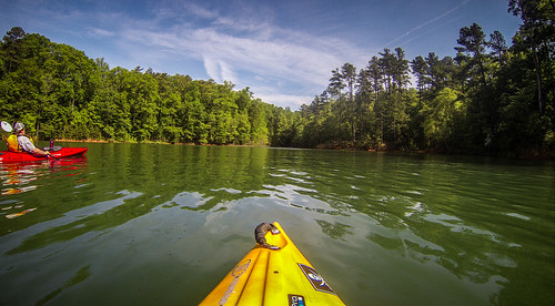
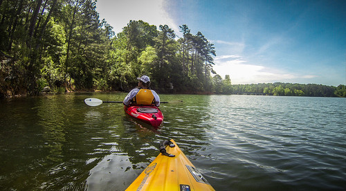
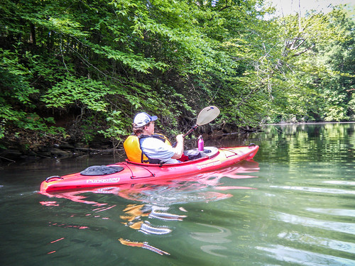
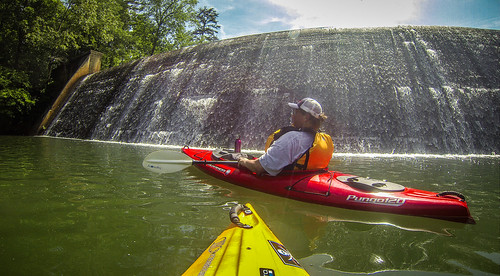
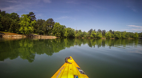
Ken was feeling more confident with controlling the boat. However, he wasn’t up to exploring the Keowee or Little Rivers. We headed back under the bridge with the intent of exploring the Issaqueena cove. We paddled along the western shore of the lake, heading in that direction.
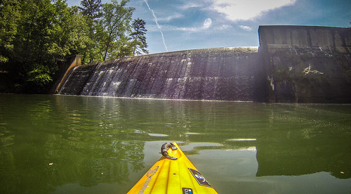
The cove back into Issaqueena is about 0.75 miles from Lawrence Bridge. The cove first curves left, then there is a sharp bend right. Once you round that bend the dam is right there in front of you.
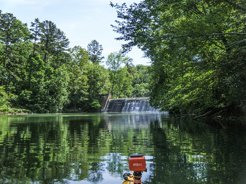
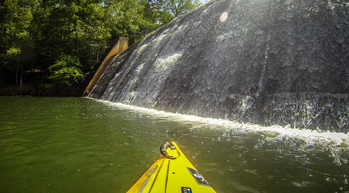
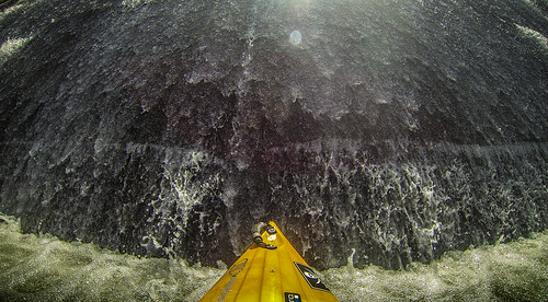
I love the sound of running water, and it was peaceful back in the cove. I could have just hung out there the rest of the afternoon. However, it wasn’t always this peaceful. The dam, which backs up Wildcat Creek to form Lake Issaqueena, was built by the WPA in 1934. In 1942 the lake and surrounding area was used as a practice bombing range for the Greenville Army Air Base (now Donaldson Center.) In 1954 the lake was drained and hundreds of practice bombs (sand-filled) were removed from the lake bed. The lake and surrounding land are now part of the Clemson Experimental Forest.
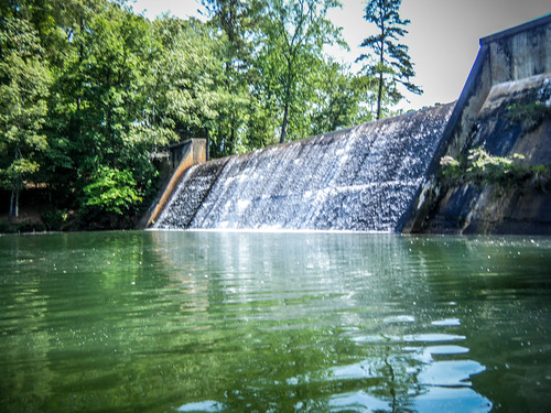
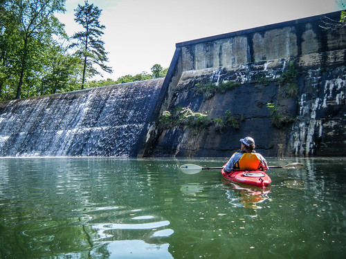
The flow over the lake was gentle, and there was no turbulence at the bottom of the dam. I could paddle right up to it.
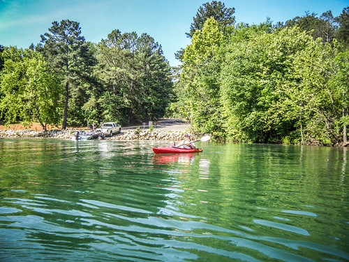
It was time to head back. We left the cove and crossed to the south bank of the lake for the return trip. Here there were several docks with houses hidden back in the forests above. One in particular was quite elaborate.
We continued on this side of the lake and made it back to the boat landing at the bridge.
We had only been on the water a couple of hours, and our route was a short 2.75 miles, but it was a good morning’s paddling trip. Here are the rest of the photos from the trip.
[fsg_gallery id=”64″]
Tom….Just finished viewing your photos and comments re: your recent paddle up to the Issaqueena Dam. Boy, did that bring back some good memories. I attended Clemson U. from Jan. 1962 until May 1967, with a 9 month interruption from Dec. 1963 to Sept. 1964 to earn and save funding for further school and to get married, graduating in Forestry Management in May 1967. I saw your notation about your earlier Newry paddle, and viewed your posts about that, too – which also brought back memories happy and sad.
My sole means of local transportation during my first two (unmarried) years at Clemson was an old and very basic Cushman Scooter (I know you are old enough to remember those). Being a lover of the outdoors, I spent what little spare time that I could steal from working for funds and studying (I had a brain about as slow as the scooter) riding that clunker all over the Clemson Experimental Forest road system exploring. One day I happened upon a sign directing me to Newry, the existence of which I had previously been unaware. As you stated, it was an isolated place. I rode a winding, leaf covered road into a village that instantly carried one back to the early 1900s. Unlike now, it was a town that was absolutely covered with large hardwood trees of many species. The mill was still in operation. It was unlike any place that I had ever seen. Quaint and gorgeous! Unfortunately, much of the tree cover that I remember is now gone (probably due to one of the ice storms of the fairly recent past). The mill is closed and falling in, as shown in your photos. This brings to me a palpable sadness that occurs every time that I see old and historic structures and lifestyles disappearing.
Your paddle up to Issaqueena Dam brought all happy memories. I visited the area around the lake many times on the old scooter in my first 2 years at Clemson. After getting married and installed in the Clemson Married Student Housing (now gone also – at least the ones that I lived in, and about the size of my present living room), I obtained a beat up but serviceable 10 foot john boat from a local (yokel) in the area just north of Issaqueena for $35, a 5.5 hp outboard motor for $25 (if I remember correctly), and hauled it on my former scooter trailer, which I had obtained free from a cousin in prior years. Many were the hours that I spent sitting in my foldable aluminum lawn chair, barely on the plane in that little boat motoring up Lake Hartwell, (which was a new lake at the time). My steering consisted of leaning left or right when cruising (hands on the chair arms) , with the motor steering tightened down. They call that “redneck” now, but I was one happy camper then (that might be difficult for an avid paddler like you to understand). I made the run up to Issaqueena Dam on occasion, but, for the life of me, I cannot remember the old structure in the lake with the warning sign in your photos. Do you have any idea what it was before the lake was flooded? I also spent quite a few lazy afternoons fly fishing from the “redneck cruiser” in Lake Issaqueena. You could catch a big mess of bream most any day, but they were small – probably due to overstocking of bream and not enough bass, which I seldom caught. I clicked on your link that discussed the use of Issaqueena as a skip bombing range for B-25s during WWII, and displaying a photo of one of the aircraft doing just that. That really got my attention when I realized that I was fishing on that lake only a mere 20 years after that photo was taken, and my last visit there is now pushing 50 years. I guess, like Newry, my environs are also suffering now, if you know what I mean.
I remember well my last “cruise” in that boat while at Clemson. It was up the Keowee River to the present dam site for Lake Keowee. At the time, construction had just started and the clearing of vegetation from the site was just about finished. It was an awesome, if somewhat disturbing, sight seeing all that beautiful, hilly land about to go under water. But, then – I was enjoying the benefits of the same type of thing cruising on the waters of Hartwell. So it would be hypocritical to criticise that.
Thanks so much for the memories. I do hope that my return to my youth was not too lengthy….
Bentley Fishburne
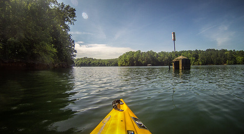
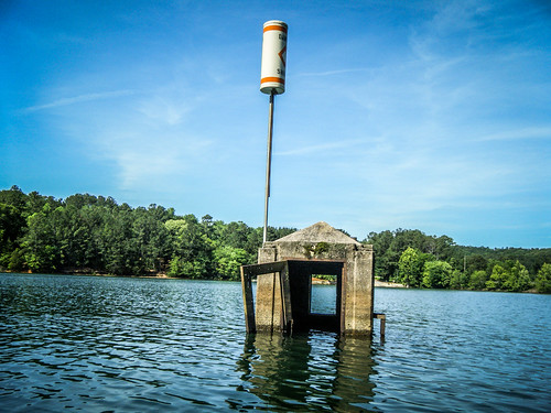
Bentley, it’s personal recollections like these that bring meaning to the history. As for the structure in the lake, I don’t know it’s purpose, but perhaps you didn’t see it because it’s submerged at higher water levels. The warning sign says “shoal” and we didn’t see any obstructions other than the structure itself.
I saw a photo of the area below the dam at lower levels than we had, and there is a pretty good amount of rock in the lake bed … and I suspect a shoal would’ve been there before Hartwell was flooded. Was surprised, as the full pond covered this really well. The photo I saw was shot from the west or north side of the cove, just downstream of the dam.
How deep is the water from the bridge up to the dam ? I was also trying to find out about how deep is Lake Issaqueena ?