Since July 4th was on a Friday and we were already off on Fridays, our office also took off Monday. We came back from the wedding fairly quickly Sunday morning since Laura was having problems with sinuses, and I hadn’t gotten the chance to explore the area as much as I would have liked. Therefore, I decided to head back in that general direction today. I knew I probably wouldn’t make it as far as Asheville, but there is lots to see and photograph in between.
My first target was the Narrows of the Upper Green River. I’d read about a trail that leads down to the most challenging rapid on that section of the river – the Gorilla – and I though I might get some shots of kayakers taking it on. I drove straight up to Hendersonville and found Big Hungry Road. I think I might have found the trail head, but I’m not sure. Regardless, the hike was supposed to be a strenous two mile hike in, and the humidity was already stifling. I decided it could wait for a cooler day.
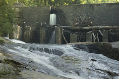
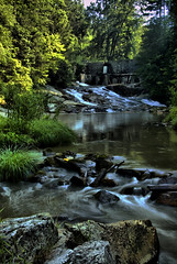
On my way to the trail head, the road crossed the Big Hungry River. Just upstream from the bridge was a little dam and shoals that looked fairly photogenic. I decided to stop for a couple of shots.
Since I had decided to forego the hike to the Green, I thought it might be fun to explore some of the lessor-known roads between Hendersonville and Chimney Rock. In addition to Big Hungry Road, I took Upward Road to Deep Gap, then backtracked, found Stepp Mill on Stepp Mill Road, and took the Sugar Loaf Mountain Road as far as I could. Most of these either ended on dirt roads that I didn’t feel comfortable pursuing in my Volkswagen, or ended altogether. It didn’t seem that there was a clear route either over the mountains toward Chimney Rock, or southward across the Green River Gorge.
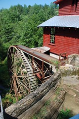
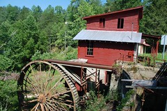
Stepp Mill was an interesting find. The water wheel was quite large, and the mill building itself was of unusual design. The road crossed the little creek right at the old dam, which looked like it wasn’t doing much to retain water anymore. The building itself had Posted signs everywhere, so I only paused for a few shots.
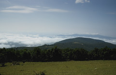
The road to the top of Sugarloaf Mountain afforded some spectacular views. I couldn’t make it all the way to the top where there were some transmitters of various types, but I still got some good views. The Piedmont and foothills beyond were covered with a low cloud layer, and I wondered if it was really cloudy or foggy in those areas. I knew I couldn’t get there in time for interesting fog shots based on where I was, so I just enjoyed the view from above for a bit.
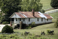
Sugar Loaf is part of the same ridge system as Chimney Rock, but as stated before, there is no good way to cross the mountain. In my attempts to do so, I did see some interesting places, though. I saw a sign for the Carolina Moon resort, and wondered if it were a nudist colony. I think there is a similarly named place that actually is one up near the Nantahala River. I passed many old farms tucked far back into coves. This is the apple-growing region of Hendersonville, and the area was covered in groves. One old farmhouse had massive stone steps that seemed out of proportion with the rest of the humble building.
Somehow I found myself in Edneyville and on the road toward Bat Cave. Since I had plenty of time, I decided to drive to Chimney Rock, proper. The last time I was up this way was Memorial Day. I had tried to visit the park then, but turned around when I saw the long line of cars waiting to ascend the twisting road. This time it wasn’t as bad, so I bought a ticket and headed on up.
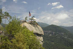
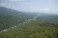
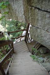
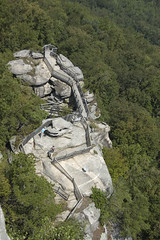
I’ve only been to Chimney Rock once before. This was as part of a seventh grade field trip when I was teaching in Gray Court. I enjoyed it then, and was hoping to get some good view shots this time around. I think I did things in the correct order. I took the elevator to the gift shop at the top of the Chimney, took in the views with photos, then took the stairs back down to the car. It was much, much easier than trying to climb up to the Chimney from the parking area. As with the Green River Trail, I decided the sweltering humidity wasn’t good for hiking. I’d like to do these trails on a cooler day.
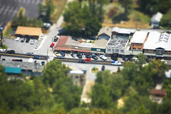
Back down off of the mountain it was time to find lunch. Some place that didn’t advertise itself as “family styled” or that didn’t have carved black bears out front was preferable. I stopped at the Beach Grill in Lake Lure, appropriately located across from the public beach on the lake. I was worried when they offered their buffet, which featured liver and onions. I ordered a sandwich from the menu instead. As with many places that have buffets, if you order something else, be prepared to wait. And wait I did. Service was not spectacular, and I was glad I had a book with me.
From the Lake Lure/Chimney Rock area I headed north toward Asheville. The twisting highway 74 has some interesting sites, but nothing I felt compelled to photograph. It was taking longer to get to Asheville than I had anticipated. I circled around to the Diamond Brand Outfitters in Fletcher, but decided that it was time to pack it on in.

Great trip! There is a road that cuts off to the right of the Ashville highway somewhere around Bat Cave and goes across to Black Mountain. Some nice valleys and old stuff up in those mountains – off the beaten path a bit, and fun to explore.
Thanks for sharing your trip. Lots of interesting places out there. You got some great shots to go along with your descriptions.