I had finished my workshops for SCETV and checked in the hotel, and there was still a good bit of daylight. I decided to explore a bit and see if there was a way to get down to the river with my camera.
Like most cities, Columbia had neglected its river for a long time. It was simply utilitarian – either as a source of water, transportation, or refuse disposal. For the longest time prime riverfront property was taken up by the state penitentiary. Gradually, the city realized the treasure they had, and now the riverfront area has walkways and parks. It’s a nice change from even thirty years ago.
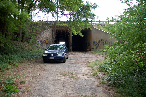
At first I tried to find the riverfront park on the Columbia side of the river. I took a wrong turn and wound up on a diminishing road that took a turn toward the interstate. At I-26 there was a long narrow double underpass. There were gates that looked like they could be closed, but everything was still open, and it still appeared to be a public road that might go down to the river. When I got to the end of the tunnel, there were vines hanging over the opening, and the pavement ended abruptly. Looking at the isolation and all the graffiti, I was a bit nervous. I managed to get the car turned back around and headed under the other section of the underpass.
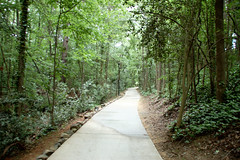
Eventually I did find the park, but by that time it had started to rain a bit and the skies looked threatening. I drove on over the Congaree River to the Cayce side, and spotted another walkway down to the river. It looked like the rain was going to pass by, so I decided to go on down.
When recalling what they learned about South Carolina in their geography classes, both Laura and her mother mention learning about the Fall Line. It seems odd to me that this one fact would stick out, but it was what they remembered most about the state. Nothing epitomizes the Fall Line more than the confluence of the Saluda and Broad rivers to create the Congaree River. South of the shoals created by the confluence the river becomes broad and meandering, with little or no rapids to impede navigation. Below this line one would find no waterfalls, hence the name. Above the Fall Line, the rivers ran faster, and that energy could be used to power mills, etc.
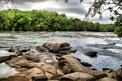
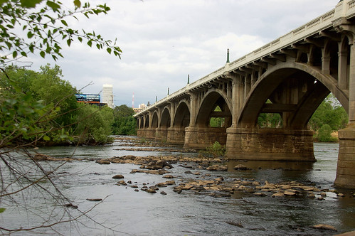
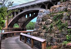
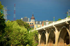
I walked along the riverfront walk for about a mile, taking pictures of the various bridges, rocks, etc. The skies were still dark and threatening, but the setting sun was peeking from beneath the clouds, illuminating the tops of buildings.
As happens so many times, I longed to put a paddle in the water. The longing got to be too much, so I decided to head on back to the car and find some dinner.
I never heard of that Fall Line. That’s very interesting.