It’s Spring Break this week, and the weather stinks out loud. Monday and Tuesday were cloudy and wet, so I spent the first part of the week on home maintenance, specifically, oiling our unfinished knotty pine paneling with linseed oil. It was a smelly job, so by Wednesday I really needed to get out of the house. Wednesday was also the only day this week predicted to have good weather, so it was now or never.
As with most of my photo drives, I only had a rough idea of where I wanted to go. I knew that I wanted to check out the Gray Court-Owings Historical Society’s new display area, and I wanted to visit some sites for genealogy purposes, but apart from that anything was open. Originally, I had planned to load my mountain bike in my truck and check out the Enoree Passage of the Palmetto Trail. However, with the weather not cooperating, I abandoned that idea.
The day started with an early dentist appointment. Since that put me on the east side of town, I took Pelham Road, Highway 14, Woodruff Road to Scuffletown Road. I basically just wanted to see where Scuffletown Road went. I followed it until the housing developments petered out and I was left with rolling farmland. It finally deposited me on Allen Bridge Road. I first drove the wrong way (despite GPS and maps), but then got turned back in a more Gray Court-ish direction. I’ve always been impressed with the topography of this area just east of Gray Court. There are some very high ridges that overlook rich farmland. So far it hasn’t fallen to the developers’ evil schemes.
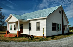
I eventually came to the Youngs Community east of Gray Court. We used to come out this way to hike along and go wading in Warrior Creek, which is nearby. I stopped at the Youngs Community School and snapped a couple of pictures. This school is significant in that it is where adult education got its start in South Carolina.
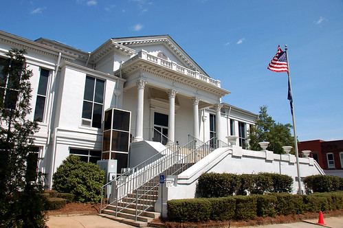
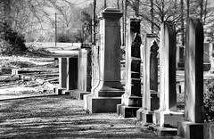
From Youngs I drove on into Gray Court proper. I guess the last time I was down this way was for our Christmas gathering, and then I hadn’t gotten on into town. Several of the older buildings on the south end of town that were able to fall down had actually been torn down. I made my way to the town cemetery and the plot next to it where the Historical Society had set up their display area.
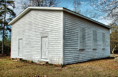
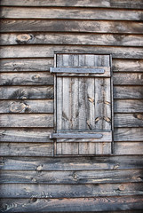
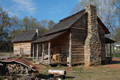
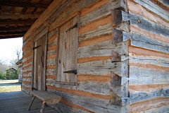
I was quite impressed with what the Society has done. They have moved several historic building from their original locations and created a display of life in the 1800’s, including several log cabins and farm buildings, a farm plot, and the Ora Old Field Church. Unfortunately, all of the buildings were closed and padlocked, so I couldn’t get inside to see any of them. I did stay and take pictures of the display area, as well as the cemetery.
From Gray Court I drove south on Highway 14, then turned onto Metric Road toward Ora. This road takes one by the Little Knob, a monadnock with a commanding view of the area. Big Knob is just a couple of miles away, but I believe that Little Knob is actually the same height. As I drove by, I noticed that lots of vegetation at the top had been cleared, and that there were rocky outcrops that I’d never seen before. I’ve never been to the top, but would love to sneak up there some time.
I briefly turned onto Ghost Creek Road, so named because of a supposed haunting. I remember there being an area where political speeches were held at one time. I remember visiting there as a child and seeing remnants of benches, etc. I couldn’t find it this time, so I backtracked to Metric Road.
From Metric Road I took Highway 221 North, and found myself in Ora. I pulled in at Ora Associate Reform Presbyterian (ARP) Church. I know that I have relatives buried in the church cemetery, but I didn’t bring any information as to which ones. I saw lots of names with which I’m familiar – Blakelys, Flemmings, and Hunters. I saw a few Taylors and Todds, but I wasn’t sure how they might be connected with our family.
From Ora ARP I headed east on Highway 308 and into the heart of the history of our family. As with Ora ARP, I felt ill-equipped with information. I knew there were Pooles and other family names located in this area, but I didn’t know where to begin. I took a few side roads, but not many pictures. I eventually wound up at Long Branch Pentecostal Holiness Church. I took a few pictures, but these weren’t really any different from the ones that I took the last time I was here.
I drove under I-385 and finally found myself on Highway 76 just west of Clinton. I was looking for the old road between Laurens and Clinton, and a cemetery that was the burial place of Nathanial Callaway Todd, my great-great-grandfather. I didn’t find the church, cemetery, or anything like it, but I did find a little store that sold pickled pig lips. I really didn’t have the stomach to try them, though.

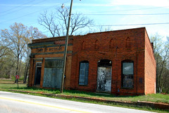
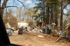
I drove on into Laurens and headed to the Square. I stopped and had a mediocre Reuben Sandwich at a place on the Square, then continued my wanderings. I headed south on 221 to Hot Point, then to Waterloo. I took a couple of pictures of the old town buildings, then took a turn around the neighborhood behind. I discovered one of the trashiest places I think I have ever been.
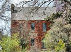
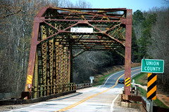
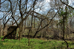
From Waterloo I drove east to Cross Hill, then worked my way toward Joanna. I was working my way toward Sumter National Forest and the Palmetto Trail. I figured that even if I didn’t my bike, I could check out the trail heads. I crossed into Newberry County and found the Brickhouse. It was once a stage coach stop and Jefferson Davis supposedly spent a night there. I would have liked to have explored it more, but the Posted signs were fairly prominent. I did turn down into the campground area and explored a little bit. I then turned north and crossed the Enoree River into Union County on an old steel girder bridge. I walked down to the river banks and saw an even older steel bridge that had long since been abandoned.
I drove around a bit and came across locations where the Palmetto Trail crossed the road. Every where I found these, there were also large pickup trucks parked. I’m thinking it is some sort of hunting season, but I didn’t know which. I also wasn’t sure if I wanted to wander down a trail with the potential for shooting.
I followed Stomp Springs Road to the community of that name and took the little circle that drive by the springs. This was once a resort, similar to Chick Springs in Greenville, but not as elaborate. The last time I was here, THIS was the trashiest neighborhood I had ever seen. That is, until I saw Waterloo. They had actually had cleaned it up a little, but it was still trashy.
From Stomp Springs I drove down to the community of Renno, and took a couple of pictures.
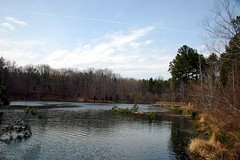
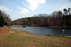
I finally made my way to Cross Keys, and turned onto a little dirt road to explore Sedalia Lake and Johns Creek Lake. These were two small reservoirs in Sumter National Forest.
By this time, I was tired. I hadn’t done as much exploring on foot as I would have liked, but at least the weather had held. I headed on back north and toward home.
Love your photo of Youngs School. May I have your permission to use it in my book about Youngs School? thanks