It wasn’t the day I expected, but it wasn’t a bad day at all. I was expecting it to be a cloudy, stormy day, and I had lined up a long list of indoor chores. So, when we awoke to beautiful sunshine, the last thing I wanted to do was hang about inside.
The question was, what to do? I remembered an article I that Petapixel had posted to Twitter about the photography of Darren Moore. Darren uses a neutral density filter to create long exposure photographs even in bright sunlight. His photos of the UK coastline are surreal and haunting.
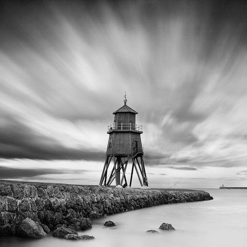
I don’t have wide open spaces or coastline, but we do have plenty of flowing water around. I decided to try Darren’s techniques locally.
At first I just wanted to try out the technique. The first place that popped into mind was the old dam at Pelham Mill. There’s plenty of flowing water, and lots of photographic possibilities. However, as I was at my first stop the idea grew.
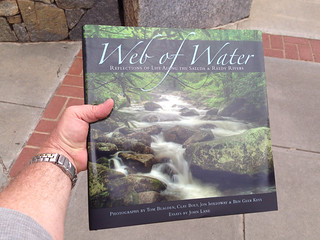
First, it’s Earth Day, and I wanted to mark the day by doing something other than simply burning fossil fuels. Secondly, Upstate Forever has just published a book entitled “Web of Water.” The book is a photographic study of the Saluda and Reedy River watersheds, with photography by Tom Blagden, Clay Bolt, Jon Holloway, and Ben Geer Keys, and essays by John Lang. I wondered if I might turn my trek into a tour of Greenville water landmarks, seeing how many I could hit in one day.
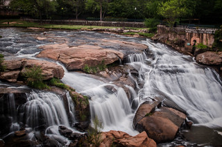
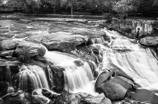
Pelham Mill
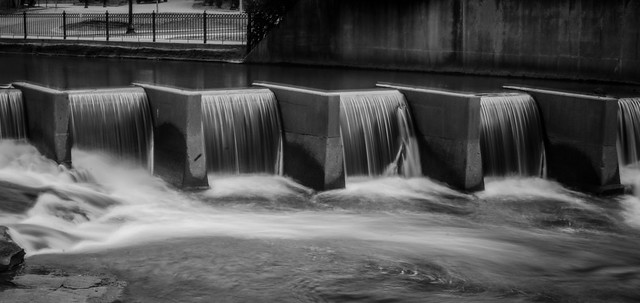
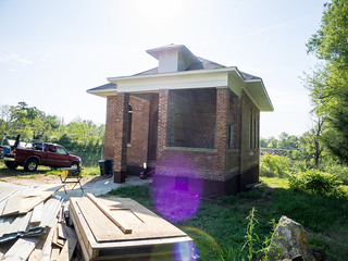
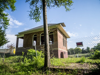
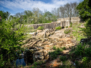
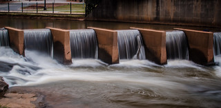
As mentioned, the first stop was the dam at Pelham Mill. The first thing I noticed is that they have made major strides in restoring the old mill office. I don’t know how they plan to use the building, but it would make an excellent open air pavilion, similar to the Wyche Pavilion, but on a smaller scale.
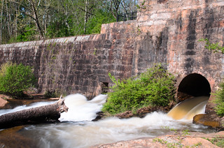
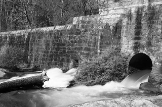
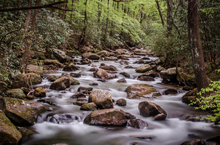
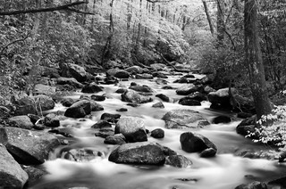
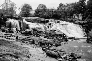
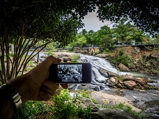
With recent rains the water was really flowing through the dam. I set up the tripod with my Nikon. I was using an ND8 filter with my 35mm prime lens. The ND filters I have only fit my prime lenses, which kind of defeats the purpose of a fast prime lens, but for this purpose it was OK. I also had my Panasonic Lumix and iPhone to take reference photos. Here are a couple from that location. I’ve included the color and black and white.
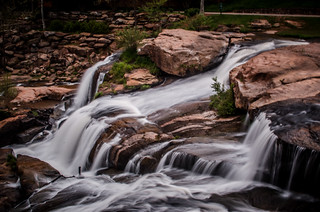
I spent a good bit of time at Pelham Mill, taking other shots…
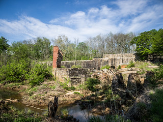
However, if I were going to stick to my ambitious plan, I could only spend a few minutes at each location. On to the next one.
Gilreath Mill
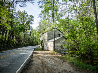
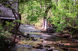
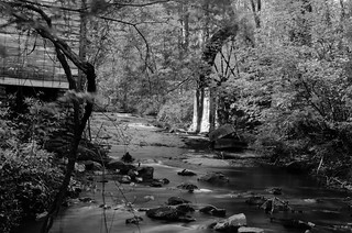
I drove north on Highway 14 through Pelham and toward Greer. I connected with Buncombe Street, then turned onto Highway 101. Around a bend the old mill owned by former Greenville sheriff P. D. Gilreath sits right on the road to the left. The road actually bends to miss the mill.
I’ve had the privilege of visiting the mill when it was open, and I could tour the inside. That was not the case today. I found a route down to the stream where I could get a shot of the mill, stream, and old wheel.
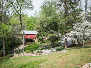
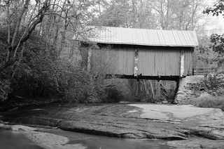
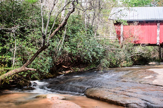
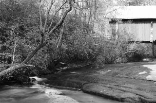
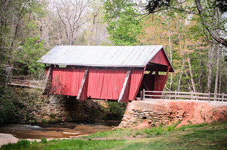
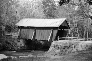
Campbell Covered Bridge
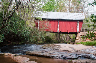
The next water landmark was Campbell Covered Bridge. Quite frankly, I’ve visited this location so many times that I’ve almost run out of ideas for photographing it. It was nice to be approaching the subject with a new take.
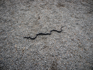
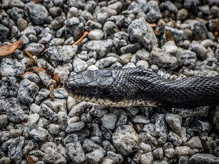
As I was heading to my chosen spot, a small black racer slid out onto the pathway. I said hello, and let him continue on his way.
I tried some low shots that would capture the stream as well as the bridge. I tried several angles, with varying results.
Time to move on.
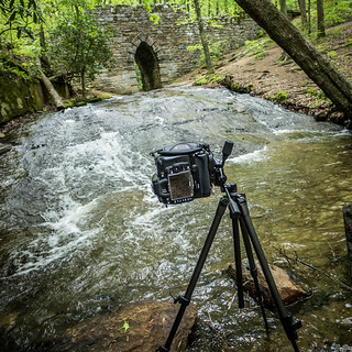
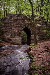
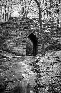
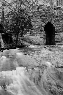
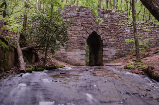
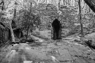
Poinsett Bridge
From Campbells I took 414 to 101, then crossed Highway 11 headed toward Poinsett Bridge. There were a couple of others there when I arrived, we managed not to get into each other’s way. I took several shots from lower down on the stream.
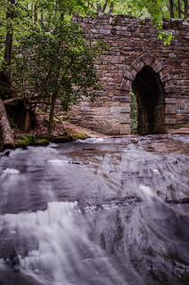
The bright sunshine of the early morning was giving way to clouds, and these were getting darker all along. I didn’t know if the weather would hold out for all of my targets. About this time I got a text from Ken saying that he had a copy of Web of Water reserved, and asked if I could pick it up for him. Since the book was right across from my last target, I said, “Sure!”
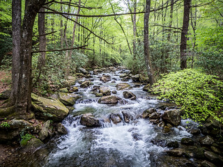
Jones Gap
I continued up to Saluda Road, then drove over to Highway 25, then headed north. I turned onto Gap Creek Road and made the drive up to Jones Gap State Park.
It’s been a long, long time since I’ve visited the park. I have a long history with this place, having hiked its trails many times before it even became a state park. We used to climb and rappel off of the rocks above the gap, and I even broke my ankle here. This time I was hoping that I wouldn’t stay long enough to break anything.
I was looking for one spot. The old bridge across the Saluda River is an iconic view. I think just about every nature photographer has done a long exposure here. The view even appears on the new Web of Water cover. You almost have to make a concerted effort to take a bad photograph of this scene. Here are my attempts:
Here’s one non-long exposure just for comparison:
As I was finishing up raindrops were starting to fall. It was time to move on, and I wasn’t sure I’d complete my mission. I really need to come back and spend more time up here. I’d love to hike back up to Rainbow Falls sometime. That used to be one of my favorite hikes.
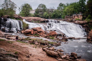
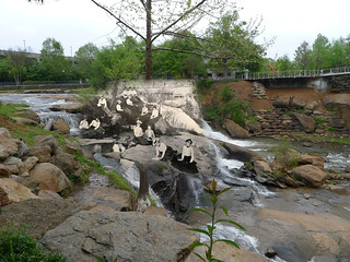
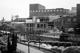
Reedy Falls
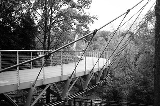
I saved the most iconic Greenville landmark for last – Reedy Falls and the Liberty Bridge. Fortunately the rain held off, and I was able to get a good parking place on the South Main Bridge.
As it turns out, the Liberty Bridge is HORRIBLE for long exposure photography. It bounces. It especially bounces when someone is jogging on it. Even so, I made an attempt.
Better shots were to be had from the other side of the falls, on more stable ground.
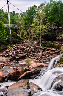
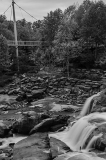
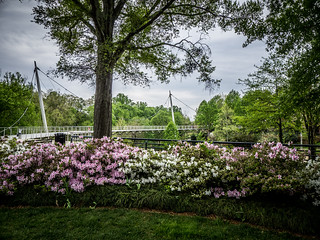
I headed back across and down into the park for a few more shots.
While I was on this side of the falls I had another mission. The folks at Greenville History Tours had posted the following photograph on Facebook.
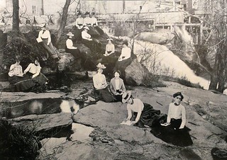
The photo was taken in 1902, and shows a group of ladies in an art class from Clemson. I figured this would be the perfect candidate for a composite. I couldn’t get into the exact spot because of prohibitions about climbing on the rocks, but I tried to line things up.
I was able to create a composite, though. The same rock appears on the opposite bank in both images, so I was able to use that as an alignment tool. It was also tricky because when the photo was taken there was a dam across the river, and this area was dry. It now has water flowing over it. Here was the result.
I continued under the Main Street Bridge, hoping to get a shot of the Falls Place area. Here I came up on an altercation. There were three men in the water trying to retrieve a duffle bag at the top of the falls. Apparently one man had thrown or dropped it there.
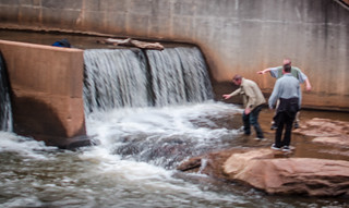
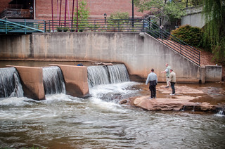
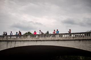
A crowd of spectators gathered on the bridge and on the banks. Many were laughing and also taking photos. I felt sorry for the guys. The behavior of the crowd made me feel a bit…sick, kind of like the type of group that eggs on a fight. I tried to think whether I had a rope or any other tool in my car (which was nearby) which might help.
Police arrived, and the next thing I knew all three men were being handcuffed. I think they were drunk, which is why their antics had drawn a crowd.
Regardless, I was able to wrap up my grand tour with these shots:

So, it was a good, but unexpected day out and about. It was also an excellent way to spend Earth Day. As usual, here is the slide show with all of the photos from the trip:
[fsg_gallery id=”44″]