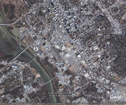
On October 3 Google Earth released a massive imagery update. Until that point, most of South Carolina was in low resolution. The new release provided much higher resolution images for almost all of the state. Almost all, that is.
Right after the update there was a very blurry section right where the town of Casey, SC, should be located. That blurred spot grew like a cancer into a full grayed-out area that swallowed all of downtown Columbia. Not good. I am scheduled to do a series of workshops on Google Earth in Columbia for SCETV in March, and it would be terrible not to be able to view the host city.
Well, this morning I was working on my presentations, and, lo and behold, Columbia is back! I’m hoping it sticks around at least through my workshops, and doesn’t decide to slip back off into its gray hole.

You mean Cayce, not Casey, right?
You are absolutely correct, and I knew better. My brain must have slipped a cog or something.