I had originally planned to ride to Congaree National Park. However, the thought of riding two hours in both directions down to Columbia was just about more than I could tolerated, even if I do have a nice vehicle. Instead, I headed northward toward the mountains. While the distance would be about the same, at least more of the ride would be interesting.
I left far too early for a Sunday morning. My goal was to catch some of the mountain coves in the early morning sunlight, perhaps with a bit of fog or mist. Even so, I wasn’t early enough, and I wound up racing the rising sun up the mountains. I made it to Tuxedo as the light broke, and drove around the banks of Lake Summit, hoping to catch a few shots. I just wasn’t inspired, so I headed westward, through Flat Rock, then on into the Crab Creek Valley.
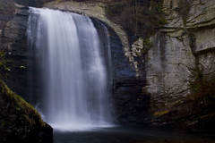
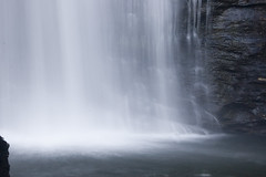
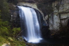
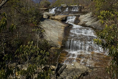
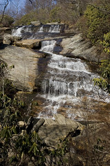
My route eventually took me to Brevard, and on into Pisgah National Forest. With much of the valley floor still sheltered from the rising sun, lighting conditions were perfect for Looking Glass Falls. It was still early enough that the crowds hadn’t gathered, and I had the falls all to myself.
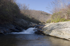
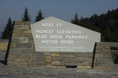
From Looking Glass I headed on up to the Blue Ridge Parkway, then headed west. I stopped at the Graveyard Fields and wandered the trail to the small waterfall there.
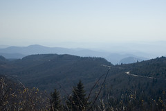
Back at the car, I turned onto Black Balsam Road and drove to the trailhead that leads further into the Shining Rock Wilderness. There were spectacular views of the Parkway and surrounding mountains from Black Balsam.
I continued on the Parkway, pulling out at the occasional overlook, but not really taking many pictures. When the Parkway crossed Highway 23, I took it heading east, and generally toward Asheville. Lunch was in Waynesville, and from there I stayed off of the four-lane, driving through the small towns west of Asheville until I reached the city. By that time, I was exhausted, and it was time to head home.
Wow, I took pretty much that same path on Saturday. Although I went up 178 and then back down 276 past Looking Glass Falls then back through Flat Rock. I even went down Black Balsam Rd. for a day of hiking.
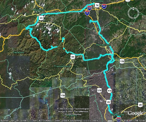
How are you creating that track log in Google Earth? Are you using one of the GPS programs you mentioned to me?
It was a great day for the BRP.
I just keep the GPS running while I’m traveling. When I get home, I download the track and any waypoints into ExpertGPS. I then save that data as a GPX file.
Google Earth can open GPX files, and the tracks show up as paths. I just zoom out to a level that shows the entire route, then save that image.
As you can see from this image, there were segments that didn’t get recorded. Either I couldn’t pick up a satellite, or the GPS got unplugged from the power source.