Skip to content

Random Connections

A collection of photography and exploration focusing on Upstate South Carolina and beyond.

  • Home
  • About Us
  • Photos
  • Resources
  • Other Voices
  • Post Archives
  • Podcast
  • Home
  • Paddling
  • Back to the Santee with Lowcountry Unfiltered
  • Page 2

Back to the Santee with Lowcountry Unfiltered

Posted on December 8, 2020December 8, 2020 By Tom No Comments on Back to the Santee with Lowcountry Unfiltered
Paddling

The next morning I drove over to Leneud’s Landing to meet up with the rest of our group. We made the convoluted shuttle trek down to our take-out at Pleasant Hill, then returned to our starting point.

Leneud, or Lenud’s Ferry is long in history. It was the site of a Revolutionary War skirmish between British Forces led by Col. Banestre Tarleton and American forces led by Col. White. The place is also noted on Robert Mills’ 1825 map of Charleston District.

Lenud's Ferry on Mills' Atlas

The Santee River was a main transportation route to inland South Carolina. Steam vessels plied these waters on a regular schedule and Leneud’s Ferry was one of the stops.

The_Charleston_Daily_Courier_Wed__Jun_27__1866_

Records indicate that one of these steam ships wrecked at this location. I wondered if there would be any sign of it after all of these years. I had a magnet with me and was tempted to go magnet fishing.

The_Watchman_and_Southron_Wed__Oct_21__1903_

Even if I couldn’t find bits of a sunken steamer, there would probably be lots to find. These area remained in operation as a ferry well into the 20th Century.

Leneud's Ferry

We set off under the modern bridge that replaced the ferry, which runs alongside a much older rotating railroad bridge, built when larger boats plied these waters.

Santee River with Lowcountry Unfiltered

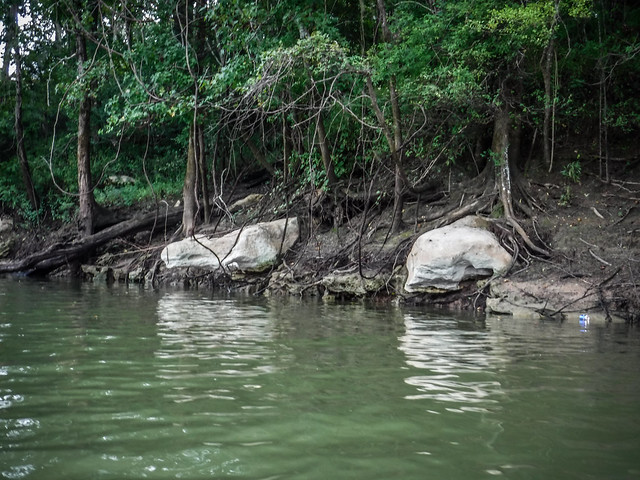
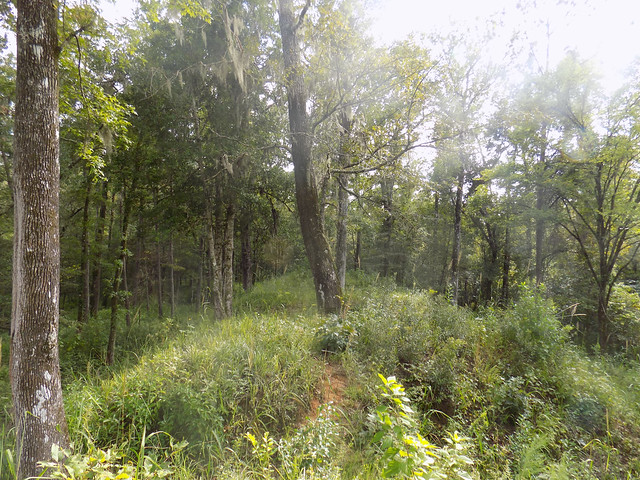
The Santee is in one of the most remote sections of South Carolina. Deep swamps and wetlands border the river, especially on the northern bank. The south bank was lined with a steep bluff covered with limestone outcrops. These limestone caps often looked like skulls lining the river.

Santee River with Lowcountry Unfiltered

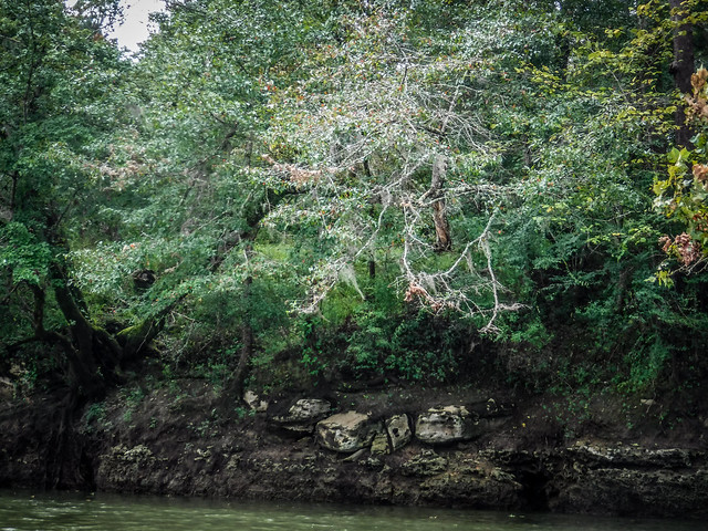
We found one unusual cove where the bluff was capped with limestone. A small waterfall emerged from below the limestone cap, falling into the river.

Santee River with Lowcountry Unfiltered
Santee River with Lowcountry Unfiltered-29

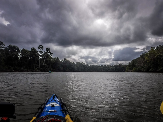
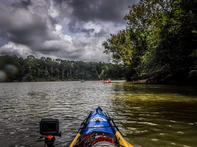
We continued on with variable weather. The river is wide and we made good time. We explored a couple of channels, but didn’t get too distracted. We had quite a long way to go.

Santee River with Lowcountry Unfiltered
Santee River with Lowcountry Unfiltered-40
Santee River with Lowcountry Unfiltered-43

We were having a hard time finding a spot for our lunch. The one low place we found turned out to be quite muddy, but we pulled over anyway. Matt pulled out The Most Photographed Stove in South Carolinaâ„¢ and we had our traditional brats and sauerkraut.

Santee River with Lowcountry Unfiltered

We continued on down the river and a light rain started, then cleared off. The scenery continued about the same for many miles. The three minute rule was in full effect, as we spotted a nice beach just downstream from our muddy lunch spot. I tried to imagine steam boats traveling this river.

Santee River with Lowcountry Unfiltered
Santee River with Lowcountry Unfiltered-50

As we approached McConnell Landing/Pleasant Hill there was a bend in the river. At this strategic point on the river one can find Battery Warren, an earthen fortification built to prevent Union boats from using the river. We pulled over to explore.

Santee River with Lowcountry Unfiltered

We thought this would be a good spot for our group photo.

LCU at Battery Warren

From Battery Warren it was just a short trek down to the landing.

Santee River with Lowcountry Unfiltered-56
Santee River with Lowcountry Unfiltered-57

Today’s trip took us 12 miles downriver through some very remote area. It was a great day out with friends.

Santee River with Lowcountry Unfiltered
Santee River Route

Here’s the time-lapse from the GoPro.

Pages: 1 2
Tags: kayaking LCU Lowcountry Unfiltered Paddling Santee River South Carolina

Post navigation

❮ Previous Post: Kayaking to the Edisto Confluence
Next Post: Winter Solstice 2020 ❯

Leave a Reply Cancel reply

Your email address will not be published. Required fields are marked *

This site uses Akismet to reduce spam. Learn how your comment data is processed.

Categories

  • EdTech (197)
  • Entertainment (202)
  • Family (124)
  • Gear (114)
  • General Technology (98)
  • Geocaching and Maps (208)
  • History and Genealogy (276)
  • Internet (142)
  • Local (459)
  • Miscellaneous (561)
  • Music (202)
  • Paddling (268)
  • Photography (782)
  • Podcast (24)
  • Rambling (234)
  • Rants (162)
  • Recipes (37)
  • Religion (48)
  • Restaurants (165)
  • Science (48)
  • Things Overheard (29)
  • Travel (413)
  • Uncategorized (144)
  • Washington Sabbatical (113)
  • Weirdness (61)

Recent Posts

  • Carolina Ghost Towns – Proctor, NC
  • Carolina Ghost Towns – Judson, North Carolina
  • Carolina Ghost Towns – Madison, SC
  • A Trip to Lando
  • Carolina Ghost Towns – Fort Motte, South Carolina

Recent Comments

  • Pher on Dipping a Toe in the North Toe
  • Paula McCall on Memories of Echo Valley
  • Cash Lewis on The Sad Fate of Chappells
  • Cash Lewis on The Sad Fate of Chappells
  • Scott Clenney on Getting Pulled into Union County – Part 1, Buffalo

Tags

blogging cemetery Christmas Columbia Edisto River edtech Entertainment family Flickr Florida Furman Furman University gear Georgia geotagging Ghost Town Ghost Towns Google Earth Google Maps GPS Greenville Greenville Chorale history Instructional Technology kayaking Lake Jocassee LCU Lowcountry Unfiltered maps Music North Carolina Paddling Photography rambling restaurant Restaurants review singing social networking South Carolina time-lapse Travel video Washington Washington State
March 2026
S M T W T F S
1234567
891011121314
15161718192021
22232425262728
293031  
« Feb    

Copyright © 2026 Random Connections.

Theme: Oceanly by ScriptsTown