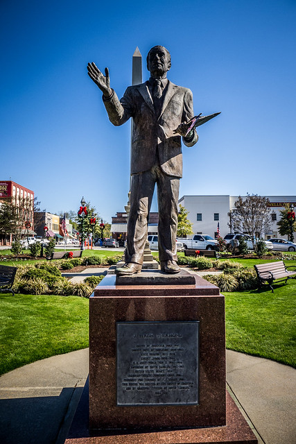
In the previous post I described how a mule kick killed eight people, and we explored the Little Stevens Creek area. In this post fellow singer and explorer Tommy Thompson and I ventured further into Edgefield County seeking out pottery and abandoned churches.
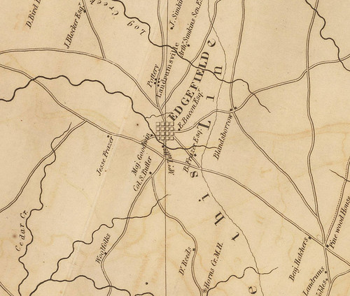
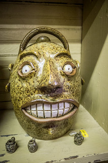
Edgefield has long been known for its amazing pottery. ETV’s History Detectives even did a segment on one of the “face jugs” from the area. Of course, I was not as interested in the pottery itself as in the town that grew up around the industry. Landrumville, aka Pottersville was located just north of Edgefield. Robert Mills’ 1825 Atlas shows its location.
I wanted to see if I could find it. The site is on the National Register of Historic Places. However, since it is still an active archeological dig, all of the location information has been redacted. There are lots of scholarly articles on the site. But, just like the NRHP listing, any article I could find said that the kilns were on private property, and that the address was restricted.
As a workaround, I took the Mills map and tried to overlay it onto Google Earth. Matching the roads and landmarks from 170 years ago was not an easy task, but in the end I came up with an approximate set of coordinates. Even if I couldn’t reach Pottersville exactly, at least I would be able to take a photo of the area.
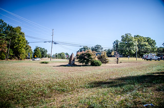
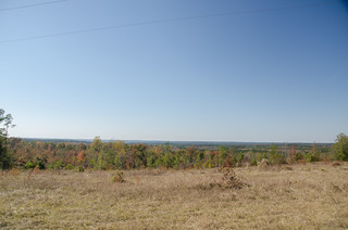
Tommy and I had left the Meeting Street and Little Stevens Creek area and headed south on Highway 430 toward Edgefield. My coordinates were on this road, just before reaching its junction with Highway 25. There were wide open fields as described by the NRHP site, but nothing that really stood out as the location for the town. We stopped and took a couple of shots anyway, then headed on into Edgefield.
Furman and Willowbrook
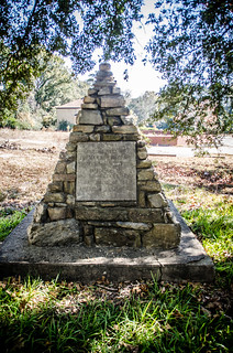
Along the way I had told Tommy about the Field Trip app from Google. He had downloaded and installed it, and the first ping it sent back was for the former location of Furman Academy. We decided we had to check it out. On Church Street, paralleling the road we were on, we found a historical marker and stone cairn marking the site.
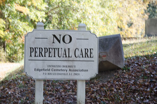
Continuing on Church Street I spotted an unusual sign:
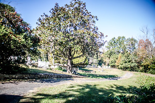
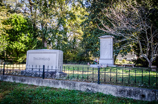
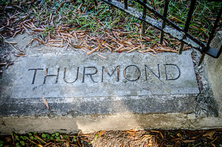
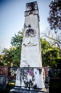
Hmmm, no perpetual care. Usually that means a very old cemetery. We decided to check it out. Turns out that we were in the historic Willowbrook Cemetery, and there were lots of luminaries interred here. As we pulled into the small loop, a large stone monolith dominates the area. Without looking for it, we had stumbled upon the grave of the late Senator Strom Thurmond. The “No Perpetual Care” sign seemed even more ironic.
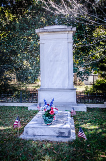
Thurmond wasn’t the only famous politician buried there. On up the hill and closer to the First Baptist Church building was the grave of Preston Brooks. Brooks was a Congressman who gained notoriety by beating US Senator Charles Sumner from Massachusetts with a cane on the floor of Senate in 1856. The issue was over states rights, leading up to the Civil War, and Brooks took issue with the fact that Sumner had greatly mocked and insulted Senator Andrew Butler, Brooks’ kinsman.
Here’s the headstone:
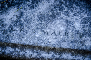
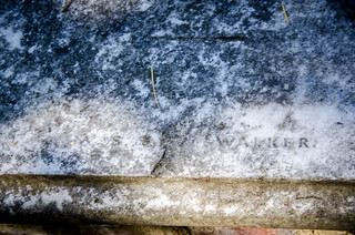
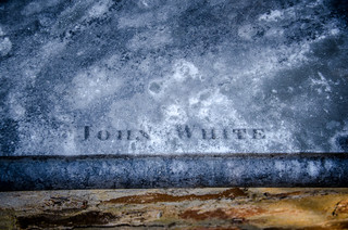
As one might imagine, with this many politicians and governors, there were quite a few signature stones. Some of these were new to me. Almost all of them were on horizontal slabs, rather than upright headstones. There were two different Walkers and one John White.
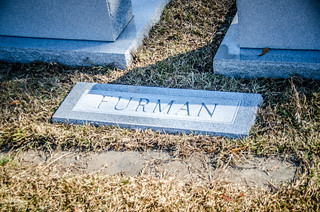
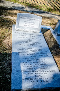
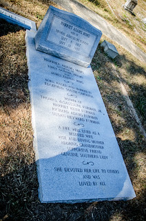
I won’t post or mention all of the cool headstones we found at Willowbrook, but one set stuck out. A very new-looking set of headstones and tablets belonged to Thomas deSaussure Furman and his wife. Since we had just seen the Furman marker, these caught my attention. That, and the fact that they looked brand spanking new. Furman died in 2008, and his wife in 1980.
It turns out that I was not far off of the mark. Fellow singer and explorer Keith Dover works for a cemetery, and upon seeing these photos online he said that he had spotted the markers at Alexander Granite in Easley while under construction just last month. Interesting coincidence.
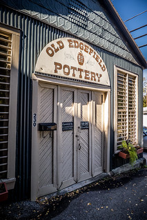
Old Edgefield Pottery
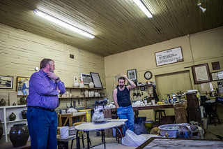
From Willowbrook we drove over to the heart of the town. I knew there was an “Old Edgefield Pottery” place not far away, and I hoped it would be open and would have some information on Pottersville. We found the place down an alley appropriately named “Potters Alley.” There was a small building set up as a potter’s studio. Jason Guy was hard at work at the wheel, but took time to talk to us.
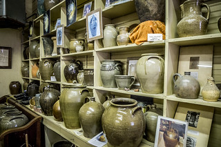
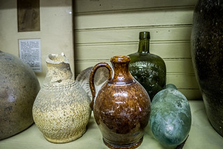
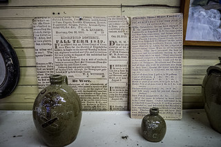
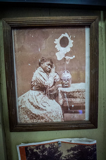
Turns out there was a wealth of information on Pottersville and on its founder, Dr. Abner Landrum. There were pots on display that date back to antebellum times, and further. There were also modern recreations of pots using the same glazing and firing techniques. These were for sale.
Jason told us that the location of Pottersville was well-known and visible from the road. He told us how to get there. We decided that when we left the town we’d head back that way.
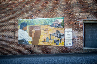
One of the most famous and prolific potters of antebellum Edgefield was David Drake. Also known as Dave the Slave and Dave the Poet, he was unusual in that he could read and write. He would often etch verses into his pots. A mural commemorating his work was painted on the alley just outside of the Old Pottery.
Lunch in Edgefield
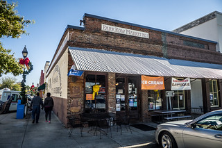
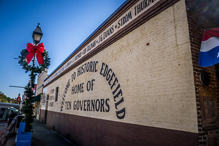
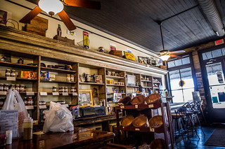
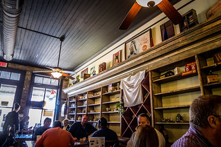
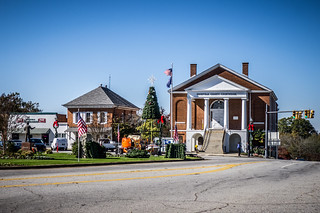
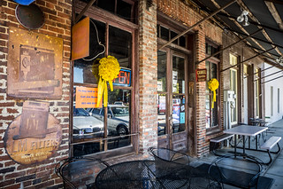
It was getting to be lunchtime, so we decided to explore the town square. Park Row Market turned out to be an excellent lunch spot. It was a small, but popular place, and tables were at a premium. Even so, we found one and were able to get some excellent soup and sandwiches. The place was decorated with antiques, and had a definite “old” feel to it. The outside of the building advertised Edgefield as the “Home of Ten Governors.”
I noticed lots of folks coming in with name tags. There was a definite “lawyerly” or legal feel to their bearing. Looking across to the old court house it looked like there was lots of activity, as if court were in session. That stands to reason. Tommy was supposed to be on jury duty this week in his home town but didn’t get seat on a jury, and another friend in Columbia was on jury duty.
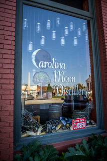
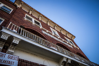
After lunch we continued our trek around the small square. There was an old hardware store, a moonshine distillery (unfortunately, closed today) and the Edgefield newspaper. The old Plantation House hotel looked like it was undergoing renovations.
Having circled the town square we found ourselves back at the Edgefield Historical Society, which operates Old Edgefield Pottery. Tommy said that he would act as my “handler” to make sure I didn’t get lost in the archives. “Mr. Taylor, remember that you’ve got a 2:00 appointment at…”
As we entered, our potter friend, Jason Guy, was leaving. It seems his significant other was running the show today at the archives. She asked what family we were researching, and the question caught me off-guard. Apparently genealogy research is most common here, and there were several engaged in that endeavor. Not having a specific question, I was left to browse while more serious researchers got her attention. In fairness, she did have her hands full. Everything looks well organized, and I would like to come back for something other than a casual visit. This place isn’t really set up for casual visitors.
Pottersville
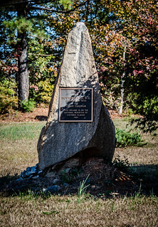
Remembering what Jason had said about Pottersville, we decided to search for it. According to his directions, we were looking for a small hill with a telephone pole on it, out in the middle of a field. We drove several miles up Highway 25, but never saw the spot as described by Jason. At the intersection of Highways 430 and 25, I was able to find a monument supposedly marking the center of Pottersville.
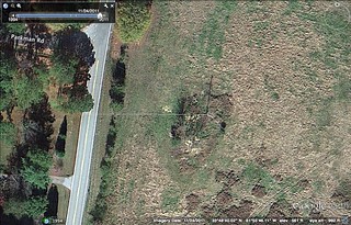
It wasn’t until later, when I was watching a video on Pottersville about excavations at the site, that I was able to piece together imagery from the video with imagery from Google Earth. As it turns out, my first set of coordinates for Pottersville were the correct ones. It is, in fact, on Highway 430 out in a field.
…or, at least, that’s where the kilns were.
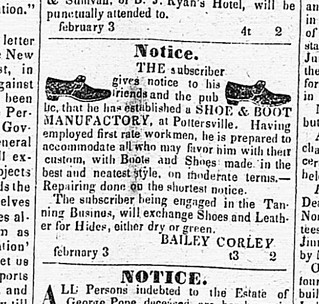
But does Pottersville qualify as an actual town for inclusion in my list of ghost towns? It’s very close to Edgefield, and might be considered just a farming suburb. However, I think it was more. For example, the towns of Gray Court and Owings are only a mile and a half apart, and they are considered separate entities. Therefore, it comes down to what was in the town. Old advertisements from the Edgefield Advertiser, found on the Library of Congress’s Chronicling America website, give an indication of the activity there. Here’s an advertiserment for a shoe maker in Pottersville…
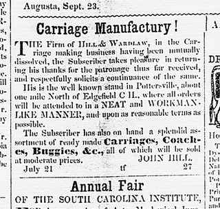
…and here’s one for a carriage maker…
The area even had its own academy, with quite reasonable rates for enrollment, by today’s standards.
It seems there was much more diverse activity than just pottery making, so I think I can safely add it to the list.
Here is the video from the Humanities Council of South Carolina about a University of Illinois excavation of the site in 2011.
Here’s one about Dave the Slave, with a sample of his pottery:
Horn Creek Baptist Church
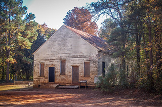
I had one more stop I wanted to make in the Edgefield metropolis area. The SC Traveler Magazine recently featured an article about Horn Creek Baptist Church. The church, formed in 1790, is long abandoned, and is on the National Register of Historic Places.
We headed south from Edgefield on Highway 34, then turned onto the Old Stage Coach Road. With a name like that, it had to have some history. The road wound through some spectacular farmland with even more amazing views. We crested Gary Hill, which provided a sweeping vista.
The road dipped down to a creek, then the pavement gave out. I’ve always said that any decent photo trek needs to include at least one dirt road, and this one fit the bill. I was glad for the all-wheel drive of the Subaru.
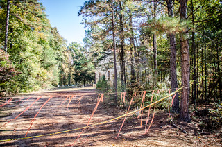
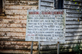
The road continued like this for a couple of miles, and eventually we reached the church. Tape and streamers were stretched across the entrance to keep people from pulling in, and “No Tresspassing” could be seen on the tape itself. Apparently they have had lots of problems with vandalism.
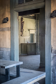
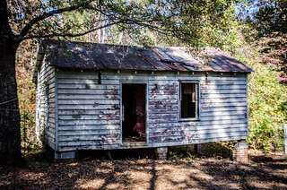
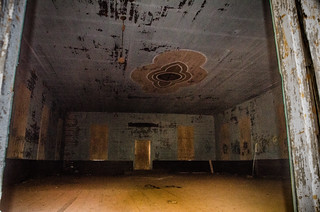
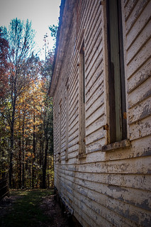
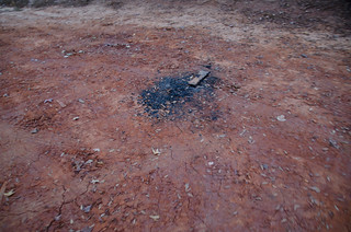
We decided that since we had come this far, and since we weren’t vandals, we would at least take a moment to check it out. A single room school or Sunday school house was closest to the road. The main building was in the meeting house style – a single room with two entrances on the front. A door behind the pulpit area led down to a creek for baptisms. There was vandalism, including a recent fire ring right in front of the church. Scary. However, there was some interesting paint design on the ceiling. We didn’t take time to check out the cemetery.
This wrapped up the Edgefield sojourn of this part of the trek. In Part Three we find a ghost town with a heavenly name and check out a small town with a huge ego. Stay tuned…
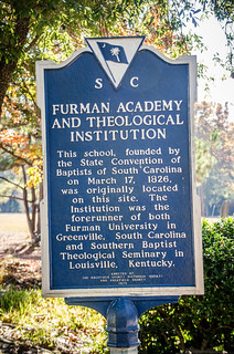


Tom….I read all of your posts with great interest as you send them, and usually migrate to your suggested prior posts that “You might also like”, which is how I got to this one. In perusing it, I noticed your photo of the Furman Academy historical sign in Edgefield, which surprised me. I had been of the opinion that the first site of the Furman Academy and Theological Institution was located here, in Sumter County, where I live, and have been for years aware of a Historical Marker indicating that location here. I always learn from your publications. Now I know that our location here was the second site of the Academy. Dr. Richard Furman was closely connected to The High Hills of the Santee in Sumter County, having come here from NY as a child with his parents, and later as Pastor of the High Hills Baptist Church (still standing). Information on the location of this marker (a granite one on the site, a metal roadside one on the roadside near the site) can be found at:
Both are readily seen on GoogleEarth street view.
Thanks for fine tuning a bit of information for me….
Bentley Fishburne
Bentley, Furman (both the man and the college) moved several times. It was even at Winnsboro for awhile. I’ve had the privilege of visiting High Hills Baptist, and inside they have a historic display set up about Richard Furman and his contributions to the church.
And again I learn – that this comment section will not accept copied and pasted link addresses, judging from its absence above. I’m going to try something else instead by copying the pertinent information to Word and pasting that here (it comes from Historic markers across South Carolina). If that doesn’t work, I will just give up on it and you can remove it when you moderate. So here’s to option 2:
Marker ID: SCHM 43-22
Location: From Sumter, travel NW on US 521 to SC 441 and turn left; travel a short distance and turn left on Road 803; it is a short distance to the marker
County: Sumter
Coordinates: N 33° 55.444 W 080° 20.656
33.92406666 -80.34426666
Style: Free Standing **
Text:
________________________________________
(Front)
Established by the S. C. Baptist Convention in 1825, Furman opened in Edgefield in 1826. Later sites were here at High Hills (1829 – 1834), Winnsboro (1837 – 1850), and Greenville in 1851 (now Furman University). In 1859 the theological department became the Southern Baptist Theological Seminary, which moved to Louisville, Ky., in 1877.
(Reverse)
The Rev. Jesse Hartwell was director of this school at High Hills, which took its name from Dr. Richard Furman (1755 – 1825), noted patriot, theologian, and educator. A native of New York state, Furman moved to High Hills with his parents in 1770. The property here was given to Sumter County Historical Commission by Furman University in 1978.
Erected by Sumter County Historical Commission – 1984
I commented on your earlier post before I read this one. Looks like the marker listed all of Furman’s locations.
Tom….It did, but it was a number of years since I had read it last. When you visited High Hills Baptist Church, you were 4.17 miles SW of the old Academy site (bearing of 52.76 degrees from church to academy).
You really do get around for a recently retired man. I was looking around the net tonight and came across the SCIWAY posting with your photos of the church and, as usual, your photos are great. It really is a beautiful old church, and well maintained. Thanks again….Bentley