Skip to content

Random Connections

A collection of photography and exploration focusing on Upstate South Carolina and beyond.

  • Home
  • About Us
  • Photos
  • Resources
  • Other Voices
  • Post Archives
  • Home
  • Richland County

Tag: Richland County

Kayaking Bates Old River and Running Creek

Posted on December 20, 2022December 20, 2022 By Tom No Comments on Kayaking Bates Old River and Running Creek
Paddling

I’ve been wanting to kayak the Bates Old River oxbow lake ever since I saw some intriguing photos of the area on Facebook. Dwight, Alan, and I scouted the area this summer and talked about paddling here when it got cooler, but we just hadn’t gotten around to it. Billy Easterbrooks posted on Facebook that … Read More “Kayaking Bates Old River and Running Creek” »

Lower Richland and the High Hills of the Santee – Part One

Posted on May 20, 2014May 22, 2014 By Tom 1 Comment on Lower Richland and the High Hills of the Santee – Part One
History and Genealogy, Photography, Rambling
Eastover Tilt-Shift
Downtown Eastover

Dwight and I had a day available in common, so we decided to do some exploring. I’ve been trying to work through my list of locations of ghost towns, seeing if there is anything of interest at these locations – ruins, an old church or cemetery, or some actual buildings. I had several possible sites in Lower Richland, Sumter, and Kershaw Counties.

As is typical with one of our expeditions, we didn’t get to all of the spots we had marked on the map, and we found a few new interesting places along the way. Plus, I got a chance to try out my new GPS (which is basically a larger version of my old GPS.)
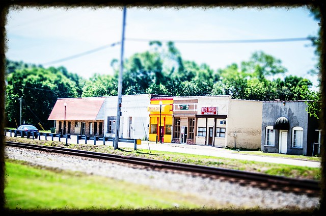
Minervaville

First on my list of places was Minervaville. It had an interesting, but somewhat brief history in the early 1800’s. I really didn’t hold out a hope of finding anything there, but wanted to check it out anyway.

Read More “Lower Richland and the High Hills of the Santee – Part One” »

Kingville, Kingsville

Posted on February 12, 2012 By Tom 22 Comments on Kingville, Kingsville
Geocaching and Maps, History and Genealogy

Kingville Station

I came upon Kingville quite by accident. I was looking for information on another ghost town in Google Earth when I spotted this name near the confluence of the Congaree and Wateree Rivers. When I zoomed in a bit further I saw that the the place indicated by the name was all wooded – there was no town there. Street View also showed just a wooded area, and not enough buildings to even justify keeping this as a place name. This intrigued me, so I did a bit of research, and it turned out to be an interesting ghost town location itself.

Kingville Google Earth

According to information on the Kingville Historical Foundation’s website, the town got it’s start in 1842 when a spur railroad line from Aiken was completed to Columbia. I checked Robert Mill’s 1825 atlas of the area, and the name Kingville does not appear. In 1850 a branch line was completed to Camden, and the town began to grow because it was now located at the juncture of two major railroad lines.

Research on the town was initially confusing. According to the historical marker for the site…

Kingville is thought to be named for its status as “king” of the railroad line between Charleston and Columbia and between Columbia and Camden.

However, the town was first called “Kingsville” with an “s”. For awhile I wasn’t sure if I was finding information on the same town. For example, this is an excerpt from an 1870 map of the Port Royal railroad in the southern states. It clearly shows the spelling with an “s”. The town’s name on this map makes it look almost as big as Columbia, but this is deceptive. Since this was a railroad map, the emphasis was on major junctions, rather than the actual towns.

Kingville_1870

Read More “Kingville, Kingsville” »

Congaree and Lower Richland

Posted on February 12, 2012 By Tom No Comments on Congaree and Lower Richland
Geocaching and Maps, History and Genealogy, Local, Travel

Starting out on the Congaree Boardwalk

Normally on a second Saturday I’d be off with the guys from Lowcountry Unfiltered. They had a great trip planned for today, but due to various reasons I wasn’t going to be able to join them. Instead, I teamed up with Dwight, his wife Sue, and son Adam to explore Congaree National Park and a bit of Lower Richland County.

Lower Richland County is located in a wedge formed by the Congaree and Wateree Rivers up to their confluence, where they become the Santee River. The area is also known as the “Cowasee” Basin, a name created by combining names of those rivers. Congaree National Park makes up most of the Cowasee Basin, but there are also lots of historical locations, including one interesting ghost town.

I headed down to Congaree on this clear, cool Saturday morning. I arrived at the park early to find an already packed parking lot. There were groups of Boy Scouts, as well as other tour groups gathering. I have to admit – I tend to be selfish with my wilderness experiences. I don’t mind others around, but lots of loud people make it hard to see wildlife. I was a bit worried.

Congaree Crowds Gather

Dwight, Sue, and Adam arrived, and soon we were off, headed down the high boardwalk. The plan was fairly simple. We would stick to the trails and boardwalks for the most part, but we wanted to do a little bushwhacking. We also wanted to find at least one champion tree.

Read More “Congaree and Lower Richland” »

Categories

  • EdTech (200)
  • Entertainment (202)
  • Family (121)
  • Gear (115)
  • General Technology (99)
  • Geocaching and Maps (208)
  • History and Genealogy (266)
  • Internet (144)
  • Local (451)
  • Miscellaneous (550)
  • Music (196)
  • Paddling (249)
  • Photography (779)
  • Podcast (6)
  • Rambling (227)
  • Rants (161)
  • Recipes (34)
  • Religion (48)
  • Restaurants (165)
  • Science (48)
  • Things Overheard (29)
  • Travel (411)
  • Uncategorized (129)
  • Washington Sabbatical (113)
  • Weirdness (60)

Recent Posts

  • A Bates Old River Two-fer
  • In Search of the Road Builder
  • The Phoenix Riots and Dr. Benjamin Mays – An MLK Day Ramble
  • An Obsession with Steak Knives
  • An Epiphany on Patriotism

Recent Comments

  • Tom on An Obsession with Steak Knives
  • Jim Culley on An Obsession with Steak Knives
  • Walter Kokoszka on Mysterious Mayucha and The Wolf Pit
  • Elizabeth on The Temple of Health: Ground-Truthing in Antreville
  • The Bay Area Basketball Fan’s Guide to March Madness on FU All the Time!

Tags

blogging cemetery Christmas Columbia Edisto River edtech Entertainment family Flickr Florida Furman Furman University gear Georgia geotagging Ghost Town Ghost Towns Google Earth Google Maps GPS Greenville Greenville Chorale history Instructional Technology kayaking Lake Jocassee LCU Lowcountry Unfiltered maps Music North Carolina Paddling Photography rambling restaurant Restaurants review singing social networking South Carolina time-lapse Travel video Washington Washington State
March 2023
S M T W T F S
 1234
567891011
12131415161718
19202122232425
262728293031  
« Jan    

Copyright © 2023 Random Connections.

Theme: Oceanly by ScriptsTown