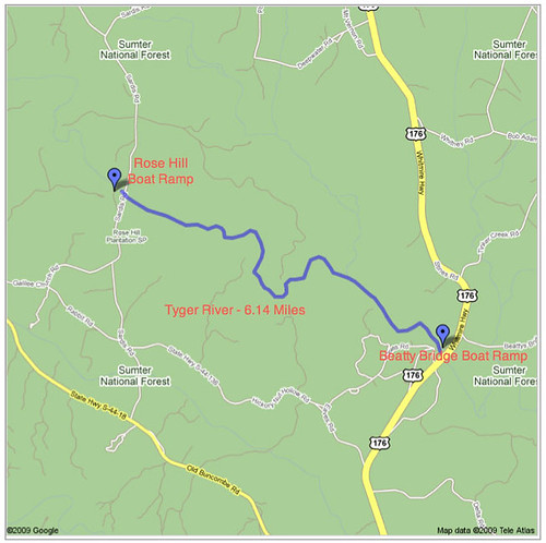
Our friends from Lowcountry Unfiltered wanted to do an Upstate River this fall. Since I’m the only one in the area that regularly paddles with them, I was tasked with finding a suitable trip. I had scouted the put-in and take-out points on a section of the Tyger River that flows through Sumter National Forest, and thought it might make a good trip. Today Bob Donnan and I scouted the section to see if it would, indeed, be a good paddle. Long story short – it wasn’t. However, it was a good day on the river, and that is always better than a day doing just about anything else.
I had my doubts about this trip. It had been raining all weekend, and when I got up Sunday morning there were flash flood warnings for Oconee County. However, I had the boats and gear already loaded onto the truck, and a phone call to Bob reported that they hadn’t received much rain. We decided to head on down to the river and check out conditions before committing to the trip.
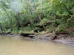
I met Bob at our rendezvous point and we drove to the put-in at the Rose Hill Boat Ramp. Both of us remarked that this area seems “ancient”. There is very little development, and it seems remote. Sumter National Forest covers most of the region, and large hunt clubs have bought up huge tracts of land. The area seems almost mystical, as if just about anything beyond the realm of reality could happen.
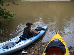
When we got to the put-in it was obvious that floods and rain were not going to be a problem. The river was VERY low. Even though the skies were gray, rain didn’t appear to be imminent. We decided to go ahead with the trip. Rising water would only help the situation at this point. We secured the kayaks with locks and ran the shuttle to the take-out.
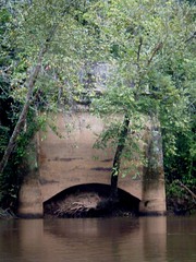
One of the main reasons for selecting this stretch was easy access to the river. The Rose Hill Boat Ramp is a great river access point, but is hardly a boat ramp. I couldn’t imagine launching anything other than a canoe or kayak from that point. Especially with the low water, there is no way that a motorboat would be able to navigate the channel. The take-out at the old Beatty Bridge, just about Highway 176, is just as nice, and just as useless as a boat ramp, even though it’s paved a bit better. The old bridge no longer spans the river, but ends abruptly at its edge, leaving and elevated paved deck above the water.
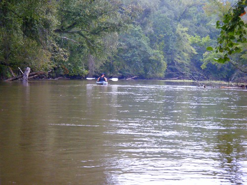
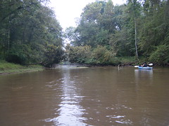
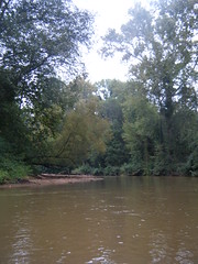
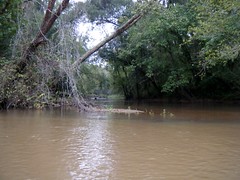
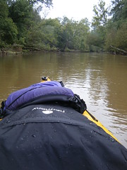
Back at the put-in we got underway. In the middle of the river was a grassy shallow spot. We encountered these all along the way. The water was a murky brown from the rains upstream, and there was a good current, but the rains hadn’t raised the water levels as far as we could tell.
Right away we starting scraping bottom. The murky water made it difficult to spot the shallows. The edges of the river tended to be deeper, with grassy shallow areas rising on the middle.
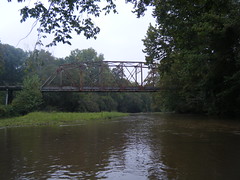
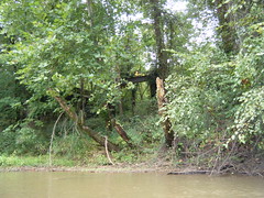
Just down from the put-in is an old steel girder bridge. Sardis Road crosses the river here, and the bridge is purportedly haunted. Known locally as “Crybaby Bridge“, the legend follows the pattern of other bridges of this name – a young woman supposedly throws and unwanted baby from the bridge, then jumps in to commit suicide in despair. Both the mother and baby then return to haunt the bridge.
Below the bridge and south of the river is the Rose Hill Mansion. While not visible from the river, this mansion and other plantations like it that once lined the river add to the historic feel of the place. Rose Hill was the home of William H. Gist, who was governor of South Carolina when it seceded from the Union.
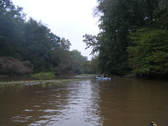
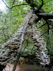
Apart from the shallow water, the paddling was good. The current moved us along, and we used our paddles to pole out of the sandy spots. There was a good bit of trash in the river – limbs, etc – but nothing completely blocking our route. We always seemed to have a way around.
The area certainly was remote. We saw absolutely no one else the entire time on the river, although we did hear gun shots from hunters when we first started out. There was plenty of wildlife along the way. Several herons and kingfishers kept us company, and we could see and hear other birds along the banks. In some of the sandy areas we could see deer footprints and other footprints that looked like large paws.

I had marked several locations in my GPS. These included some beaches that might make nice lunch or rest stops, one large island, and an oxbow. The oxbow really threw us for a loop (so to speak.) The channel to our left had more water running through it, but it was clogged with debris. The channel to the right was much more open, but also more shallow. Despite the shallow water we opted for the right hand channel. Soon it was too shallow to paddle, so we paused for a lunch break and to scout the area.
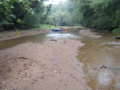
We decided to drag the kayaks along the shallow channel until it rejoin the other stream. The boats would float – just not with us in them. So it was more a matter of us just pulling them along the route. Still, it was over a quarter of a mile of this, and both of us would have much rather been IN the boats. To make matters worse, somewhere along the way I dropped my camera, and we had to go back and try to find it (which we did.)
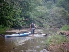
It was at this point that we both gained an appreciation for our Perception Torrent kayaks. While we like the new boats, the Torrents are more maneuverable and have a shallower draft. We probably would have been able to paddle either channel in those boats.
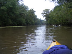
Eventually we joined up with the other stream and we were able to get back into the boats. Even so, it was tricky navigating the shallow waters. I was getting very tired of running aground, especially after the long haul.
About two-thirds of the way along Fairforest Creek joins the Tyger River. The current and depth picked up, and we had better paddling. We could go faster if we wanted, or we could just float along with the current without worrying about running into a strainer. Even so, there were still shallow areas along the way the would occasionally snag us.
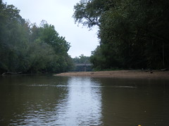
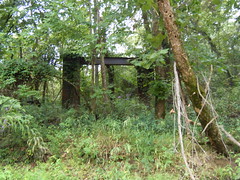
After about four hours on the water we finally reached our take-out at Beatty Bridge. We had seen the old bridge at the boat ramp. However, the other side of the river was even more interesting. There was not one, but TWO old bridges. Metal framework was all that was left of the older bridge, while the other was a concrete deck similar to its partner on the other side.
We paddled down to the Highway 176 bridge for a minute, then returned to our take-out. As we were pulling the boats out, a Union County deputy pulled up and asked what we were doing. He seemed more concerned about the “abandoned” vehicle at Rose Hill, but understood when we explained that it was ours. With the boats loaded into the truck, we returned to retrieve said vehicle.
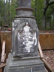
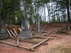
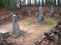
On our way out we decided to stop at the Gist family cemetery on Gallilee Church Road, about a mile from Rose Hill. Bob was amazed that the grave site of such a historical figure was in such a remote place. The cemetery looked like it was in much worse condition than the last time I was here. There were ugly wooden braces that were attempting to hold up the old wall. I hope that they can restore the area. I do find it ironic, however, that the secessionist governor is buried in Union County.
Conclusion:
This would be a great place to paddle, but it needs more water. It was just too shallow to be enjoyable. I’m afraid I’m going to have to suggest an alternate for our October trip.
Even so, I’m not sure how long we can wait for another opportunity to paddle this stretch. There is currently a proposal to dam the river below Fairforest Creek, creating a 5300 acre lake. This would inundate much of the Tyger/Fairforest flood plane, including parts of the Rose Hill estate. The proposal has the support of some businesses and the local Union newspaper, but is opposed by various environmental groups. The initial proposal was in 2006, and I don’t know the current status of the proposal. There was a Bush-era plan to sell 300,000 acres of national forest land that fell through, and I think (I’m hoping) that it’s failure will also kill this dam(n) plan. I guess we’ll see. As much as Union would like to have the economic benefits of a lake, I’m afraid the subsequent development would destroy the mystical nature of this area.
Good write up Tom. Might have to try this stretch myself sometime, even with the low water levels. Something about the “ancient” feeling is attractive.
Just let me know when. However, if we go we’ll probably want to use the sit-on-top whitewater boats. They won’t drag bottom as badly as the Pungos will on this river.
I was planning a two night trip down this section next weekend, but after reading this I might have to reconsider. Is the water still too low? If so, can you recommend any other rivers in the area? Thanks for your help.