I’ve known about Boyd’s Mill Pond for most of my life. It was on the way from Gray Court to Greenwood (via short cut.) Visits to my dentist in Greenwood would take us on the road that curved by the pond, giving me glimpses of the small lake. Even back then, I longed to stop and explore.
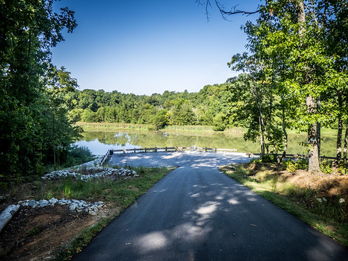
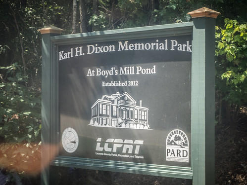
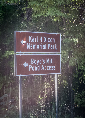
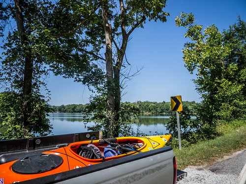
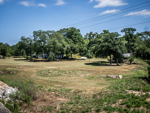
Fast forward several decades and I finally have a chance to explore the area. In 2012 The Karl H. Dixon Park opened, and now provides the only public access to the lake with a playground and boat ramp. I had dropped by here to scout several weeks ago, and this morning I decided to haul my boat down and check it.
First a bit of history…
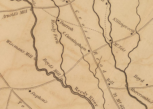
The name “Boyd’s Mill” predates the pond by almost a hundred years. As early as 1825 the mill shows up on the Reedy River on Robert Mill’s Atlas for Laurens County. The name “Boyd” even shows up on this map as a separate locale. There are references to the Boyd’s Mill community throughout the 1800’s in archives of the Laurens Advertiser.
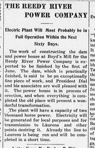
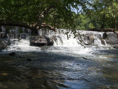
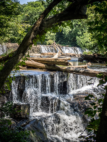
In 1907 the Reedy River Power Company was established, and a dam was constructed across the river at the former location of the mill. Thus, in 1908, Boyd’s Mill Pond was born.
So, the name “Boyd’s Mill Pond” is a bit of a misnomer. One thinks of a “mill pond” as supporting a mill of some sort. But in this case the mill predated the pond. Even so, this is an old body of water compared to some of the other man-made lakes in the area.
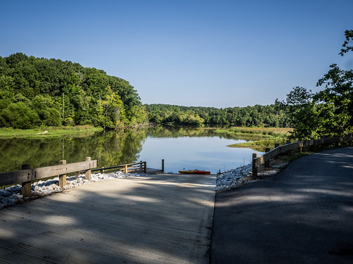
I arrived at Dixon Park at about 9:30 and there were two other vehicles there. One belonged to a fisherman, and the other had a boat trailer. I spotted the fisherman later out on the lake, but never saw the other boater. I had the boat ramp to myself when I launched.
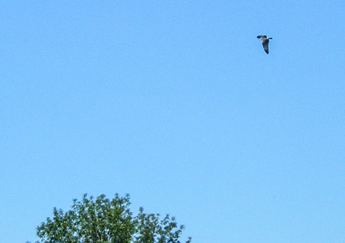
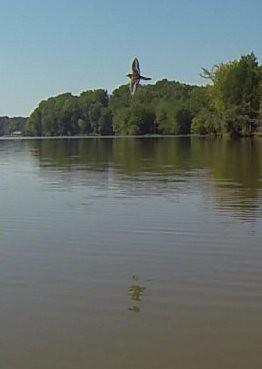
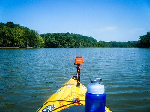
As I was getting ready to launch I spotted an osprey diving into the water to make a catch. The bird then circle overhead and headed off into the woods. The osprey would keep me company for most of the trip, and I was really wishing I had a longer lens with me.
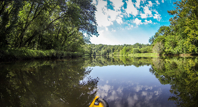
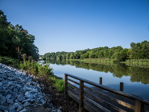
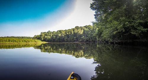
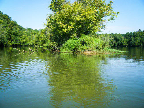
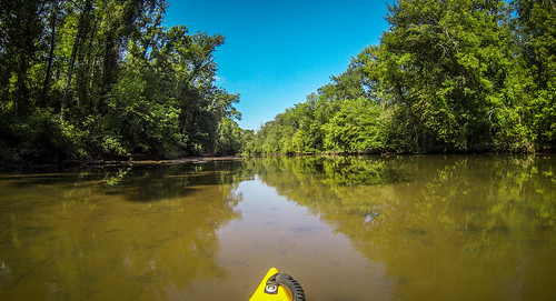
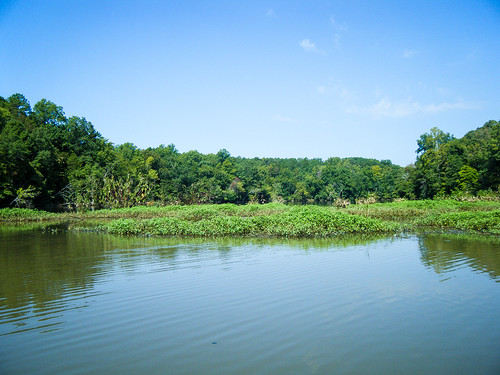
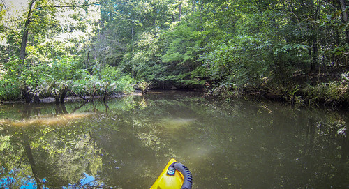
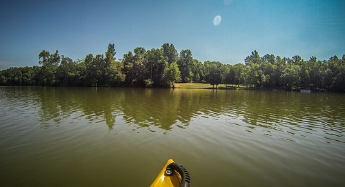
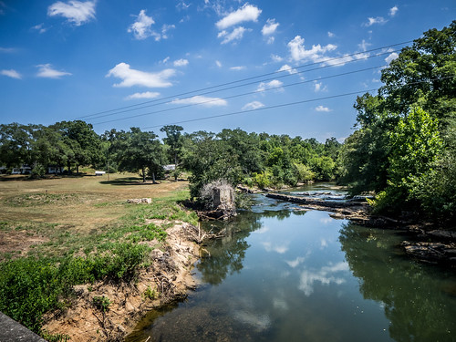
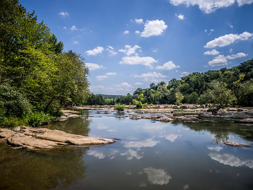
The ramp launches into a narrow channel. It’s wide enough, but lately I’ve been on rivers much wider. I paddled upstream, hugging the right bank and staying to the left of a good-sized silt island. In fact, siltation looked to be a major problem with the pond. I found myself in VERY shallow water very quickly.
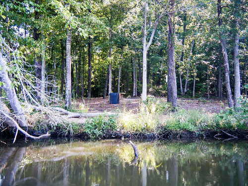
I managed to make it through, and found myself at a nice little fishing point accessible from the park. A bit later I spotted the occupant of the other vehicle out on the bank fishing. I continued into a tiny cove that looked like it might be a tributary, but it was a dead end.
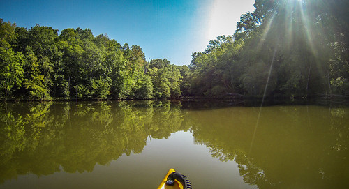
I rounded this cove, heading toward what I thought was where the Reedy River enters the lake. I was mistaken. The cove was completely blocked off. However, it looked like the west boundary of the cove was a narrow spit, and appeared to be open on the other side. I suspected that the river was on the other side of that spit. I paddled back toward the boat ramp, rounding the little silt island.
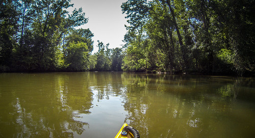
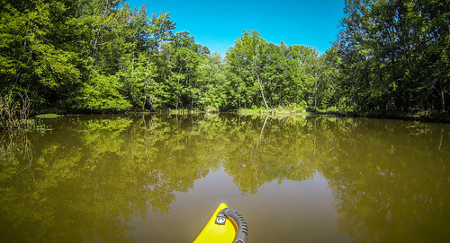
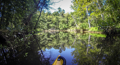
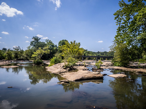
I found the entrance to the river, and headed upstream. I always like to try to paddle as far as I can on the river before exploring the lake. There was some current, but it was doable. The problem was with shallow water. I kept running aground and having to closely watch where I was paddling.
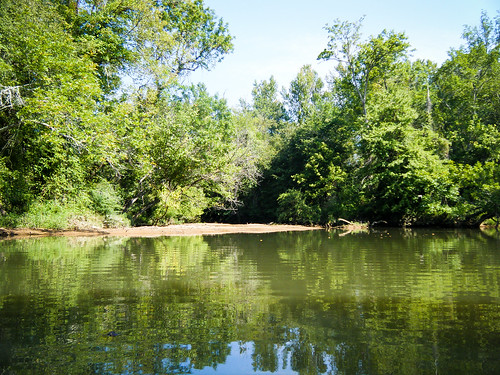
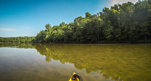
I didn’t make it too far up the river. I rounded one bend and I could see mounds of silt with narrow passages between. I decided I just didn’t want to bother with it, so I turned and headed back out to the lake.

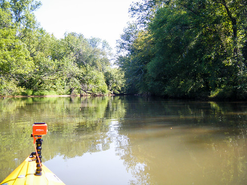
Both on the river and out on the lake I was seeing lots of bird life. In addition to the osprey, several herons kept me company. There were also several turtles basking in the sun.
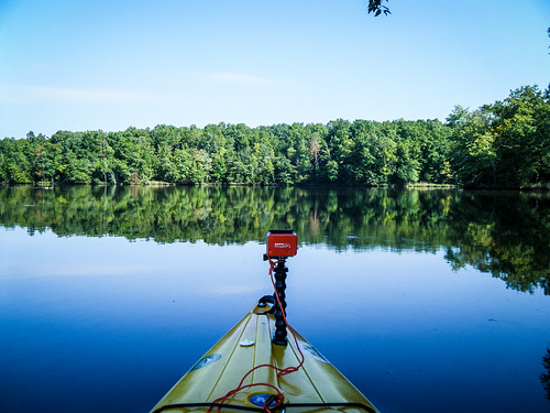
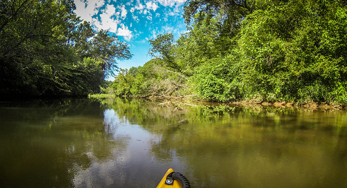
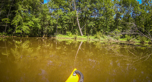
The river dropped me right back at the boat ramp. I used it as a stopping place to change batteries in the GoPro and continued my trip. I paddled on downstream and rounded another silt point into another deep cove. As I rounded the point I was dive bombed by what looked like a sanderling or similar bird. I suspect it had a nest nearby, because it continued to scold me as I paddled past.
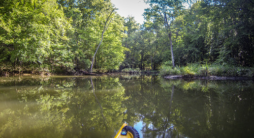
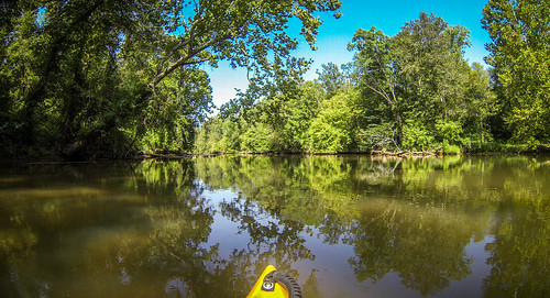
I paddled on into the cove, carefully watching for snags and low points. It looked like this was another tributary stream, but I couldn’t tell for sure. The stream was much narrower than the Reedy, and I couldn’t get too far. There were several herons in the trees, so I may have stumbled onto a rookery. I took several shots with the cameras I had, but none of the heron shots were clear enough.
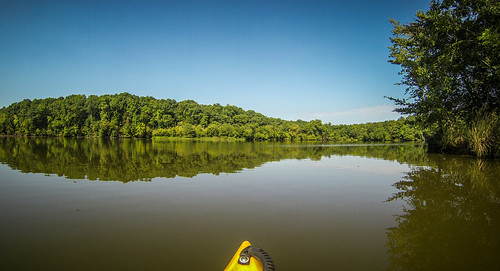
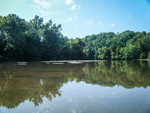
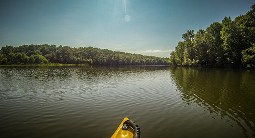
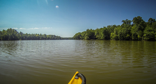
From this cove I paddled back out onto the lake. My original intent was to try to paddle down to the dam. However, I had no clue how far that might be, and it was already hot as blazes out on the lake. I crossed over to the east bank of the lake, then made my way back to the boat ramp. I had been out for only a couple of hours, but the heat was getting to me.
After loading up my boat I decided to drive down to the curve where the road dips down to the lake. It was further down than I remembered. I could have paddled down there, but it would have been a longer paddling trip than I planned for today. As I remembered, there were no trespassing signs everywhere.
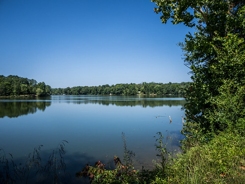
Conclusions – this is a nice little pond for a quick getaway. The pond seems more remote than I imagined, and there was lots of wildlife, especially birds, up on the upper reaches of the lake. The problems are with siltation. While the scenery and wildlife might be nice, water quality is terrible. At one point I encountered brown bits of floating sludge that I just didn’t want to see or know what it was. Lake Rabon is close by and larger, but it’s been a long time since I’ve paddled it. I may have to venture out that way to see how it compares with Boyd’s Mill in terms of scenery and water quality.
I was off the water, but it was still early. I continued on down to Highway 252, intending to head over to Ware Shoals. When I saw the sign for Indian Mound Road I decided to head that way. I’d passed by this road many times, but to my knowledge, had never traveled it. I decided to check it out. I didn’t know whether I’d actually see an “Indian mound” or anything like it.
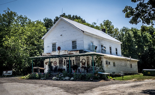
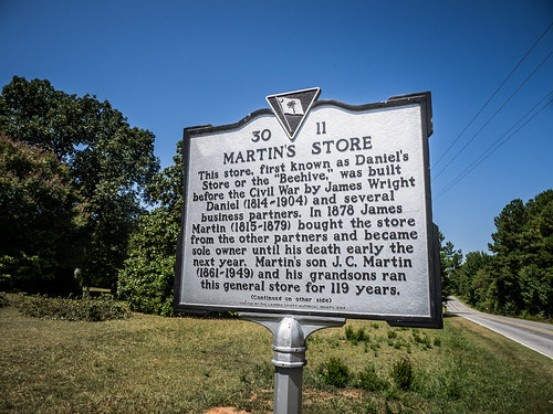
I did drive past lots of mounds and rolling farmland. It was a beautiful road, but I didn’t see anything obviously archeological. I was surprised to come around a corner and spot Martins Store. The store was established in the early 1800s, and was known as Daniel’s Store, or “The Beehive” until it was purchased by James Martin in 1874. It was in in operation until the 1990s. A sign on the door said that it was opening again on September 3.
Indian Mound Road turned out to be a MUCH longer road than I had imagined. It crossed several roads with which I was quite familiar, including Neely Ferry Road and Ekom Beach Road. Eventually the road connected to Highway 221 at Cold Point and Crenshaw’s Store.
It was well past lunch, but I was nowhere near any place to get something to eat. I stopped at one of the quick shops at Madden’s Station to get a drink and snack to hold me over.
On a whim I decided to had back down Ekom Beach Road. It had been a long time since I’d been down this way, and I wanted to see what changes, if any, had taken place.
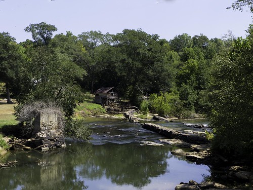
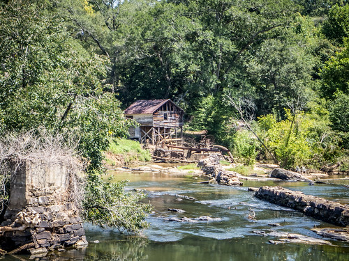
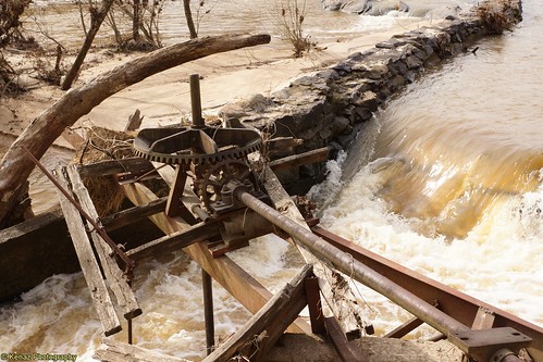
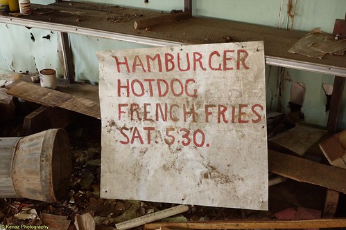
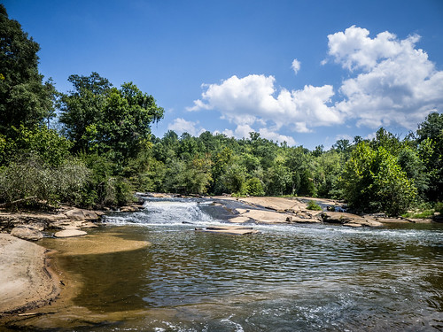
Ekom Beach was once the site of Culbertson’s Mill on the Reedy. The river falls over a small shoal and takes a deep bend. The wide sandy area was perfect for swimming and picnicking, and the land owners took advantage of that by putting up a dance hall, skating rink, and snack bar. At one time Ekom Beach was a popular hangout.
I have some personal history with the location. In the 1970s my brother Stephen was making some extra money by roofing houses with his high school friend. On rare occasions I would help them out. The home place at Ekom Beach was one of those locations, and I spent several very hot days removing shingles from the house, then cleaning up the mess. Stephen had bought a six-pack of beer and put them in the Reedy to cool down. He was 18 and of legal age to purchase beer at that time. I was just 13, but decided to have a beer anyway – my first.
The river water wasn’t cool enough to chill beer, so what we got was a hot unpalatable mess. I guess I have to thank Stephen for that experience, because I didn’t touch beer again until I was in college. Still, I tell people I had my first beer at age 13.
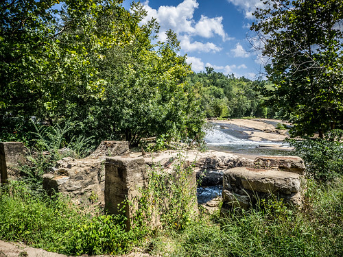
The land looked very much cleared from what I remembered. There were the remains of a dam and the old mill, as well as one of the smaller buildings. The home place was also still intact. There were No Tresspassing signs, so I took a few photos from the road.
The land came up for sale recently, and the Laurens County Museum was given the opportunity to visit the site. I wasn’t able to go with them, but fellow photographer and explorer Sean Green took a great series of photographs of the site. The photos below are from his collection.

Ekom Beach Road dumped me back on Indian Mound, and I followed it until I got to Power House Road. This road took me under Highway 25 and around to the power generating station at Ware Shoals. From what I’ve read, this power station was modeled on the design used by the Boyd’s Mill Pond station.
I continued until I got to Ware Shoals Park. I pulled in to wander onto the rocks and take a couple of photos.
I had recently downloaded the Photos Sphere app from Google for my iPhone, and decided this would be a good place to give it a spin, so to speak. This was the result.
An altercation was breaking out up the bank, so left in case gun play was involved. I drove through the town of Ware Shoals and made my way back to Highway 25, heading in the general direction of home. I decided I had time for one more stop, so I took a detour to Cedar Falls Park. Since my Ware Shoals Photo Sphere turned out well, I wanted to try one there. I took a few photos first.
Here’s the Photo Sphere:
All in all, it had been a good day out and about, but I’m ready for cooler weather for these explorations.
I paddled the Reedy from Hwy 76 bridge down to Boyd’s Mill Pond about 10 times this past year and the river was never the same twice. It’s a fun little run with lots of wildlife. I have seen wild pigs, beaver, turkey, and birds, birds, birds. The scenery is constantly changing and I love the high rock cliffs, makes me feel like I’m in the mountains. There are usually many sandbars to stop and hangout or takeb
I really enjoyed reading this and hour pictures. I love learning about the history of this area. My son, cousin and I just paddled it this morning. We really enjoyed it!
How long is this float ( time wise) ? What type of water ,rapids, calm , jammed up , combination ect..? Has anyone checked this section of the river since the big rain ?
Just as an update:
There is a brand new park going in right now that should open up between late August and Early September of 2016. This park will be at Tumbling Shoals (Where the Reedy River goes under Highway 76). The new park will have kayak access and it will be about 4.5 miles from the park to Boyd’s Mill Pond. I paddled it a few months ago and with the mild current and steady but relaxed paddling we made it in about an hour. Water was deep enough at the time that no one got stuck and while there were a few trees down, there was always a way around. As usual though…. it is always subject to change.