With Laura out of town at a conference and a long weekend at my disposal, I had decided to goof off with Houston, and hopefully get a few decent shots. Houston and I have had some strange photo adventures over the many years, going all the way back to when we built pinhole cameras, and including a bizarre ride in a Caddilac hearse that had mutated into a convertible with a bathtub on the back (but that’s another story.) Today we just wanted to get away from the rubber-stamped vinyl-sided monstrosities that have blighted nearly all of Greenville County. Over a plate of bratwurst and saurkraut at Haus Edelweiss, we decided to find some waterfalls in Pickens County.
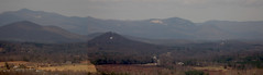
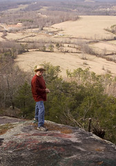
Our first stop was Glassy Mountain in Pickens County. We hiked down to the exposed rock and enjoyed the views of Table Rock, Pinnacle Mountain, and Sassafras for awhile.
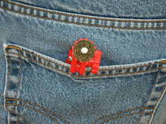
At one point I asked my brother why he was taking photos of my butt. He was fascinated with contrast of the red of my mini-tripod with the blue of my jeans.
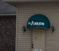
There was a quick entry into the town of Pickens proper. It always strikes me as a quaint town with potential, but on the verge of weirdness. For example, I’m not sure what to make of this place. Is Le Juan’s French or Spanish??
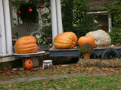
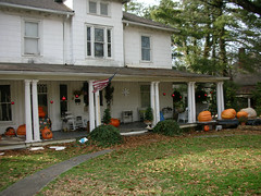
We spotted on house on the way out that was covered in pumpkins. Some of these things were monstrous. Many had started to rot significantly. We couldn’t decide if they just hadn’t cleaned up from Halloween or if it was a pumpkin-themed house. It still had Christmas decorations up. I’m tempted to come back by after February 14 and see if they have added Valentines to the mix.
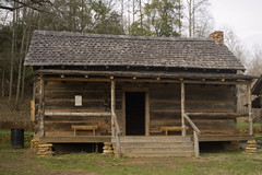
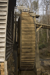
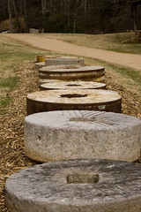
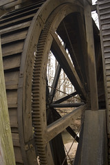
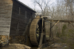
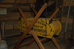
We headed north on 178 out of Pickens, and made a quick detour to Hagood Mill. The buildings were open this time, unlike my last visit. We toured the exhibits and wandered into the interpretive center and store.
With my shooting my Nikon D50 and Nikon S1, and Houston shooting his Nikon S3, we decided upon a little photo competition. Both of us were taking pictures of anything and everything, employing weird angles and lighting. Most of those didn’t get uploaded to the Flickr account.
Further on up 178 we passed one Harley rider who is apparently not going to let ANYTHING get in the way of his ride, including a broken leg.
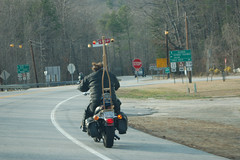
We continued on 178 crossing Highway 11, and soon came to the most likely destination for our determined bikers. Bob’s Place Tavern sits at the intersection of 178 and Cleo Chapman Highway. It hangs the side of the hill, and looks like the kind of place where anything could happen. We were going to stop for pictures, but we were obviously on the wrong vehicle.
We turned onto Cleo Chapman Road and headed down the ridge into the Estatoe Valley. Now I was exploring new territory. The valley itself was spectacular – beautiful bottomland bounded by hills running along the river. Houston wanted to buy the entire valley.
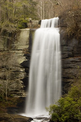
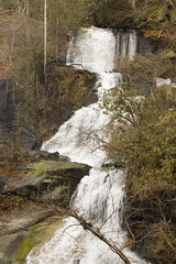
A turn onto an even tinier road eventually lef us to a parking lot for the Twin Falls trail. The trail was wide and well-maintained, and there were several already there visiting the site. Along the trail, we had to resist the temptation to take photos at every tiny cascade.
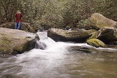
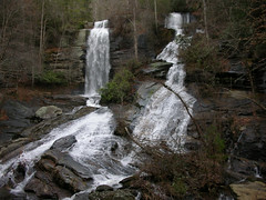
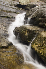
After about a quarter mile hike, we reached the falls. Either of the casecades would have been impressive in their own right. The combination of twin falls was truly impressive. There is a nice viewing platform opposite the falls. Unfortunately, walking causes vibrations, so my shots didn’t turn out as well as I might have liked. Houston climbed on up to the base. I would have loved to have done so as well, but would have risked the camera and tripod. We still got some good pictures.
Another couple was at the base of the falls. I immediately spotted the HP IPaq and GPS, and thought "geocaching." I had my GPS so I could geotag the shots. When they saw it, they said, "Hey, we know you!" I gave them my real name, and they immediately knew my geocaching handle. Turns out it was Sweet Ole Bob from the Upstate Geocacher’s Association. Houston started giving be grief about not being able to go anywhere without runing into someone I know.
We drove out of the valley, with both of us salivating over the wonderfal farmland. We passed 50 acres for sale, and imagined buying it and putting a cabin up there for us and the rest of our siblings to use as a retreat. Those thoughts were soon dashed, though, as we saw a sign for another Cliffs development nearby. That land wasn’t going to come cheap. It was time for a trip back to reality, so we headed on down the maintain and toward home.
Last time I was at Twin Falls, I don’t recall a wooden overlook. We took the trail up to the base of the left hand (plunge) fall. As you asy, it is a beautiful and spectacular location.
I remember the Eastertoe valley from my childhood. My dad installed a fairly high number of the phones put in up there in the 50s and 60s, and we used to ramble up there. Pre-Keowee, so we usually ended up at the end of Hwy 11 at the Girls camp where the rivers come (came) together and the pavement ended. Would drive up the left hand river (Whitewater?) a ways, then walk over the wooden bridges. Water looked a few inches deep, but was a number of feet. “The backside of nowhere”.