My last Saturday before heading back to work after Winter Break, and I decided to do some geocaching and photography in Fairfield County. I had new GPS units to test drive, I had specific locations I wanted to photograph, and I wanted to take some time to swing by my parent’s house. I had ambitious goals for what I wanted to see and do, perhaps too ambitious. It turned out to be a day of mixed results – delight and frustration, discovery and missed opportunities.
Background and Preparation
Fairfield County is not that far away (as, say, Myrtle Beach), but it is completely outside of my normal sphere of travel. I really hadn’t paid it much attention. My parents and I had taken a couple of drives in the Pomaria/Peak area just east of where they live in Prosperity and afterwards I was checking out geotagged photos for that region in Google Earth. I was intrigued by some interesting shots of quarries and mines with sharp angles and interesting lines just across the Broad River in Fairfield County. Specifically, the photos of Flickr photographer “ngramly” caught my attention…
I decided that the area was worth a visit.
I got two new GPS units for Christmas (more on that in a later post) and was itching to try them out. I downloaded a bunch of geocaches for the area into both the handheld and car GPS units. I also selected all of the place names for Fairfield from my SC Place Name Database and loaded those into the car GPS. Additionally my new Garmin Nuvi 205 has photo navigation, so I downloaded a selection of photos from the area into the car GPS.
The Journey Begins
I had originally planned to head out on Friday morning, but the weather was just too bleak. It was raining, and the forecast didn’t call for any improvement. Saturday morning was foggy, but the forecast was for partly cloudy skies, so I decided to go for it. I left the house early, armed with books, maps, multiple GPS units, and multiple cameras. I had enough gear to produce a documentary for public television.
I had hoped to get off of the Interstate in time to get some interesting fog shots. My plan was to exit on Highway 72 at Clinton and drive south from there. I actually exited one prior to that, onto Highway 56, so I could also grab breakfast at the McDonald’s there. I figured that since I was so equipped with mapping GPS units, I should be able to find a connecting road between the two highways. I did, and it took me by Duncan Creek Presbyterian Church, one of the oldest Presbyterian churches in Laurens County. I wanted to explore the area, but the church was surrounded by a chain link fence that was padlocked. Oh well. I needed to move further south toward my main target, anyway.
A Bit of Geocaching
I eventually connected with Highway 72 and drove into the town of Whitmire. I saw that there were a couple of geocaches not far away, so I decided to catch those. The first one I attempted turned out to be a multi-stage cache. I decided I didn’t have the patience for that, so I selected the next closest. The description said to turn onto Lee Cemetery Road, and from there onto a forestry road. I remembered seeing a cemetery when I came into town, and figured that was the one, since it looked close to the cache on the map. I drove through the cemetery, but could find no connecting roads. I had to give up. When I checked the actual cache location later, I saw that Lee Cemetery Road was on the opposite side of the Enoree River. There was no way I could have gotten to it from where I was. So far I had two strikes to my count, the morning was slipping away, and I was nowhere near my target area.
I had two more specific caches I wanted to find before headed toward Fairfield County. The first was Jew’s Harp Spring in the Sumter National Forest. I hiked the 500 yards down to the spring, but never found the cache. I was trying to go paperless, and was relying on my Blackberry to download the cache hints and descriptions. I couldn’t get a connection down near the spring, so I could only rely on the GPS. Strike three, but I was not ready to give up completely.
Cache number 4 commemorates the tale of the Ghost Hound of Goshen Hill Road, a story about a dog that supposedly haunts the area. The cache was on the road, and turned out to be a quick park-n-grab micro. I felt a bit better having at least one find to record. The fog still had not lifted, and the remote area almost made one think that a ghostly dog was possible in this part of the world.
Wandering in the Wilderness, despite the GPS
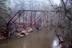
I was beginning to panic at the amount of time my furtive attempts at geocaching had eaten up. My first target in Fairfield County proper was the little town of Blair. I set Garmin Nuvi to navigate to the town, and set off following its directions. I was a bit concerned when both the GPS and my car’s compass said I was traveling northeast. I had already crossed the Tyger River and stopped to take a photo of the old steel girder bridge there. As it turned out, I had to find a way to cross the Broad River, and that meant going north.
Along the way I kept seeing geocaches pop up on the GPS display. I came to the turn off for Pittman Lake, which had three caches in the area, so I decided to give them a shot. About a mile down a dirt road I came to the lake, proper. There was one micro that was an easy find, and another not too far away. Once again the Blackberry failed me. I was in an area with steep gullies, similar to one where my sister-in-law had broken a leg on a geocaching trip. I didn’t want to repeat that incident, especially since I was by myself, so I decided to give up on that one. The third cache in the area proved equally elusive. The score was now 5-2 against. I needed to keep moving.
I passed through the community of Carlisle and came to the Broad River. Just on the other side was a sign pointing to the Sandy River Landing, so I decided to check it out. There was a nice boat ramp on the Sandy River just above where it joins the Broad River. It looks like a great place to launch a kayak, and I may have to research this further as a possible expedition.
Finally into Fairfield County
When I crossed the Broad River it was from Union County into Chester County. South of there I finally crossed the northern boundary of Fairfield County. As I drove distractions in the form of geocaches and interesting waypoints kept popping up on my GPS. I tried to ignore them. I came to an interesting old farm home and a sign pointing to the community of Shelton, so I thought I might check it out.
The road wound through several remote communities, and eventually turned into a single-lane track that wound past the railroad track that borders the Broad River. According to the GPS I was in the community of Clayton Depot. Along the tracks were several brick and masonry structures that looked like water containers or silos. I couldn’t really figure out their purpose, but they looking interesting.
Finally I got tired of the voice on my Nuvi saying that it was recalculating my route, so I decided to follow it on to Blair. The recalculated route put me on the Old Blair Road, and I could see both the railroad and river off to my right as I headed south.
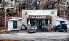
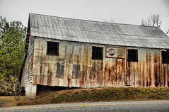
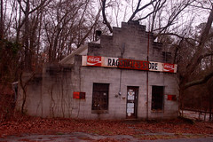
The town of Blair is just west of a Vulcan Materials quarry. This is still an operating quarry, so I turned my attention to the town. This was at the end of a road, and was right on the railroad. The town consists of two stores, one of which is still in operation as an antique store, a feed warehouse, and a post office.
Just outside of the town was a micro-cache with I was able to add to my “found” list. The final geocaching score was 5-3.
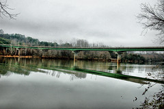
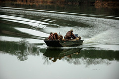
I decided to give the photo navigation capabilities of the Nuvi a try. The GPS showed a photo of the Highway 34 bridge over the Broad River nearby, so I set the unit to navigate to it. The GPS took me off of the highway down a dirt road to a river access point with the exact view I had seen in the photo. Pretty cool! The dirt road led on to a waterfowl management area. Two different duck hunting partings pulled up to the access point while I checked things out.
On to Winnsboro
By this time it was getting close to lunch, and I was getting hungry. I looked on the GPS for food options, and most of these were in the opposite direction in Newberry. I decided to head onto Winnsboro. Once again I drove along ignoring photos, waypoints, and geocaches along my route.
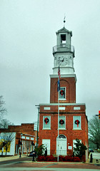
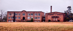
Highway 34 travels past some interesting large old homes as it enters the town. Eventually I made it to Congress Street, the main street of the town. Winnsboro has some distinctive architecture, including the town’s clock tower and town hall. I drove along looking at the old buildings, including one old abandoned high school.
By this time I was getting really hungry. The closest option according to the GPS was a place called “Hoot’s” on Congress Street. I found it, along with a sign that read “Gone Fishing.” Another GPS attempt led me to a house in a residential area. I finally selected McDonalds, and the GPS led me two blocks away from it. I decided that (A) the Nuvi GPS is not good for finding food and (B) Winnsboro really needs more food options. Since I had done McD’s for breakfast, I settled for Sonic for lunch.
On to the Quarry
The day’s weather was not improving. The fog had lifted into clouds, and now a light rain was falling. I had seen some interesting things, but not what had initially drawn me to this area. I set the photo navigation to take me to the quarry I had seen online.
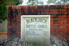
On the way out of Winnsboro I passed by a church with an interesting name – Blackjack Baptist Church. I had to wonder what their church socials must be like, or how they collected their offererings on Sunday mornings.
Eventually I found the Anderson Quarry Road. The official state stone is Winnsboro Blue Granite. This was mined at Anderson Quarry and also at Rion nearby. The state capitol building is made from this stone.
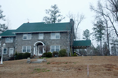
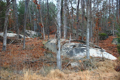
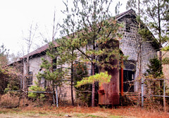
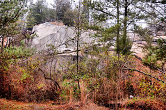
As I drove down the quarry road I saw many large boulders made of the granite. It seemed like all of the houses and buildings were made of the blue stone, including the abandoned mine buildings themselves. I wanted to explore the area further, but there were No Trespassing signs, the weather was starting to go downhill, and I had eaten up too much of the day geocaching. Since I couldn’t take any neat photos, I’ll at least link to some on Sciway.net. Here are the few I was able to take…
Reluctantly I left the quarry. I do want come back.
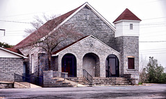
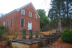
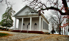
I was now headed westward. Along the way I spotted an interesting building which turned out to be the Old Brick Church. According to “South Carolina: A Day at a Time” by Todd and Wait, the church is known as the birthplace of the Associate Reform Movement in South Carolina.
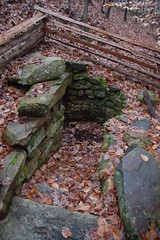
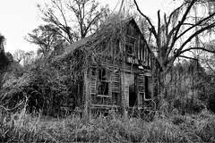
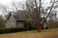
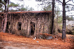
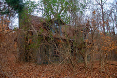
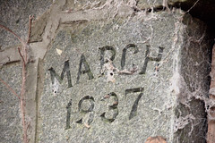
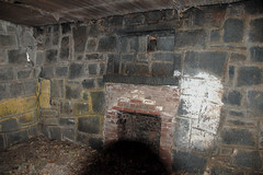
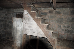
In the woods next to the church was an abandoned cabin made of the blue granite. I didn’t see an fences, locks, or posted signs, so I decided to explore. The house featured dormers on the second floor, which is a relatively new architectural feature. A carved stone indicated that the house was built in 1937. There were two small rooms downstairs, both with fire places. A wooden staircase led upstairs to two more rooms. I didn’t explore for fear of falling through rotted timber. It was an interesting place.
Monticello Lake Country
I took the Monticello road north toward the community of the same name. This runs along the east coast of Monticello Lake. At one point there was a scenic overlook with cloudy, misty views of the lake and of the V. C. Summers Nuclear Power Station at Parr Shoals.
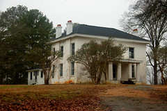
I continued northward Monticello. There was a huge estate on the left with a promenade of trees leading to a grand house. It looked like there were at least a couple of hundred acres, mostly lakefront. The house itself had a long back yard that led down to the lake. It looked like a great place to live. I found out later that this house had been built by Dr. Jonathan Davis, who contributed to the founding of Furman University.
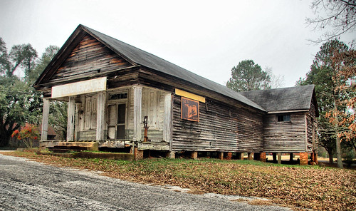
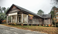
In Monticello proper on finds Monticello Methodist Church, located on the lake, and the Monticello General Store. The store has long been closed, but it features some interesting old signs and a gas pump located on the porch itself. There are several other old buildings and houses in the area.
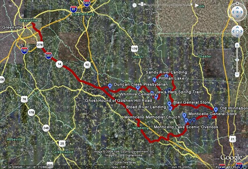
By this time it really was getting late, and I still hadn’t gotten by to see my parents. I did manage to get over to Prosperity to see them, and managed to make it home in time for dinner. Here’s a screen capture from Google Earth of the day’s travels..
…followed by an interactive map from Google Maps of the more interesting stops…
View Larger Map
Conclusions
I had tried to pack too much into this trip. Next time, if I’m going geocaching, I’m just going to do that and not worry about photo explorations. I found myself getting to distracted. I also want to make a trip down to this area and just explore the quarry region. The other pictures I’ve found online look very interesting. I’m also wondering who to contact to arrange a visit to these locations. It’s a fascinating area.







Cool trip. Other stuff down that way are Rose Hill, Union, Buffalo, Chester, and Lockhart. I spent time in the area between Cross Anchor, Whitmire, and Union when my dad used to deer hunt. The area got too full of gun-carrying folk who were not as gun safe as we were. Beautiful area, though, particularly in the woods. Oh yeah; Glenn Springs (on the southeast side of Croft State Park) is pretty cool as well.