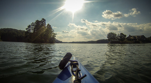
It was another beautiful October day, so I decided it was time to take one of the boats out for a solo paddle. I wanted a place fairly close that wasn’t a place I paddled frequently. At the last minute, I decided upon Lake Keowee, launching from Keowee-Toxaway State Park and paddling up the Estatoe Creek branch.
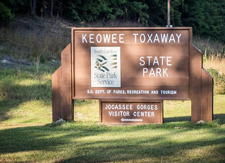
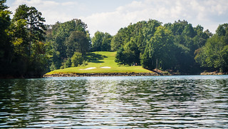
Keowee-Toxaway State Park is located on either side of Scenic Highway 11 on the western edge of Pickens County. The park borders two sections of Lake Keowee. Years ago Laura and I had taken my canoe on the southern part of the park, which borders the main body of the lake. I remember it as a typical South Carolina lake, full of motor boats, lined with houses, and generally not appealing to paddlers. Not long ago we stopped at the northern section. A dedicated canoe/kayak launch had been built, but directly across from the launch was the Cliffs golf course. Again, not too particularly appealing. However, I could see that from this location one could explore some more remote reaches, and that meant it had potential.
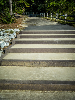
I arrived right about noon. One drives past the Jocassee Gorges Visitors Center on the way to the launch. The building that now houses the center is the former Holly Springs Baptist Church, donated to the state in the 1970s and restored. Since I wasn’t sure of my timeline, I didn’t stop this time.
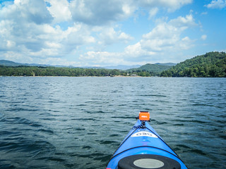
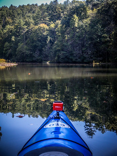
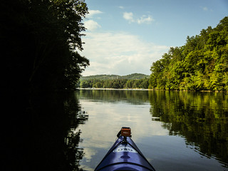
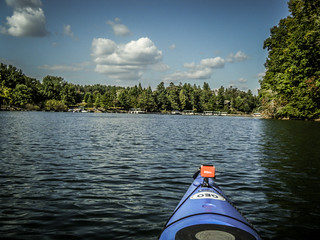
When I arrived at the launch I was the only one there. However, there was a good bit of motor boat traffic. I guess others wanted to take advantage of the unusually warm October day. I got launched and headed eastward, toward the lake’s backwaters and away from civilization.
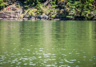
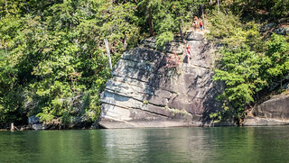
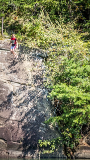
Just across from the launch was an island with several enticing beaches. A boat had pulled up to one beach and sunbathers were hanging out. I continued past the island and into Poe Creek Cove. At the base of McKinney Mountain was an impressive rock formation. A woman and her two children were climbing the rock. When the older kid reached the top, he jumped into the lake, then climbed back up to try to get his little brother to jump.
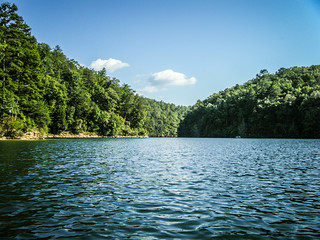
I continued on my way. A couple of boats passed, as well as a couple of jet skis. Past the Cliffs golf course I could see enormous houses lining the lake. Fortunately, the south coast had no houses, I guess because this was still state park land.
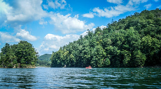
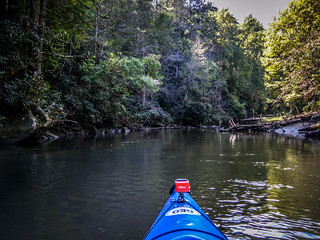
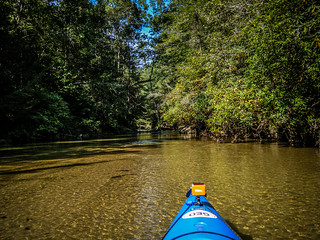
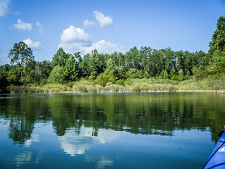
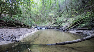
Soon I reached a place where Estatoe Creek branched off to the right. I headed that way. The route got shallow faster than I thought. Motor boats would struggle to get down this way, but I had plenty of clearance for my kayak.
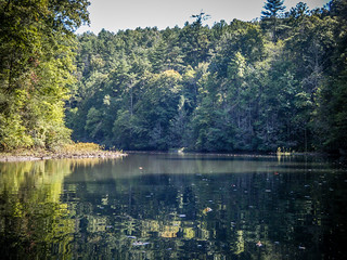
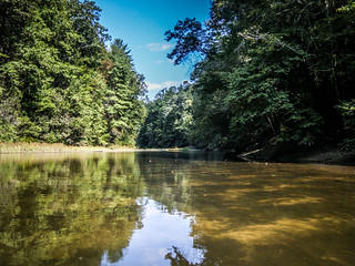
My plan was to try to reach the Highway 11 bridge. The creek splits, with Eastatoe Creek continuing up through Reedy Cove and Twin Falls. Little Estatoe goes under the bridge and continues up to the popular Long Shoals park. I knew I would be able to reach either of those locations, but I wanted to see how far I could get. Along the way I passed several rocky and sandy areas that would make perfect spots to hang out on a warm day. These have the benefit of being accessible only by kayak.
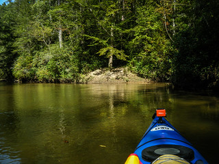
As it turns out, I could go only as far as the confluence of the two creeks. The water just got too shallow to continue. I got turned around and headed back toward the lake.
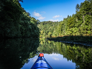
The trip back down passed more quickly since I was paddling with the current. The late afternoon sun cast long shadows across the stream, a hazard for paddling later in the year. Soon enough i had reached the point where the creek enters the lake.
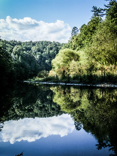
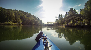
Instead of headed straight back to the put-in, I decided to check out the area at this end of the lake. The Cliffs development houses, lined the north bank, and the lake just ended with another tributary.
I paddled back along the fancy docks of the development. A large clubouse occupied a prominent point out on the lake.

When I got back to Poe Creek Cove I decided to check out the creek itself, which runs through the state park. The route narrowed down very quickly, but I was able to reach the point where the creek enters the lake.
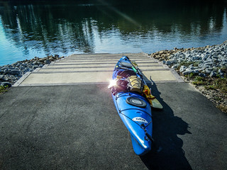
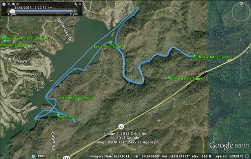
Eventually I made it back to the landing. It had been a good trip. In all, I paddled 7.35 miles, according to the GPS. Here’s a map of the route:
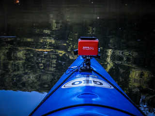
This was also the first time I ventured out with my replacement GoPro camera. There was no way I was going to let this one wind up at the bottom of a lake. I had it secured with multiple tether points to prevent any further disasters.
I took the shots from the GoPro and created this time-lapse, which covers most of the trip.
Finally, here’s a slide show of all of the shots from that excursion.
[fsg_gallery id=”19″]
This turned out to be a great venue, with some nice little hidden areas accessible only by kayak. One day I would like to return and see if I can paddle up to the Jocassee Dam. However, that will have to wait for another day.
I saw that photo of your well-secured GoPro when you posted it on Flickr. I got it right away, lol.
From someone who has never kayaked (sorry), just how shallow is too shallow? That one photo above (“Getting Too Shallow”), it looks like I could put my foot in and the water might not come up to my ankle.
Mark, I can get by with about 8 inches of clearance. Ankle deep is pushing it.
Looks like you had a great paddle. Yesterday was a perfect day. We went down the Saluda River just north of the Dolly Cooper Park and all the way down to Piedmont. It was ok till we went under the 85 Interstate Bridge, then the current slowed right down and it was work. Not a very clean river and lots of mud. It does have some nice little rapids here and there. Just wish we could find an easy put in by the Saluda Dam.
I’ve been looking at that area on Google Earth for a bit. Interesting how the stream comes out of the Eastertoe Valley and then goes through what looks like a narrow defile through some low mountains before reaching the lake. Had wondered how much water was there – if the stream was deep enough for a kayak and if there were scenic shoals/falls through there. Sounds like it really is a creek and not a river suitable for a boat.