Ken had a craving. He wanted to visit Bell’s Diner in Toccoa, Georgia. I was more than willing to provide transport, and I was hoping that we would find some good food and interesting photographic opportunities along the way. We found an abundance of both.
I picked up Ken in Clemson, and we made our customary stop at MoJoe’s for a bit of caffeine. Suitably juiced, we headed west through Seneca, then over to Westminster.
We decided to check out the small downtown area. As with so many southern towns, they have tried to reclaim the downtown area. There was a reconstructed depot that serves as a visitor’s center. But, as with so many of these towns, there are still lots of empty spaces.
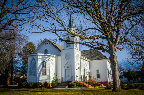
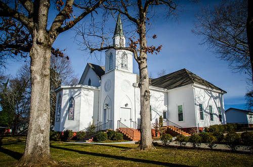
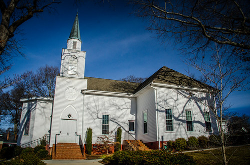
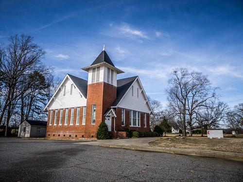
On the other side of the tracks we spotted a neat looking church. This is the Westminster Presbyterian Church, not to be confused with the larger church of the same name in Greenville.
From Westminster we headed west on Highway 76. My plan was to take Highway 123 on across the Tugaloo River and over to Toccoa. However, we had a bit of time to spare. I stayed on 76, looking for the signs for the Chau-Ram Park. I figured we would have some time to take photos of Ramsey Creek Falls and some of the others on the Chauga River. Unfortunately, when we got there a sign proclaimed it closed for the winter. Oh well.
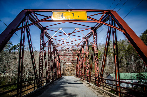
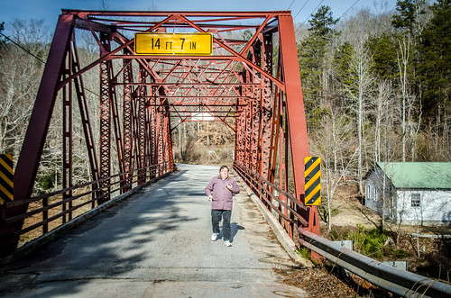
We crossed Ramsey Creek on 76, then turn back to look at the old concrete bridge that runs parallel to the current one. We couldn’t find a good, safe place to stop, so we decided to explore the river a bit further. Cobb’s Bridge Road turned to the north, and with a name like that, it had to be interesting.
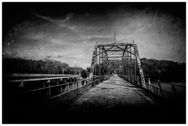
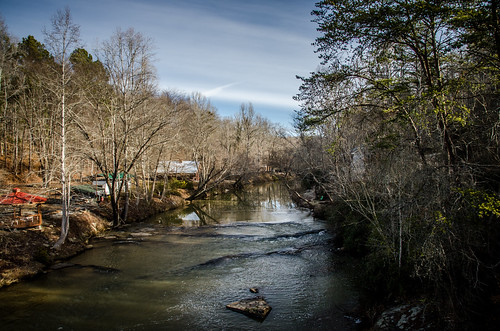
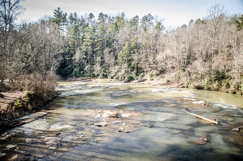
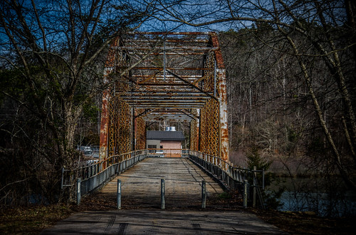
The road twisted through typical Oconee County farmland before eventually reaching the river. The route dropped down to a neat old steel girder bridge that crossed a series of shallow shoals on the rivers. Various river get-away cabins lined the banks.
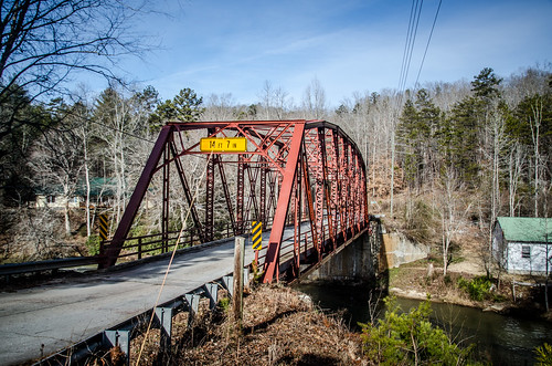
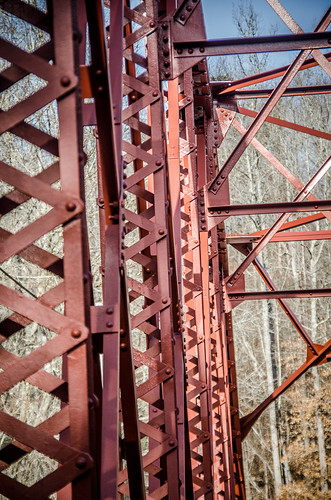
The bridge was in great shape, and it look looked like it had been painted recently. There were even spots of red paint (and I’m hoping that was paint and not blood) dripped on the pavement at the entrance to the bridge.
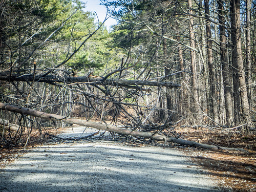
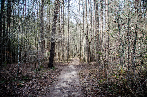
We crossed the river and continued on the same road. Soon we saw a sign for Riley Moore Falls, on the Chauga north of Cobb’s Bridge. A dirt road turned to the right, so we went in search of the falls. The route climbed up and over a ridge for several miles. At a couple of points we weren’t sure if we could go further. Down trees blocked the road, but each time we were able to find a way around.
A couple more dirt roads turned off in the direction of the river, but there were no signs, and nothing obvious to indicate which way to go. Before we knew it, we had reached Highway 76 again. We had missed our road. Turns out it was for the best. When I looked back at our route in Google Earth, it would have been more than a hike than we had planned for this morning.
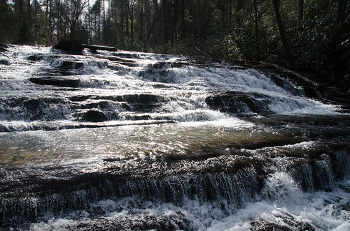
Back on 76 we spotted a sign for another waterfall – Brasstown Falls this time. We figured, what the heck? We needed to find at least one this morning. At least Ken had visited this one previously. The road took us past more bottom-land farms lining Brasstown Creek. As with Riley Moore there wasn’t another sign, but the road turning north was Brasstown Falls Road, which was pretty obvious. There was a good parking area, so we pulled in.
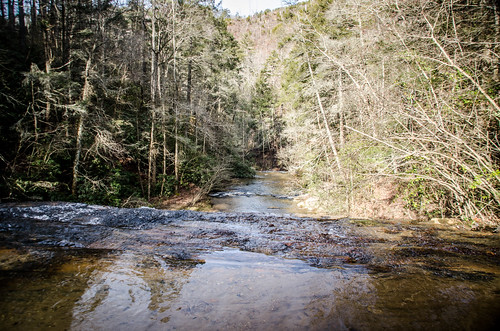
The trail led to a nice camping area. Two branches of the creek come together at that point. On one branch is Little Brasstown Falls. There was no good way to get over to it without wading. It was a bit too chilly for that, so I was only able to get a shot through the woods.
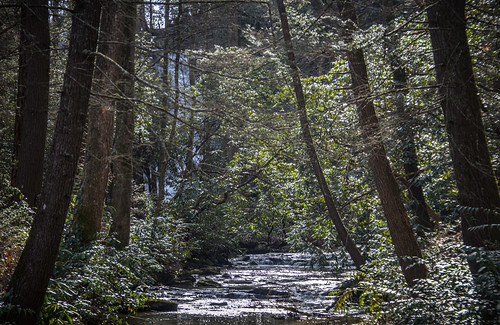
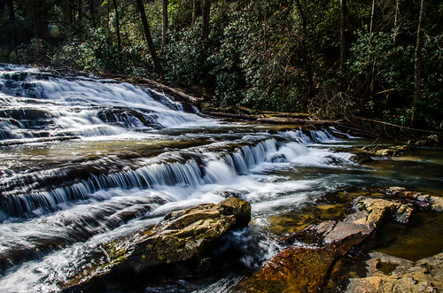
We took the trail on down to the top of Brasstown Falls. The falls are actually in three parts. Again, we weren’t up for a long hike, so we only visited the top set of falls.
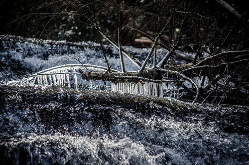
There were still icicles hanging over the water this made a nice contrast to the flowing water. I wasn’t sure which would bring out the icicles the best, to use a longer exposure with a water blur, or not. I did both.

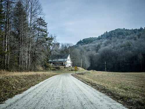
By this time we had used up our time cushion for getting to Bell’s before the lunchtime rush. We headed on back to the car. We had to stop to get a shot of the beautiful farmland along Brasstown Creek Road.
At this point we had to get from Highway 76 back to 123. This meant headed back toward Westminster. Following the GPS, it did connect us to a shortcut that crossed over through the New Madison area. We crossed the Tugaloo River on Prather Bridge. Just downstream are the pylons for the old Prather Bridge, which was one of the last covered bridges in the state until it met an arsonist’s fate.
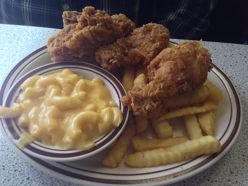
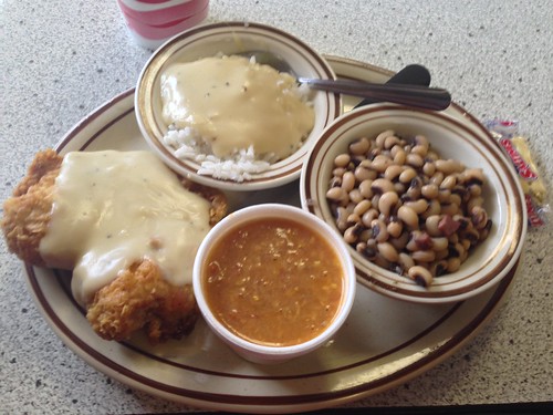
To Ken’s surprise, we never reconnected with 123 before entering Toccoa. We found Bell’s on the south side of town, headed south on Highway 17. There was a good crowd, but we still found a seat with no problem and had a great meal.
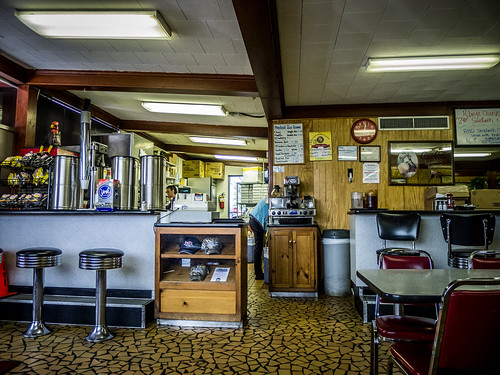
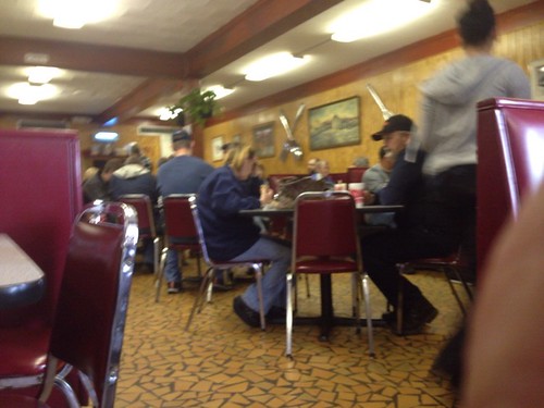
Oddly enough, I didn’t get a shot of the exterior.
The original plan was to head to Toccoa, then go north from there to Tallulah Falls. For some reason both of us were being pulled south. We decided to explore the area along the west bank of Harwell Lake a bit more.
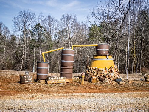
Highway 17 turned out to be less appealing than we’d hoped. There was a lot of construction as the highway was being widened to four lanes down to the Interstate. When we reached the ghost town of Avalon we turned onto smaller roads and back east toward the lake. The road did take us over a small branch of the lake at Gumlog Springs.
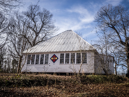
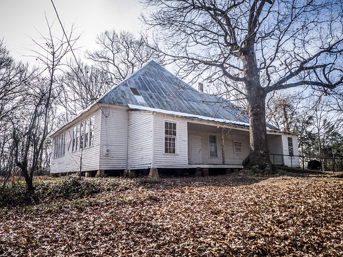
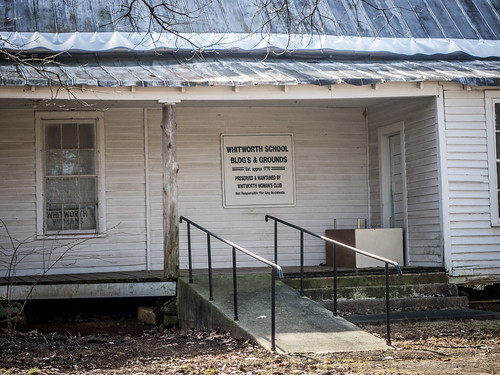
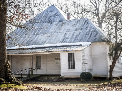
Beyond that is the community of Whitworth. I spotted the familiar shape of a building, and turned onto a side road to see the Whitworth School. There was a quilt square on the building, which is what had initially caught my eye. I couldn’t tell if this building was used as a community center, or if it were private. No Trespassing signs made me think the latter.
We crossed I-85 and continued zig-zagging roughly toward the lake. This is one of those cases where I really should have checked my maps and Google Earth first. There are lots of historical communities disrupted by creation of the lakes along the Savannah, and I might have had a chance to see some of those. Regardless, we eventually found ourselves in the town of Hartwell. We didn’t do much more than just drive through.
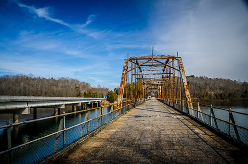
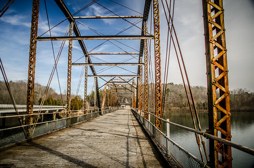
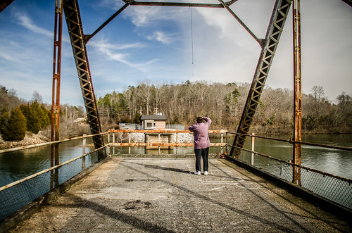
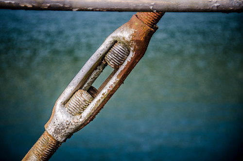
We were on US 29, which I knew went by the Hartwell Dam. Having been there recently, I was interested in seeing something different. Ken mentioned another old steel bridge, so we decided to find it. Turns out it was easy to find. The Smith-McGee Bridge is on Highway 181 across the Savannah River just below the dam. Just like the old Highway 123 bridge that crosses the Tugaloo, this steel girder bridge has been left in place as a fishing pier.
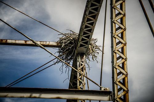
On the steel girders at one end was a large nest. I’m guessing it was an osprey nest. Across the way was a pumping station. As Ken and I watched, water roiled up from the middle of the river. I would hate to be in a kayak (or any other type of small boat) and have that happen unexpectedly under me.
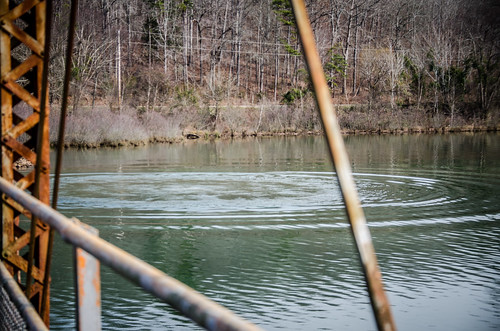
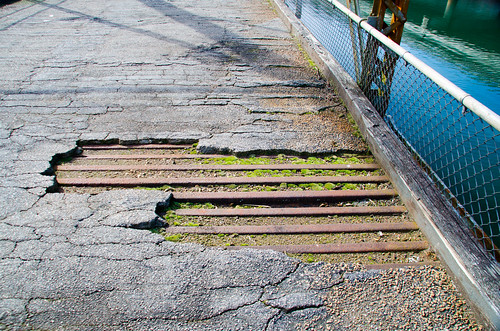
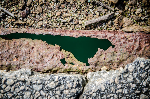
The old bridge really was in bad shape. In some places the asphalt had worn through and you could see through the rust straight to the water below.
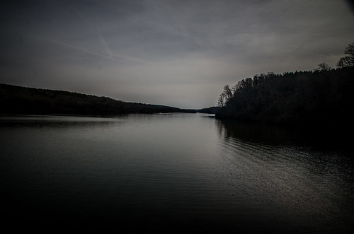
There really is not much river left of the Savannah. From Augusta on up it’s all lake in one form or another, and this stretch was no different. The water is wide and still, backed up from the Richard B. Russell Dam. I could see a boat ramp on the other side, and it still might be an interesting paddling venue, unexpected surges aside.
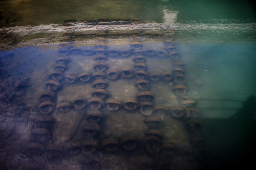
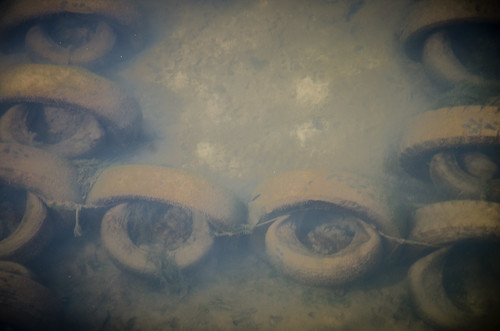
The water looked low, though. We had noticed this on Lake Hartwell, too. On the end of the bridge closest to the bank we could clearly see a reef made of old tires. I guess they do make good habitat under the right circumstances.
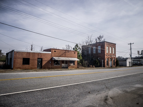
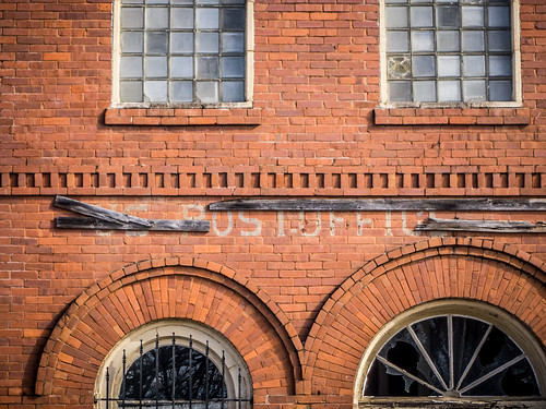
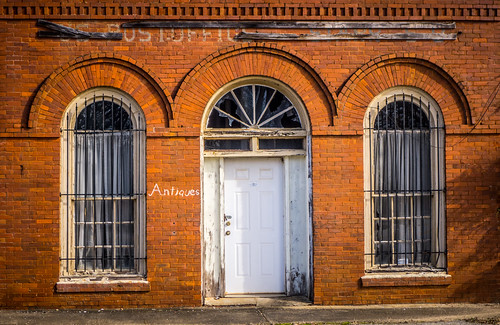
Back in South Carolina we had one more surprise in store. About six miles from the river we found ourselves in the town of Starr. I’ve driven through Starr on Highway 81 many times, usually headed north after a paddling trip or some other outing. What I didn’t realize was that there was an old town center just off of the main highway. Since we were approaching from a different direction this time, I was able to see it. There was a couple of old buildings and a Methodist church, but the star (so to speak) was a two story building that had been the old post office.
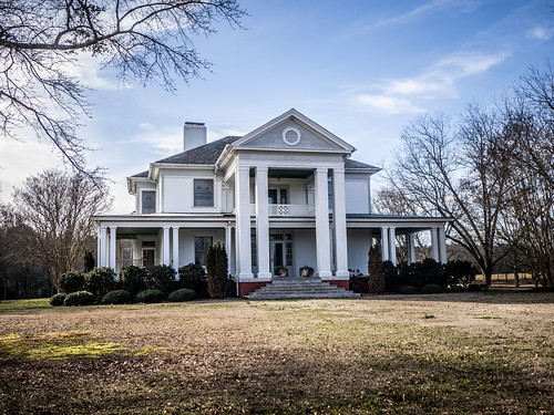
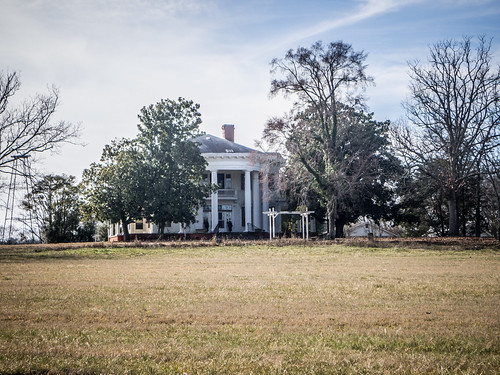
There were several very impressive plantation homes along this stretch, too.
We made our way through Anderson without stopping, but I made a note of several other places I’d like to visit. It had been a good day out and about.
Here’s the map of our visits: