This really should be entitled “A Day in Denver, Part 2” and is a direct follow-up to that previous post. It was still early in the afternoon when we finished up at REI, so we decided to ride out of town and up into the foothills. Our tentative target was Golden, Colorado, of Coors Brewery fame. From there we would see where things took us.
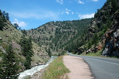
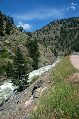
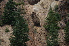
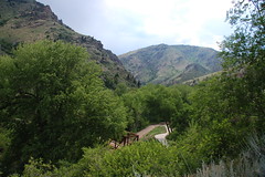
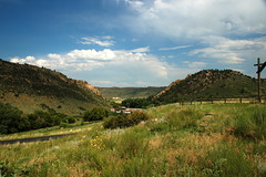
We made it to Golden with no problems. Rather than hang around the town we drove straight through. We took Highway 6 northwest of town and along Cedar Creek. The highway runs through a valley along the creek, and through some beautiful scenery. The creek was more like a roaring river with some impressive rapids. Apparently folks normally go tubing and swimming in this area. Today, however, there were signs saying that it was prohibited because of the high water.
There was lots of traffic on the road, including RVs and large tour buses. It was a scenic route, to be sure, but this seemed like too much traffic for normal. There were also lots of cars parked along the road. There didn’t appear to be any trails, and with the signs warning about the river we weren’t sure what was happening. Soon, though, we spotted several climbers scaling one of the rocky crags along the road. It turns out that we were in prime climbing territory.
Highway 6 turned to the left, continuing to follow Cedar Creek. However, the main road (and most of the traffic) continued straight. We decided to take the less traveled road and turned. A sign indicated that Idaho Springs was just a few miles up the road, so we decided to see what that was.
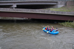
To our surprise, Highway 6 took us back down to I-70. Since we weren’t in an interstate frame of mind, we took the next exit, which was supposed to take us to Idaho Springs. As soon as we got off the interstate we spotted several cars pulled off the road and folks looking upriver with cameras and binoculars. It turns out that they were waiting for family members running the river with a commercial rafting company.

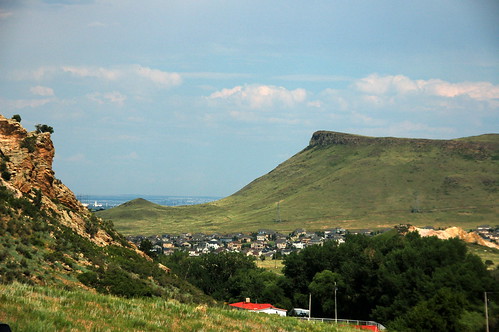
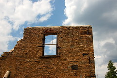
Somehow we managed to miss the road to Idaho Springs, and instead found ourselves on the Central City Parkway. This was a wide, well-maintained road that climbed steeply up into the mountains. There were some nice views, and we decided to continue along. At the crest of the parkway we started to see mine tailings and abandoned mine buildings all along the hills.
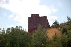
The road turn downward again and we found ourselves in the little mining town of Central City.
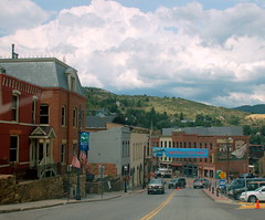
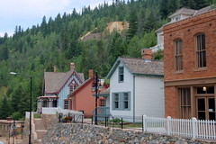
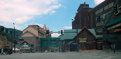
The main street of the town was torn up and under construction, but the rest of the town looked like what I would imagine an old western mining town would look like, with one notable exception. There was some major opera production under way, and folks were gathering in very elegant attire. We found ourselves heading out of town further up into the mountains. We got to a place where a huge cookie-cutter condominium development had been plopped on the hillside. The vinyl siding looked out of place next to the old abanoned mine buildings.
We turned around and headed down the hill back toward the town. As we rounded the curve into town, the reason for the condos, elegant attire, parkway, and general niceness of a seemingly out of the way town became clear. A huge high-rise casino loomed above the valley. Smaller casinos lined the road. The place was hopping.
We continued on down the road past the casinos. Soon our route intersected Highway 6. This explained the traffic. If we had headed straight instead of turning, we would have driven straight up to the casinos along with all the RVs and tour buses.
We continued along Highway 6 back to Golden. We stopped just outside of town for one more view of the roaring Cedar Creek and the valley.
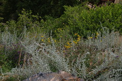
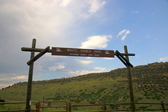
From Highway 6 we turned north onto Highway 93 toward Boulder. A couple of miles outside of Golden we saw a sign for the Jefferson County Open Spaces Park, and decided to inveistigate. We found a trailhead with a trail leading out over an open prairie. Grabbing binoculars and camera, we decided to hike at least a part of the trail.
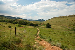
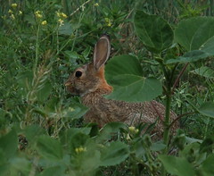
There were views back over the town, but more importantly, there were lots of birds. We spent a good bit of time just watching as they gathered along a small creek. I wasn’t able to get any good shots of them, but we also spotted a deer and rabbit.

We would have stayed longer and hiked further, but there was thunder over the mountains and it seemed to be headed our way. Back in the car we continued north along Highway 93. The route took us past a wind energy research station, and along a stretch with views of the National Atmospheric Center Research Building and the Flatirons.
Soon we were in the city of Boulder. Laura did her post-doctoral work at the University of Colorado and lived here for two years in the early 1980s. We drove through her old stomping grounds, but didn’t spend much time in the city.
By this time we were getting pretty tired. We took the quickest route back from Boulder to Denver. Laura commented on how much that stretch had grown since she lived here. There used to be a green belt surrounding Boulder, but you would be hard-pressed to find it now.
Back in Denver we found ourselves in quite a traffic jam. The route our GPS had mapped back to our hotel took us right past Coors Field, home of The Rockies, and a home game against the Milwaukee Brewers was about to get underway. It took us longer to drive the mile or so into town than it did to get from Boulder to Denver. Eventually, though, we did make it back. It was a nice day in Denver and environs, but we were ready to head home.