Skip to content

Random Connections

A collection of photography and exploration focusing on Upstate South Carolina and beyond.

  • Home
  • About Us
  • Photos
  • Resources
  • Other Voices
  • Post Archives
  • Podcast
  • Home
  • maps
  • Page 3

Tag: maps

Photo Navigation

Posted on December 3, 2008 By Tom 6 Comments on Photo Navigation
Gear, Geocaching and Maps, Photography

First a caveat – I try not to review or discuss specific gadgets here at RandomConnections unless I actually have the device in hand and have played with it, either having purchased it for myself, for work, or having swiped it from a friend for a test run. I don’t like to speculate on a device’s capabilities unless I’ve seen them myself. Also, especially this close to Christmas a favorable review might be taken as a “wish list”, and that’s not necessarily the case. So, I tend to stick with what I’ve actually seen.

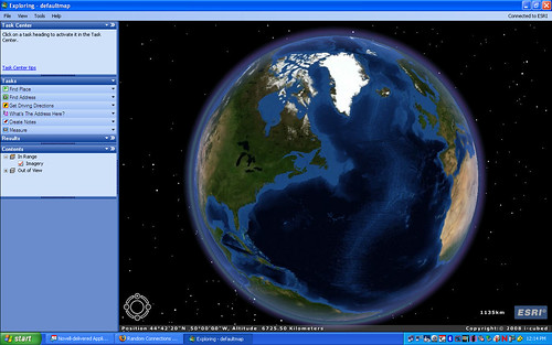
Today I’m going to break with that policy somewhat. My intent was to discuss a capability rather than a specific device or brand, but it turns out that only one brand has this feature (so far.) I’m talking about photo navigation, the ability to navigate to a geotagged photo via GPS as an inherent capability of the device.

Read More “Photo Navigation” »

The Fine Art of Rambling, Part 2

Posted on November 17, 2008 By Tom 1 Comment on The Fine Art of Rambling, Part 2
Local, Miscellaneous, Travel

Last time I talked about my inherited propensity and motivations for rambling. This time I’m going to be a bit less random, and discuss some of the tools I use for rambling and how I choose particular targets. I love to explore aimlessly, and there is always some component of randomness to any of our … Read More “The Fine Art of Rambling, Part 2” »

Secrets Revealed in ArcGIS Explorer

Posted on October 2, 2008 By Tom 8 Comments on Secrets Revealed in ArcGIS Explorer
Geocaching and Maps

ArcGIS-Explore-Screen-Captu

LongArcGIS-Explore-Screen-Captu

Long before Google Earth came on the scene there was ArcGIS from ESRI. There are two (actually, multiple) flavors of this. There were the professional GIS versions consisting of ArcMAP and ArcServer, and a free viewer, ArcExplorer. I attended a couple of workshops on ArcExplorer, was impressed by its potential for the classroom, but never really got into it. Along came Terraserver making free satellite imagery available, then Google Earth took the world by storm, somewhat obscuring these previous free mapping services.

While working on another project I needed to check out ArcGIS Explorer once again, and was surprised to find that it now looks very much like Google Earth with a similar user interface. Navigation is essentially the same – you can zoom in, tilt, and pan just like in GE. There are search functions and you and create placemarks. While Explorer will open KML files, it’s designed to be more compatible with ArcGIS data.

Google Earth has a much larger user-contributed base. However, there is much more accurate GIS data available for Explorer from various GIS organizations around the world. When comparing the free versions of these programs, you could think of Google Earth as being more populist, and ArcGIS Explorer as more professional.

Read More “Secrets Revealed in ArcGIS Explorer” »

Embeddable Google Earth

Posted on May 29, 2008 By Tom No Comments on Embeddable Google Earth
Geocaching and Maps

The functionality of Google Earth is showing up in more and more places outside of the actual Google Earth software. Much of what you could do in GE is now available in Google Maps. Maps has had the ability to read KML/KMZ files for awhile now, and for the most part the imagery is the same for both systems. Well the folks at Google have blurred the line even more with the recent release of the Google Earth COM API.

The new API allows developers to create interfaces to the Google Earth data. Probably one of the best examples of this has been done by the folks at TakItWithMe.com. They have created a version of Google Earth than can be embedded into blog posts, web pages, etc.

In order to take advantage of this three things have got to be in place:

  1. Google Earth 4.x or higher must be installed on your computer.
  2. You have to install the Google Earth 3D plugin for the browser you plan to use.
  3. The KML/KMZ file you plan to use must be available online, either on hosted webspace or on the user’s My Maps folder in Google Maps.

If you have at least the first two of these already in place on your computer, you can click the link below to read more, and you’ll see a demonstration…

Read More “Embeddable Google Earth” »

Sky, Moon, and Mars

Posted on March 14, 2008 By Tom No Comments on Sky, Moon, and Mars
Geocaching and Maps, Science

Google has taken its Google Sky functions and made them available on Google Maps as well as Google Earth. Google Sky for Maps features much of the same space imagery as its Google Earth counterpart. You can zoom in (out?) for a closer view of deep space objects and stars. There are also links that … Read More “Sky, Moon, and Mars” »

Posts pagination

Previous 1 2 3

Categories

  • EdTech (197)
  • Entertainment (202)
  • Family (123)
  • Gear (114)
  • General Technology (98)
  • Geocaching and Maps (208)
  • History and Genealogy (275)
  • Internet (142)
  • Local (459)
  • Miscellaneous (560)
  • Music (202)
  • Paddling (268)
  • Photography (781)
  • Podcast (19)
  • Rambling (233)
  • Rants (162)
  • Recipes (37)
  • Religion (48)
  • Restaurants (165)
  • Science (48)
  • Things Overheard (29)
  • Travel (413)
  • Uncategorized (143)
  • Washington Sabbatical (113)
  • Weirdness (61)

Recent Posts

  • Helene One Year Later
  • Once Again, Up the Long Nose
  • Upstate Renaissance Faire
  • Exploring Lake Summit
  • The End of Days

Recent Comments

  • Gay on In Search of the Road Builder
  • Virgil Howell on The Ghost Towns of Lake Marion
  • Virgil Howell on Return to Ferguson
  • Mary Copeland Myers on Renno and Stomp Springs
  • Virginia Pepper on Helene One Year Later

Tags

blogging cemetery Christmas Columbia Edisto River edtech Entertainment family Flickr Florida Furman Furman University gear Georgia geotagging Ghost Town Ghost Towns Google Earth Google Maps GPS Greenville Greenville Chorale history Instructional Technology kayaking Lake Jocassee LCU Lowcountry Unfiltered maps Music North Carolina Paddling Photography rambling restaurant Restaurants review singing social networking South Carolina time-lapse Travel video Washington Washington State
October 2025
S M T W T F S
 1234
567891011
12131415161718
19202122232425
262728293031  
« Sep    

Copyright © 2025 Random Connections.

Theme: Oceanly by ScriptsTown