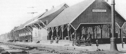
I came upon Kingville quite by accident. I was looking for information on another ghost town in Google Earth when I spotted this name near the confluence of the Congaree and Wateree Rivers. When I zoomed in a bit further I saw that the the place indicated by the name was all wooded – there was no town there. Street View also showed just a wooded area, and not enough buildings to even justify keeping this as a place name. This intrigued me, so I did a bit of research, and it turned out to be an interesting ghost town location itself.
According to information on the Kingville Historical Foundation’s website, the town got it’s start in 1842 when a spur railroad line from Aiken was completed to Columbia. I checked Robert Mill’s 1825 atlas of the area, and the name Kingville does not appear. In 1850 a branch line was completed to Camden, and the town began to grow because it was now located at the juncture of two major railroad lines.
Research on the town was initially confusing. According to the historical marker for the site…
Kingville is thought to be named for its status as “king” of the railroad line between Charleston and Columbia and between Columbia and Camden.
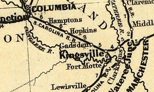
However, the town was first called “Kingsville” with an “s”. For awhile I wasn’t sure if I was finding information on the same town. For example, this is an excerpt from an 1870 map of the Port Royal railroad in the southern states. It clearly shows the spelling with an “s”. The town’s name on this map makes it look almost as big as Columbia, but this is deceptive. Since this was a railroad map, the emphasis was on major junctions, rather than the actual towns.


