Skip to content

Random Connections

A collection of photography and exploration focusing on Upstate South Carolina and beyond.

  • Home
  • About Us
  • Photos
  • Resources
  • Other Voices
  • Post Archives
  • Podcast

Revisiting Eastern Fairfield County

Posted on June 18, 2011 By Tom 3 Comments on Revisiting Eastern Fairfield County
Geocaching and Maps, History and Genealogy, Photography

Blair General Merchandise

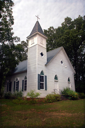
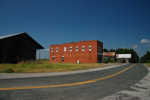
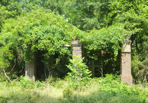
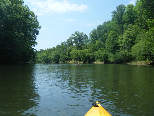
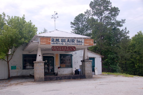
A couple of weeks ago Glynda and I had been down to see the parents, and had stopped back by Renno and Stomp Springs. On Friday we had made another trip to Prosperity, and decided we would catch a couple more locations on the way back this time. We passed through some truly remote areas and visited a few towns that could just about qualify as ghost towns.

Back in January we had taken the parents on a right through the southwestern corner of Fairfield County, and along the eastern shore of Lake Monticello. This time we extended that earlier trip, with stops in Jenkinsville and points further north on Highway 215.

Shiloh Methodist

Read More “Revisiting Eastern Fairfield County” »

Geocaching on Lake Marion

Posted on June 13, 2011 By Tom No Comments on Geocaching on Lake Marion
Geocaching and Maps, Paddling, Photography

Lake Marion Paddling

Another second Saturday, and it was time for another epic paddling trip with Lowcountry Unfiltered. This one was truly epic. This time our explorations took us to the eastern part of Lake Marion to do some geocaching around Persanti Island.

Our launching point was Carolina King Landing, just north of the Santee National Wildlife Refuge. It’s a private landing with cabins for rent, and was quite the happening place when I arrived. It turns out that this was the day for the Sparkleberry Poker Run up at the north end of the lake. Lots of camouflaged boats were getting ready for departure.

Lake Marion Geocaching-2Lake Marion Geocaching-1Lake Marion Geocaching-4

Alan arrived, and we entertained ourselves with Cokes, Moon Pies, and conversation with the proprietors of the local shop. These turned out to be very nice folks, and were very helpful suggesting parking and launch spots for the boats. They also had some interesting taxidermy.

Read More “Geocaching on Lake Marion” »

Ghost Towns of Calhoun County

Posted on June 13, 2011 By Tom 3 Comments on Ghost Towns of Calhoun County
History and Genealogy, Travel

Lone Star, SC

This past week was the first of our four-day weeks on our summer schedule. That meant that I had Friday off, so I decided to take advantage of it. This was also a Lowcountry Unfiltered paddling weekend, so I decided to head down early and check out a couple of places. My trek led me to some true ghost towns in a very remote part of the state.

Since I hit so many places on this trip I’m abandoning my format for ghost town posts, but may go back and revisit those locations. We’ll have to see how closely I stick to this.

The first part of the trip was the non-descript I-26 trek down to Columbia. As soon as I got past the city, though, I was ready to leave the interstate. I took the Highway 176 exit, which parallels the interstate to the east. This led me to the little community of Sandy Run. I paused to take a few shots of the old red general store building on the side of the highway, now long abandoned.

Read More “Ghost Towns of Calhoun County” »

Renno and Stomp Springs

Posted on June 13, 2011 By Tom 16 Comments on Renno and Stomp Springs
History and Genealogy

Renno Store

Last weekend Glynda and I headed down to Prosperity to visit our parents, and on the way back we stopped by a couple of remote places in Laurens County. These spots are places our family has visited long, long ago. Back then they were already abandoned, but there was still lots to see. Today, however, the communities of Stomp Springs and Renno are almost completely gone.

Both Renno and Stomp Springs are part of the Jacks Township. This area was one of the first settled in Laurens County, sometime in the mid 1700’s. Nearby Duncan Creek Presbyterian Church is the oldest in the county.

Our first stop was Stomp Springs. This was one of the old mineral springs resorts popular in the early 1900’s. Folks would come to these springs for the purported healing properties of the water from the springs. The water was even bottled and sold around the state. Unfortunately, I’ve not been able to find much on the history of the springs, other than a random reference to acknowledge that it once existed.  There is one brief reference in the 1909 Newberry Observer that a teacher from Bush River had just “returned from vacationing at Stomp Springs.” I also came across a couple of references from bottle collectors seeking the rare bottles from the springs.

Read More “Renno and Stomp Springs” »

Teasers and Spoilers

Posted on June 12, 2011 By Tom No Comments on Teasers and Spoilers
Miscellaneous

Got lots to write about, but I’ve been too busy to blog lately. I’m hoping to take today to catch up on several posts. These may seem a bit out of sync as to when they actually occurred, but that’s tough. Anyway, here are a few teasers and spoilers of things to come… Kayaking Took … Read More “Teasers and Spoilers” »

GNIS Dilemma

Posted on June 6, 2011 By Tom No Comments on GNIS Dilemma
Geocaching and Maps, Internet

The Geographic Names Information System(GNIS) is one of the greatest boons to those of us who love maps. It’s an extensive database of place names created by the US Geological Survey, and includes cities, towns, communities, crossroads, schools, churches, mountains, rivers, etc,. etc. Basically, any place in the US that has a name is in the database. The database includes coordinates, county, and other basic information about that location.

I’ve used and referenced the GNIS data on this blog many times. The raw data is freely available for download, and I have downloaded just the South Carolina data to create my South Carolina Place Names application. If you’ve ever used a GPS or looked up a location on an online mapping system, you’ve encountered GNIS data. Unfortunately, some companies use this freely available data to flood the web with crappy websites that pollute search results and interfere with the ability to do any meaningful online research about an area.

Here an example…

Yesterday my sister Glynda and I drove through the communities of Stomp Springs and Renno on our way back from visiting our parents in Prosperity. It’s a historical area, and we snapped a few photos and looked at the ruins of the old towns. When I got home I wanted to find more information about the area, so I did a quick Google search for Renno, SC. Here’s the first page of results. You’ll want to click to enlarge…

Renno1.png by RndConnections on Aviary

Most of the pages are for “hometown locators” and various real estate companies. There were even multiple websites for various cable companies. This goes on for multiple search pages – basically a spamming of the Internet based on the GNIS data.

Read More “GNIS Dilemma” »

The Sad Fate of Chappells

Posted on June 1, 2011 By Tom 64 Comments on The Sad Fate of Chappells
History and Genealogy, Local

Chappells Ruins

After our Saluda River kayaking trip and post-paddling excursion to Chappells, I became somewhat obsessed with the ghost town and its history. Several left comments on that last post also expressing interest in what happened to the town.

Ghost towns fascinate me. At one time this street was bustling with traffic and activity, and now it’s completely overgrown and deserted. The how and why towns die out are varied, but in this case there are some straightforward reasons why Chappells didn’t survive. It appears that weather and bad luck dealt the worst blows.

Read More “The Sad Fate of Chappells” »

Exploring Chappells

Posted on May 31, 2011 By Tom 14 Comments on Exploring Chappells
History and Genealogy, Local

One my posts that seems to get the most hits and generates the most discussion is the one on the Ghost Towns of South Carolina. In that post I mentioned that probably weren’t many true ghost towns, but only near-ghost towns — towns with a dying city center, but a thriving community around it. Monday … Read More “Exploring Chappells” »

From Buzzards Roost to Chappells

Posted on May 31, 2011 By Tom 15 Comments on From Buzzards Roost to Chappells
Paddling

Saluda River Paddle-24

With the long weekend I felt the need to hit the water. The challenge was to find a paddling venue that was relatively close, doable without killing the entire day, and not over-run by Memorial Day crowds. We found the perfect location on the Saluda River, below the Lake Greenwood Dam.

Our plans were for an 8-mile stretch of the river from Buzzards Roost at Highway 34 to the Highway 39 bridge at Chappells. I was a bit concerned about river access. I knew there was parking and river access at Buzzard’s Roost, but I couldn’t find any info about Chappells. All my resources indicated that it would be a throw-in, at best. Fortunately, Dave was able to do some advanced scouting, and concluded that it would be a challenge, but doable. We decided to go for it.

Dave, Alan, and I rendezvoused at Alan’s house early Monday morning and we headed on down. Our first stop was at the take-out at Chappells. A steep, rutted dirt road lead down to the river, and it looked like there was adequate parking, assuming one had four-wheel drive and could get down the initial hill. The bank down to the river did look steep, but not insurmountable. We decided to put all of the kayaks in my truck and leave Dave’s Land Rover at the take-out.

The shuttle for the trip was only about 3 miles. While the road goes east-west, the river takes a deep dip southward. Before we knew it we had arrived at the Highway 34 bridge and the area known as Buzzards Roost. The dam forming Lake Greenwood was completed in 1940 and was referred to as the Buzzards Roost Project. The name has been around much longer than the lake, but I haven’t been able to find any history on it.

Read More “From Buzzards Roost to Chappells” »

Balloon Chasing

Posted on May 29, 2011 By Tom 1 Comment on Balloon Chasing
Local

Freedom Weekend Aloft Balloons-8

Memorial Day means Freedom Weekend Aloft is in town. This is the 29th year of the festival, and it’s hard to believe that it’s been around that long. We decided we would head down this evening and see if we could spot some of the balloons.

FWA started out as a July 4th holiday, and was held at Donaldson Center. It kept that venue and time slot for many, many years. Either because of expenses at Donaldson, declining attendance, or whatever, it was moved to Anderson for awhile. Then its date was moved from Independence Day to Memorial Day, and the venue moved to Heritage Park in Simpsonville. It seems to be doing very well on this date and location.

There was to be a mass ascension between 6:00 pm and 8:00 pm, so we headed on down after an early dinner. We didn’t want to get mixed up in the crowds, nor did we want to pay a park entrance fee just to watch the balloons. After a bit of driving we found lots of folks in the parking lot of Bryson Middle School, and that’s were we set up shop, too.

It wasn’t long before the balloons started to appear above the trees. Some went up very quickly, others, just sort of skimmed the tree line at a leisurely pace.

Freedom Weekend Aloft Balloons-6

Read More “Balloon Chasing” »

Posts pagination

Previous 1 … 117 118 119 … 298 Next

Categories

  • EdTech (197)
  • Entertainment (202)
  • Family (124)
  • Gear (114)
  • General Technology (98)
  • Geocaching and Maps (208)
  • History and Genealogy (276)
  • Internet (142)
  • Local (459)
  • Miscellaneous (561)
  • Music (202)
  • Paddling (269)
  • Photography (782)
  • Podcast (26)
  • Rambling (234)
  • Rants (162)
  • Recipes (37)
  • Religion (48)
  • Restaurants (165)
  • Science (48)
  • Things Overheard (29)
  • Travel (414)
  • Uncategorized (145)
  • Washington Sabbatical (113)
  • Weirdness (61)

Recent Posts

  • Carolina Ghost Towns – Childsbury, SC
  • Edisto River – Long Creek Landing to Martin’s Landing
  • A Western Caribbean Getaway
  • Carolina Ghost Towns – Statesburg, SC
  • Carolina Ghost Towns – Proctor, NC

Recent Comments

  • Larry Easler on A Western Caribbean Getaway
  • Pher on Dipping a Toe in the North Toe
  • Paula McCall on Memories of Echo Valley
  • Cash Lewis on The Sad Fate of Chappells
  • Cash Lewis on The Sad Fate of Chappells

Tags

blogging cemetery Christmas Columbia Edisto River edtech Entertainment family Flickr Florida Furman Furman University gear Georgia geotagging Ghost Town Ghost Towns Google Earth Google Maps GPS Greenville Greenville Chorale history Instructional Technology kayaking Lake Jocassee LCU Lowcountry Unfiltered maps Music North Carolina Paddling Photography rambling restaurant Restaurants review singing social networking South Carolina time-lapse Travel video Washington Washington State
March 2026
S M T W T F S
1234567
891011121314
15161718192021
22232425262728
293031  
« Feb    

Copyright © 2026 Random Connections.

Theme: Oceanly by ScriptsTown