Paddling to the Towns
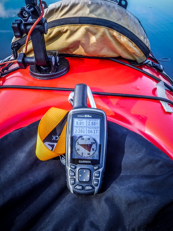
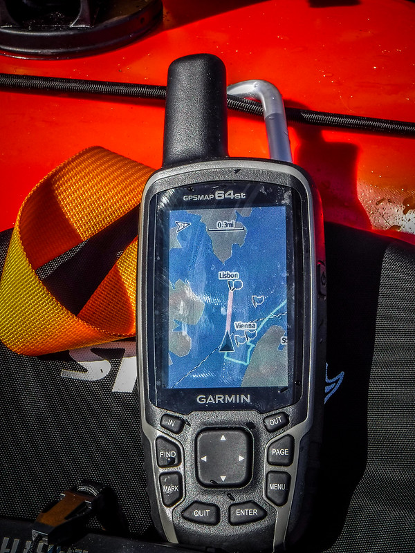
When I started out I wasn’t sure where I was going. I just knew that with temps approaching near 80 I wanted to get out on the water. This was going to be a shake-down cruise for my new Garmin GPSMAP 64st, which I’d just purchased. This one replaces an older eTrex Venture that finally quit working. As I was scrolling through waypoints for the new GPS I came across the locations for the Savannah Towns and decided that would be a perfect place to paddle.
Laura was out of town, so I got an early start and headed down toward McCormick County. My route took me through many places I’ve stopped to photograph in the past – Calhoun Falls, Mount Carmel, etc. I passed one road sign for “Old Vienna Road” and was tempted to stop and take a picture of the sign, but I really wanted to get on the water.
My target was the Mount Carmel Park boat ramp. That looked to be the closest ramp to the town sites on the South Carolina side. The Bobby Brown State Park ramps on the Georgia side would be closer, but were also a longer drive. As I made the turn onto Fort Charlotte Road in Mount Carmel there was a sign saying that the Mount Carmel Campground was closed for the season. I was a bit worried. I saw a sign for another ramp not far away, and soon found myself at the Hester Boat Ramp.
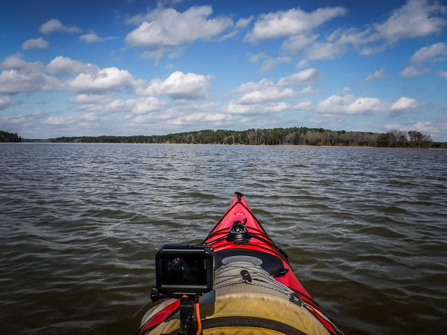
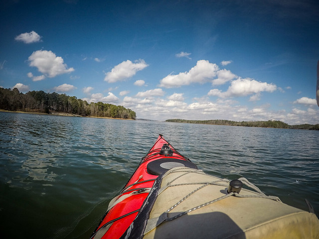
The new ramp put me nearly 4 paddling miles from the town sites (2.88 miles as the crow flies according to the GPS.) I wasn’t too worried. I had my new GPS and was in my new 18 ft boat, so I figured I could do that distance with no problem. I got everything ready and launched into a very placid cove.

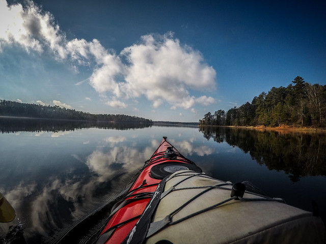
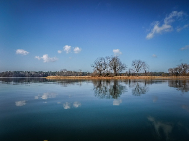
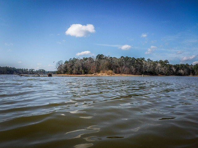
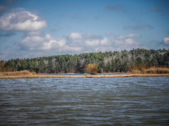
I made good time, but only by fighting temptation. There were lots of coves that cried out for further exploration. I was most impressed with the lack of development in this part of the lake. There were no houses with boat docks to clutter the view. Herons and loons were the only ones keeping me company this fine morning.

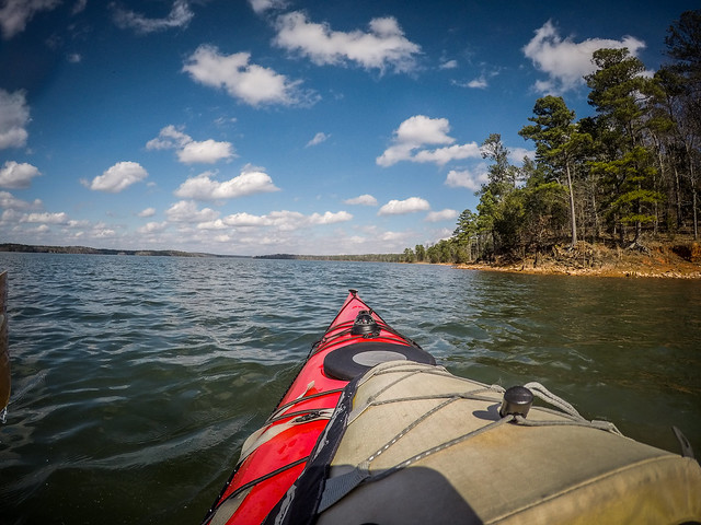
I reached the main stream of the Savannah and continued south, watching the distance tick off on my GPS. Soon I was passing the peninsula on the Georgia side where Bobby Brown Park is situated. It really would have knocked a lot of time off of my paddling if I’d driven over there.

Petersburg was the closest location, but I was heading toward Vienna. This one would be the furthest south, and from there I would make my way back up to Lisbon and Petersburg. To the west I made note of interesting clumps of trees at the Petersburg site. I’d have to check those out. To the east was a wooded bluff that overlooked the Vienna coordinates.
Google Earth really doesn’t give a good distance perspective on these locations. These towns were close – really close. The entire area would probably fit within a shopping mall, if you include the parking lot. Frontier towns were very small by our standards. As I sat in my boat atop the coordinates for Vienna I was surprised by how close I was to the bank and how close I was to the other coordinates.
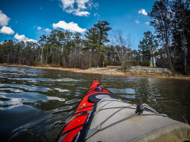
I’m not really sure what I was expecting. Would ghosts rise to greet me from the depths? Would there be a tremor as I reached the coordinates? Nah, nothing but stillness. Yet, looking at the shore I could imagine a farm or perhaps a church with a cemetery along the pine-covered bluff. Even with the heart of the town now underwater there had to be activity on the area that was not inundated. I decided to paddle closer to the shore.


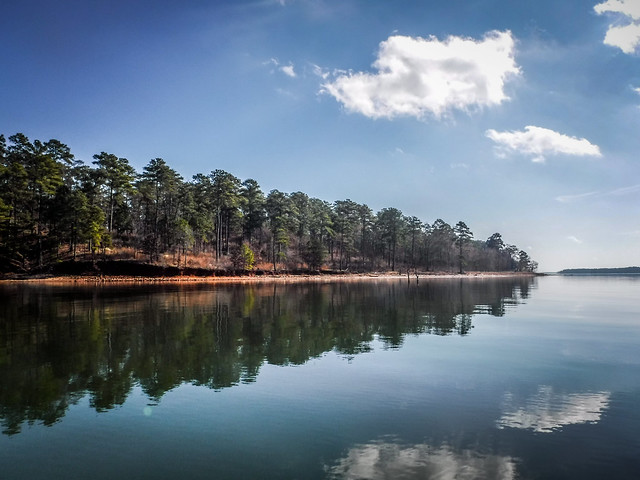
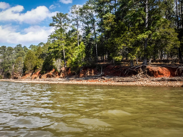
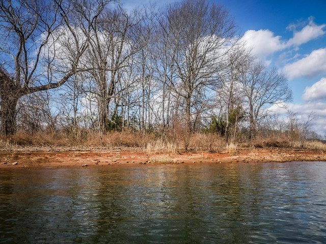
The first thing I noticed was the erosion along the lake’s shore. There was wooded debris along the banks, but with rising and falling lake levels it was unlikely that I’d be able to spot any artifacts from the old town. Areas with this type of erosion were probably not the place to stop. What I really wanted to do was climb the hill with a metal detector. Since I don’t own one (and I’m beginning to wonder why that is since I have just about every other gadget under the sun) I settled for paddling southward along the eastern shore of the Savannah.


I looked back upriver with a view of all three town sites. I could imagine ferries crossing the rivers, much narrower than present-day open water.


My next stop was Lisbon. The underwater location is now just off of a peninsula, but back then it would have been just at the base of another ridge. As with Vienna, there was nothing much to see except a strip of land occupied by seagulls.


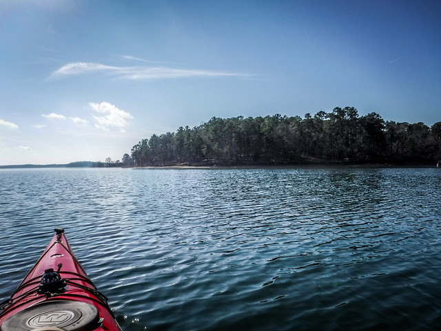
I crossed the Broad River arm of the lake over to the Petersburg peninsula. Along the western edge there was erosion similar to what I’d seen near Vienna. There wouldn’t be much to find here.
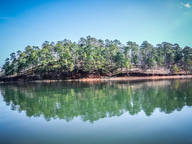
Further out along the point the erosion wasn’t as bad. The area was flat and covered with grasses and sandy areas. This had potential, but I didn’t spot anything as I rounded the end of the peninsula.


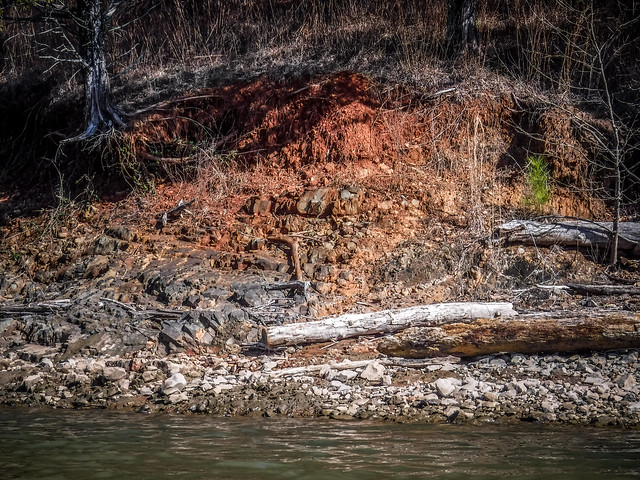
Around the corner, where I had spotted the clump of trees earlier, I hit pay dirt. Scattered along the shore below the high water mark were bricks, lots of them. I had seen squarish rocks and rocks with sharp angles earlier, but these were unmistakeable. They were of uniform size and distributed in such a way as to make me think they were park of paving or of a structure, rather than a random scattering.

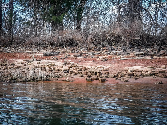


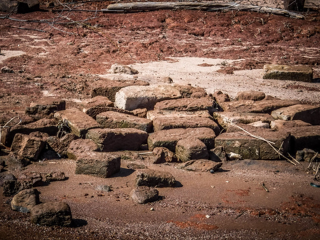
The clump of trees reminded me of an old home place. Normally I’d start looking for daffodils and other indicators of domestication, but I had to remind myself that this is area that floods regularly. Probably no daffodils. Even the trees would not have been around when Petersburg was at its peak. Yet, once again I found myself wishing I had a metal detector. All of these artifacts are protected and cannot be removed legally. I don’t want to dig – I just want to know where stuff might be.
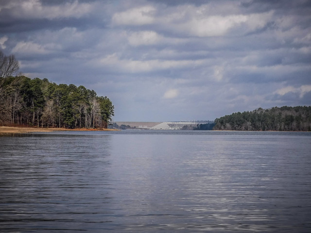
As much as I wanted to, I didn’t get out of the boat. I had already formulated a plan for exploring a couple of places in McCormick County along the eastern bank of the Savannah, and time was slipping away. I turned upstream and headed back toward the boat ramp. The Richard B. Russell Dam seemed quite close as I made my way back. I also paddled over to the Bobby Brown Park for a closer look.


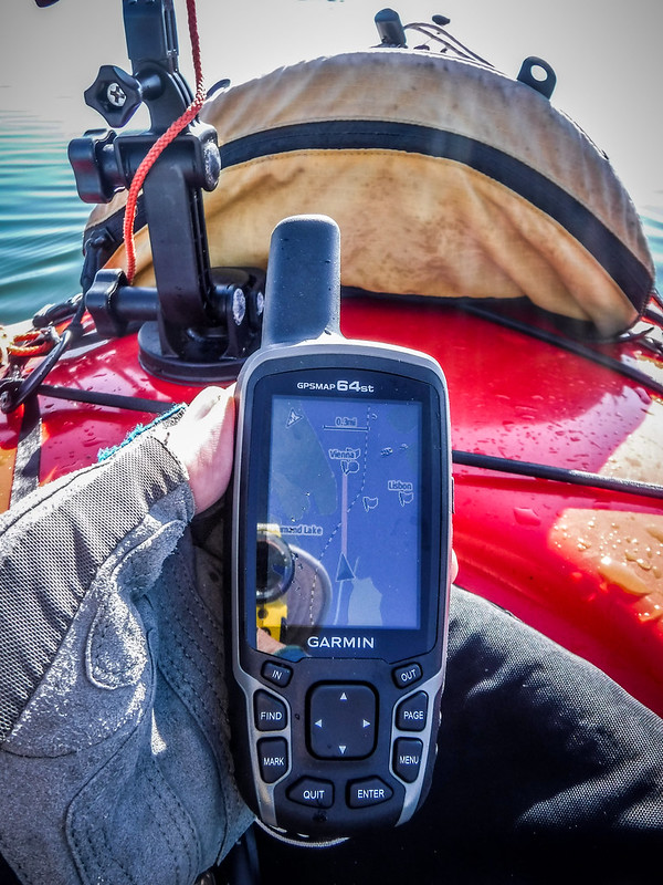
There were markers all along the paddle route. After checking with my GPS I figured out that these marked the state line between South Carolina and Georgia.

Finally I made it back to the cove with the Hester Boat Ramp. The paddle was longer than I’d thought at 8.4 miles.


I loaded the boat and gear and changed out of my paddling clothes, but I wasn’t done exploring. Page three covers the post-paddling explorations.
About 2 1/2 hour drive south from Lake Thurmond is another historic town on the Savannah River, known as New Ebenezer, settled by the German Salzburgers in 1734 – fleeing religious persecution. It is located near the town of Rincon, GA. More information is on the Georgia Salzburger Society website. Might be a decent paddling / historic exploration outing.
The Lowcountry guys have one Ebenezer Creek a couple of times and I’ve been with them once. It is an interesting paddle.