
I have long wanted to get a boat out on Lake Summit. It’s a smallish lake in Tuxedo, NC ringed with boat houses and vacation homes, but it’s always intrigued me. There used to be minimal public access, but now that seems to have been closed off, only available to lake residents. I’ve driven around the lake several times looking for access, but with no success.
Having recently done a podcast episode on the nearby Kingdom of Happy Land, I’ve really been wanting to explore this area. When Perry Weinberg said that he had access to the lake through some family land, I jumped a the change to add this lake to my paddling resume’.
The day started with bad decisions. Since parking might be tight, we would put the boats on top of Perry’s car rather than take my trailer. I hadn’t paddled my big red Tsunami 175 in a long time, so I thought I’d bring it, since it wasn’t already loaded onto the trailer.

That was the first bad decision, for lots of reasons.
Perry only has crossbars on his car with cushions for his wooden kayak. I decided that I could add my Thule J-Racks to his crossbars to better hold my boat. That was bad decision #2. Perry’s Yakima bars are round, and Thule doesn’t seem to place nicely with Yakima. It was tough getting them to stay put without rotating. With a bit of weeping and gnashing of teeth we managed to get the boat up onto his roof and headed out.
Perry’s family has owned various houses up on Lake Summit for years. He spent many childhood summers up there and knows the lake well. His cousin now owns what used to be an old camp on the north side of the lake. As we pulled onto the dirt road to get to the camp, one of my J-racks rotated, causing my kayak to shift on the roof. It’s a good thing that this happened so close to our destination. If it had done this on US 25 I fear I would have had a boat sitting on the side of the road…or worse.
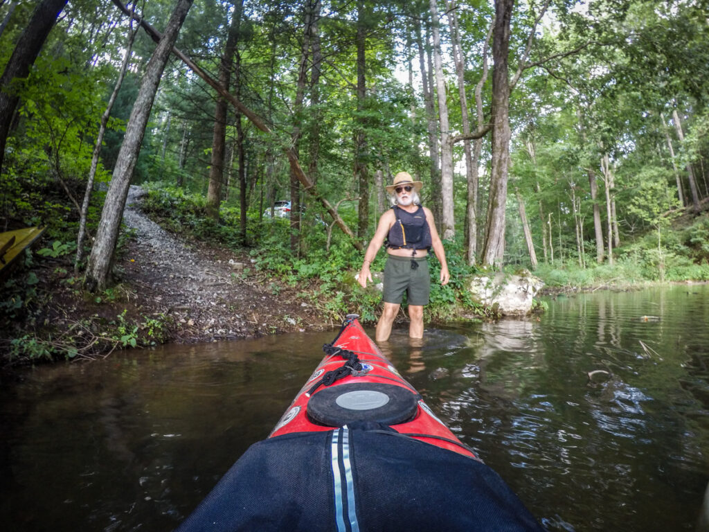
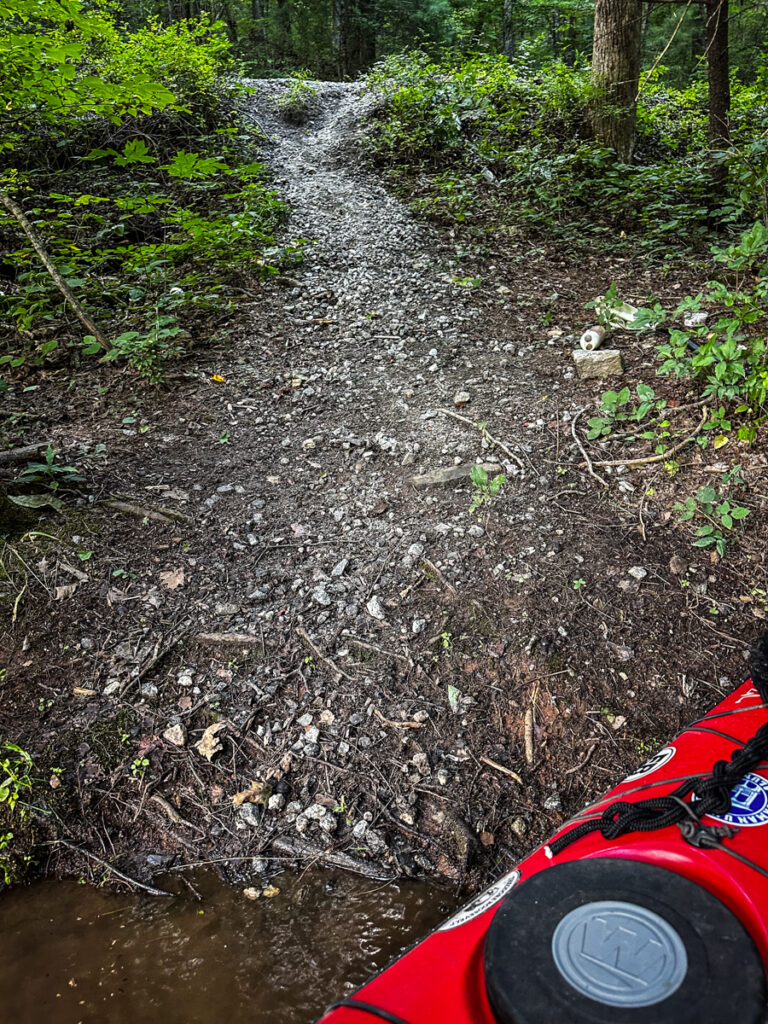
Our access would be from the cousin’s property. We made it without my boat falling off. The only problem is that it was down a steep gravel path to a fishing spot. Parking would be along the road. I now saw that bringing my biggest boat wasn’t the best idea given how steep it was down to the lake.
Once we did get down to the lake and out on the water I discovered that my foot pegs weren’t in the right spot. I had also forgotten to flip my rudder down. When I did, I found that the rudder wasn’t working correctly. When we eventually pulled over to check things out I found that the pegs had locked into place from disuse, and one of the rudder cables had broken. Bad decision #3 – not checking the boat over before I decided to use it. I only checked it for copperheads and other creepy crawlies, but not for functionality.

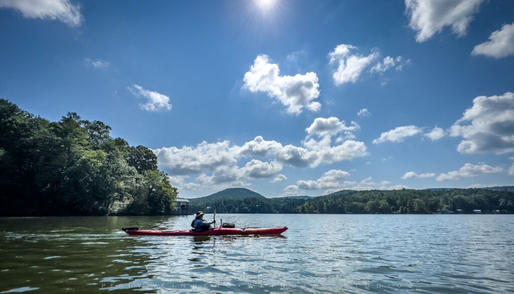
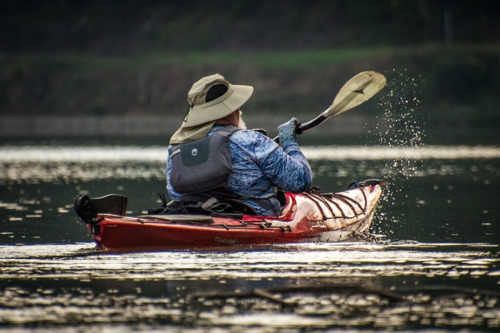
Other than that, the big boat was actually quite comfortable and paddling it was easy. The weather was beautiful, and the scenery out on the lake was stunning. Perry is a fantastic photographer, so I’m going to swipe some of his photos for this post rather than just use mine.
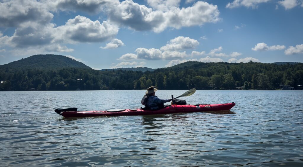

From my trips around the lake on the access roads I thought that the scenery would be marred by the many vacation homes and that the lake would be choppy with boat wakes. That wasn’t the case. I’m sure it would be crowded on weekends and holidays, but today we had the whole lake to ourselves. The homes around the lake weren’t nearly as distracting from the views as is the case on Lake Robinson or Lake Keowee. There were some beautiful homes.


Once we exited Perry’s cove onto the main body of the lake we had to make a decision. We could paddle south toward the upper reaches of the lake and the Green River, or we could paddle north toward the dam. We decided to head south.
In this direction lie the camps of Lake Summit. Camp Mondamin, Camp Greystone, and Camp Green Cove lie to the south, on the upper reaches of the lake. Camp Mondamin was the first that we encountered. The lake levels were very high, so some of the docks at the camp were under water.

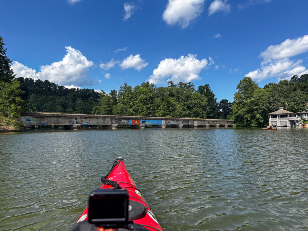
Just around the corner from the camp the South Lake Summit Road crosses the lake. Below that is an old iron trestle bridge.


This spot was actually an important location in the history of the lake. In 1908 J. O. Bell received a charter for the Green River Manufacturing Company. This would be one of the first water-powered textile mills in the stated. Bell built a dam across the Green River to form Lake Edith. The original dam was built at this spot at the iron bridge. There were remnants of the original dam at the old bridge. We pulled up on one of these to see if we could sort out my rudder cable. This explains why the camps are all on this end of the lake. They were built on Lake Edith, which was much smaller, and ended at this bridge. Most of the original camps were upstream from this bridge.
The power capacity proved insufficient for both the mill and the surrounding village. In the 1920s the present dam was built, creating Lake Summit as we now know it.
The lake narrowed at this point and continued to a deep bend in the river. In the bend there was a an embankment that held back another small reservoir. Behind this was the aptly named Camp Green Cove. Even though it was early August, the trees along this stretch were already starting to show fall colors.

There was another narrow stretch that came to a bend to the left. At this bend, closer to US 25, is Camp Greystone. In addition to the requisite canoes and other watercraft, this camp had an extensive waterside and ropes course at the water’s edge.


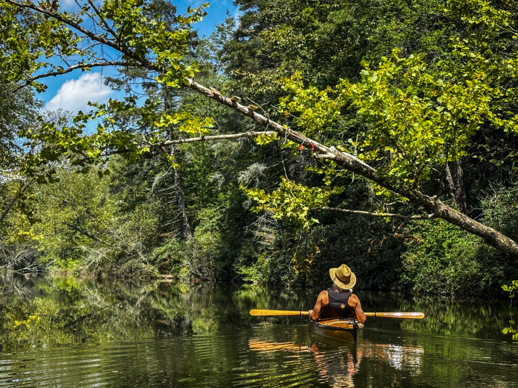
Across from the camp was a flooded woodland area. Perry and I pushed our way through.

Along this stretch we encountered some wildlife…

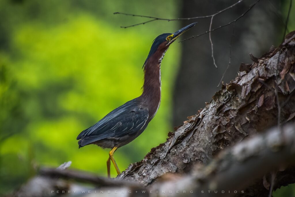
…and some not-so-wild life.


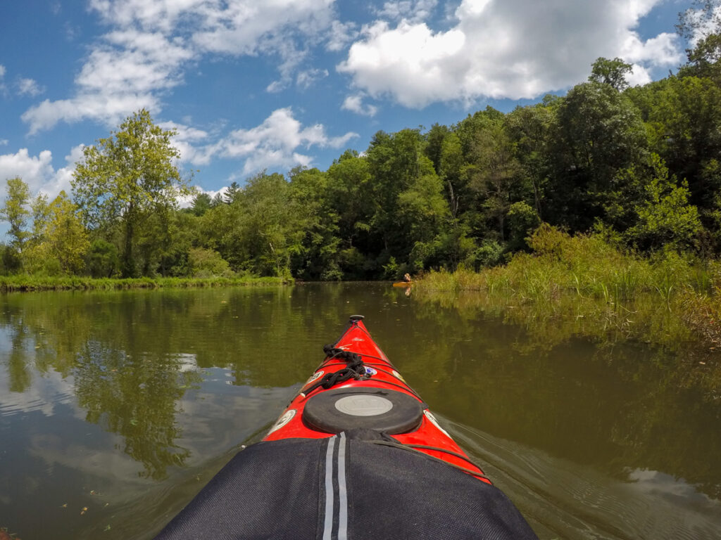
The scenery along this stretch of the lake was stunning. This was the Green River, but still retained its lake-like nature.


We met a friendly fisherman. He was full of information about the lake and its residents. He was particularly loquacious because he treated Perry as a local, and really admired his wooden boat.

The houses along this stretch were farther apart. Most of these were set back from the lake, but all seemed to fit in without overwhelming the lake itself.

The lake started to take on more of the river characteristics. The current started to pick up, but wasn’t so bad that it made paddling difficult.


The noises of US 25 started to intrude into the serenity of the river. I wasn’t following my GPS or maps on my phone, so I didn’t know how close we might be. Eventually we came to road 225, the old US 25. There were several channels under the bridge through box culverts.


Past this bridge the river parallels US 25 for a bit. There was lots more traffic noise. Still, I had no real concept of where we were in relation to the highway. I was expecting to see the bridge over the river at any time.


We did reach a bridge, but it wasn’t the one I expected. Perry called this the “overgrown” bridge, and that it was. There were lots of vines and other vegetation all over the bridge.


Given the amount of vegetation, I thought this must be another old, abandoned bridge. However, certain elements of the bridge looked a bit more modern. When i got home I was all prepared to look at old maps to see what this old might have been. I was surprised to see that it’s still an active road.
Just past this bridge the current started to pick up and the river took a turn away from the big highway. There was a much more remote feel. There were now rocks in the river and it was becoming more difficult to navigate, especially in my big boat. Once again I was questioning my decisions. The scenery really made up for it.

Soon enough we got to a point where it was too shallow to go any further. I didn’t know how far we were from US 25, but it didn’t matter. We paused a bit and looked at the rocks and surrounding area.


We headed on back the way we had come. The weather continued to be outstanding.


We reached the confluence of the Green River with Vernon Creek. This is the point where the river comes closest to US 25 before it goes under the highway. Twin box culverts carried the creek under the highway. It would have been fun to kayak under the highway, but it was too shallow to get the boats through and there were trees and branches down. We decided to park the boats and explore on foot.


It was tempting, but we didn’t go all the way through. We just walked in a bit of the way.
We made our way back toward the main part of the lake. Along the way we encountered the friendly fisherman again. He was even more loquacious, full of tales of lake residents.


Back out on the main body of the lake we eventually reached the cove where we launched. Here we had a choice. We could call it quits and head back in, or we could continue on toward the dam. Questionable choice #4, we decided to paddle to the dam. The only reason this was a questionable choice is that I had thought this would just be a small lake and we would paddle a couple of miles, at best. I hadn’t packed a lunch and only had two water bottles with me. It was already getting on in the afternoon. Yet, I didn’t know when I’d ever get another chance to paddle this lake, so we decided to go for it. I called Laura to tell her that the trip was taking much longer than we planned, but we were having a good time.

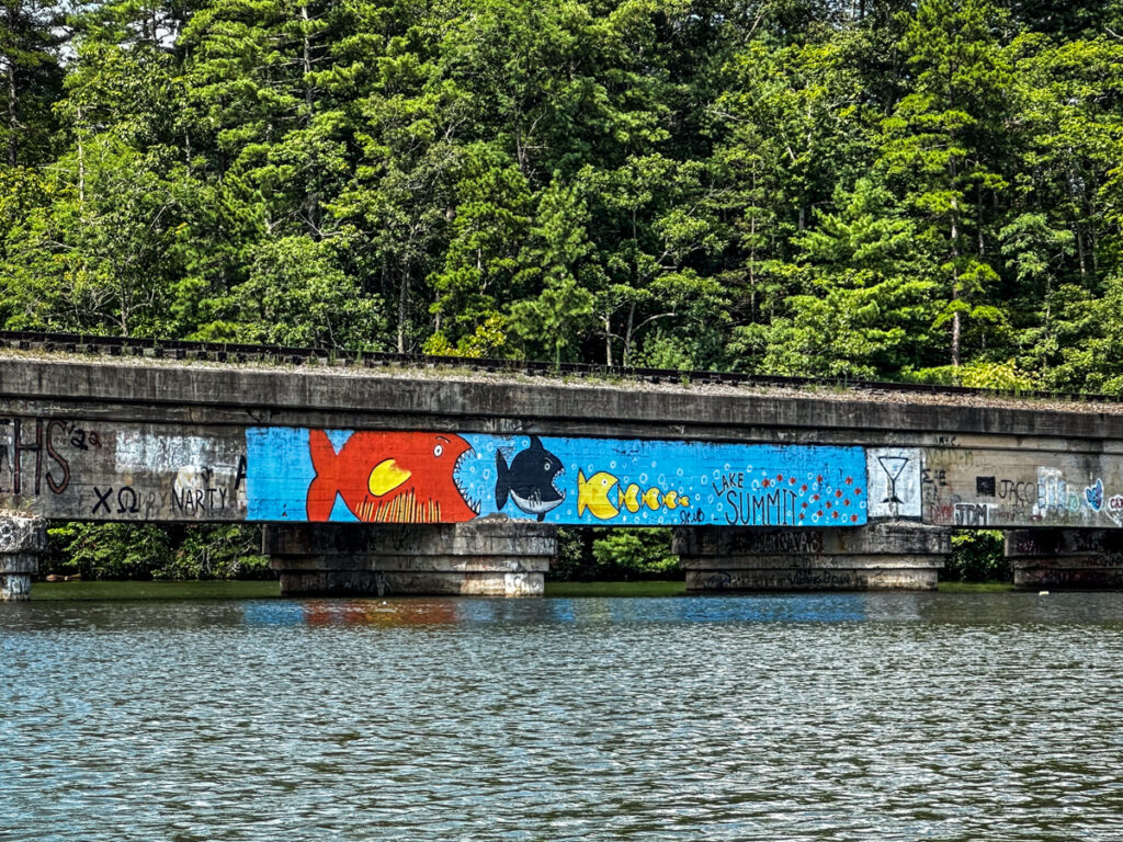
We reached the old railroad bridge across the lake. Now abandoned, this had been part of the Norfolk Southern Railway, which included the Saluda Grade just to the east of here. The bridge was covered with some of the most elaborate and tasteful graffiti I had ever seen.

Beyond the bridge was a yellow barrier marking the limit of where we could paddle. Not far beyond that was the actual dam.

We made our way back across the lake and toward our takeout.

Back out our landing spot we had to negotiate the steep hill back up to the car. It was a challenge. As we loaded the boats I decided to give up on my J-racks and just tie my boat to Perry’s crossbars. That proved to be much more stable.
As we left we drove under a trestle that supported the old railroad.

I had expected this to be just a quick morning trip on a small lake. As it turns out, we paddled nearly 10 miles on flat water, some of that against a current. Surprisingly, we had almost no boat traffic out on the lake, though there were ski boats and pontoons in boat houses all around its banks.

I did make a time-lapse from the GoPro images.
The beauty of Lake Summit was a surprise, especially the portion upstream on the Green River. I had expected it to be cluttered with houses and boats. While there were houses, these didn’t really detract from the scenery. I’m going to have to find a way to get back up here. My thanks to Perry for making this trip possible.
Beautiful pictures.
My father had a friend who owned a property on Lake Summit. When we were moving out of the area he invited us there for a day. I was 8 and had loved trains my entire life, and found it so fascinating to see trains going over the lake on the trestle. What a beautiful area it was!
About 20 years ago I was in the area and did go back and find where the property was, still very similar to the way it had been all those years ago…and, of course, just as beautiful!