Our first stop was Shelton Ferry in Union County. Scott and I had visited it in 2019, but I had forgotten what it was like. Looking at a map I was thinking that it would be found to launch here and paddle down to Strother Landing on the Broad. A dirt road led down to the landing. There is no boat ramp, but there is river access. Even so, it looked like someone had attempted to launch some kind of boat. There were deep trenches in the mud.
Having confirmed this as a possible launch site we checked out a couple of other dirt roads, but most of these turned out to be dead ends.
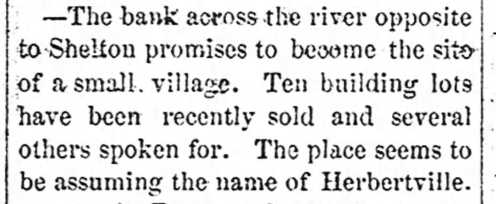
Our next stop was the site of Herbertville, or simply, Herbert. In 1882 J. W. Crosby decided to open a bank and general store on the western end of the railroad trestle in Union County. Crosby decided to call his town Herbertville, for some reason. This was reported in the Fairfield times.
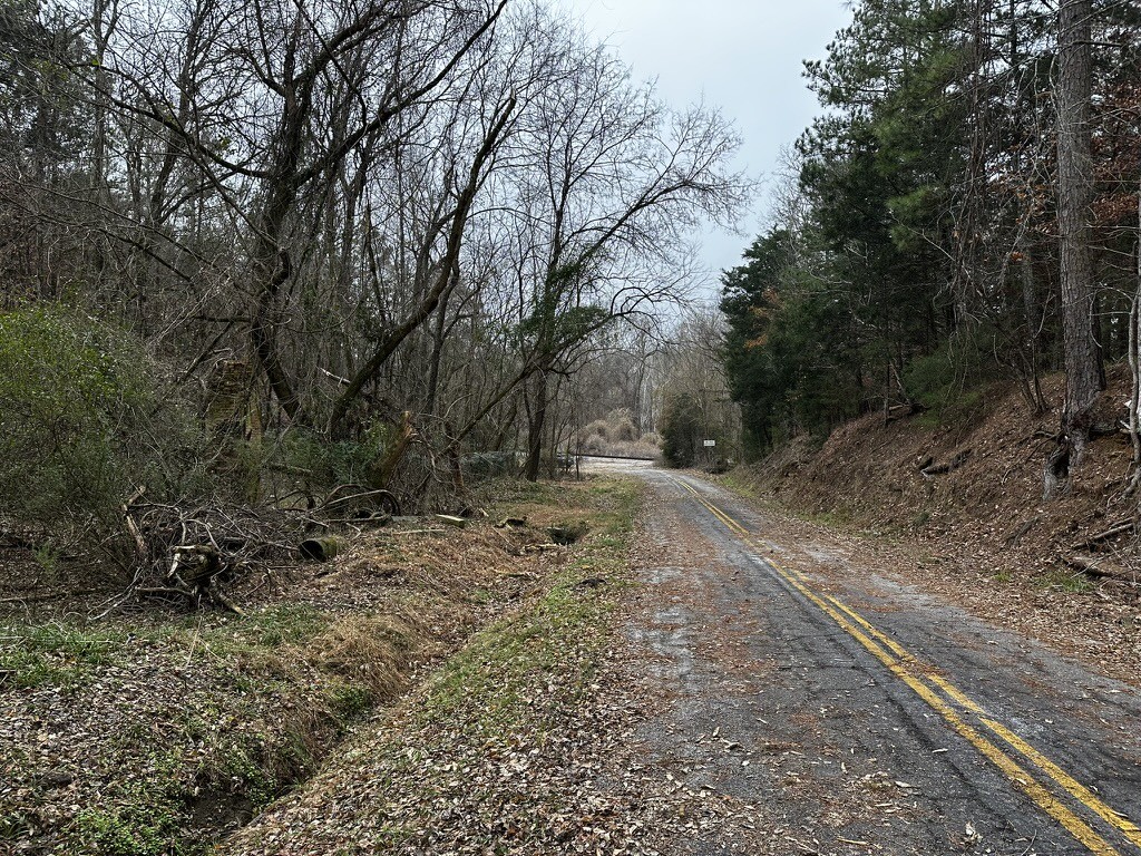
Herbert still shows up in GNIS data, so I had the coordinates for its location. It was just a half mile or so upstream from the ferry landing, but ten miles by road. We drove over and found a dead end next to the railroad. There was a gate, and beyond that Alan saw a house or some sort of building. Access from the road turns out to be a bust, but my thought was that we could explore from the river whenever we do our kayak trip.
It was time to head on over to Shelton. As always, there were cool things such as old churches and cemeteries that could have distracted us, but we stayed on target. We found Shelton Road and drove down to the dead end at the railroad.
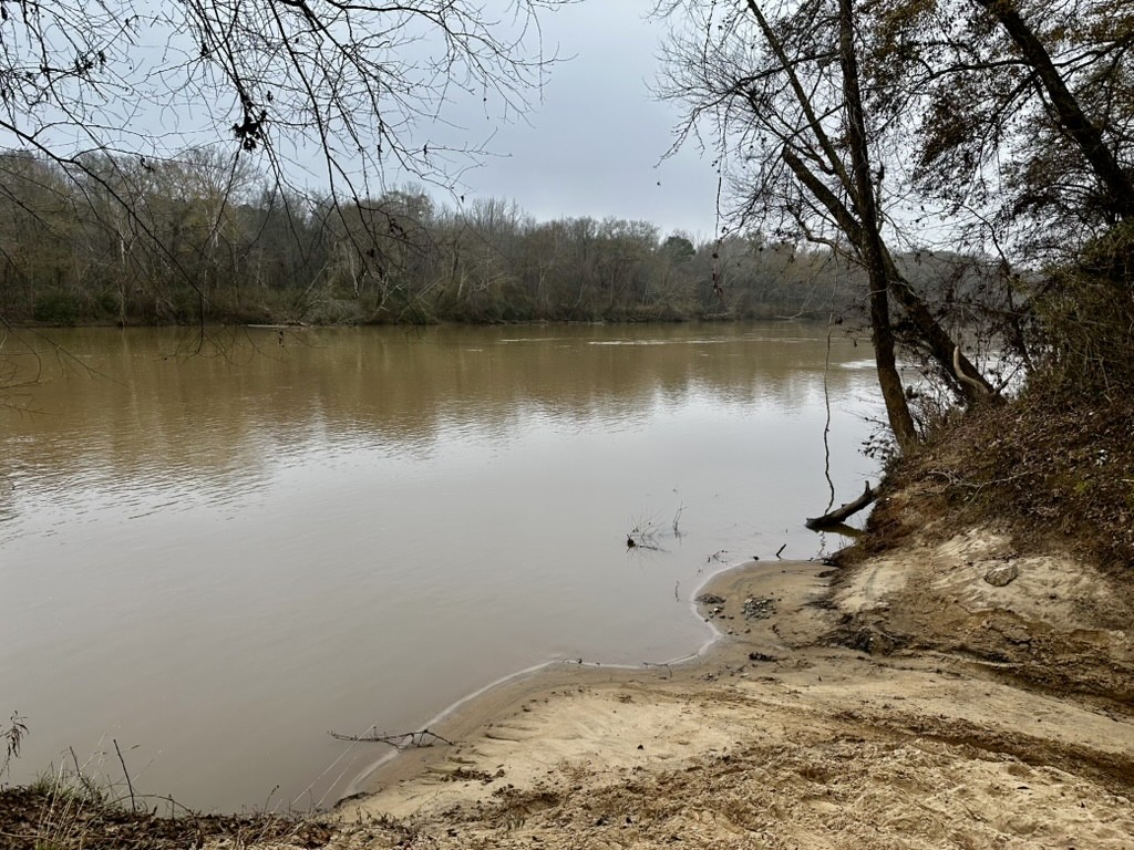
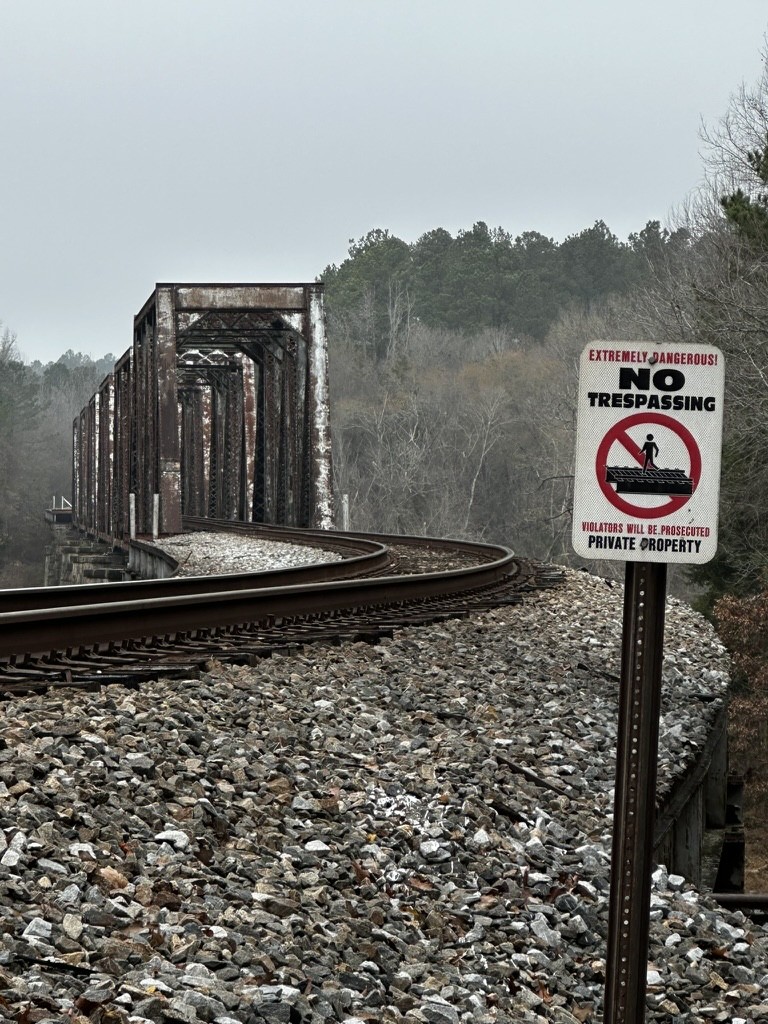
We parked the car and decided to walk down the river along the railroad tracks. There was a clear path so that we didn’t have to walk on the tracks themselves. When we reached the tracks there was a sign warning people not to walk on the trestle. We didn’t. We walked down an embankment and under the trestle toward the river.
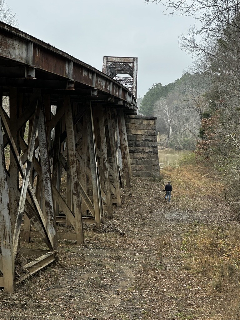
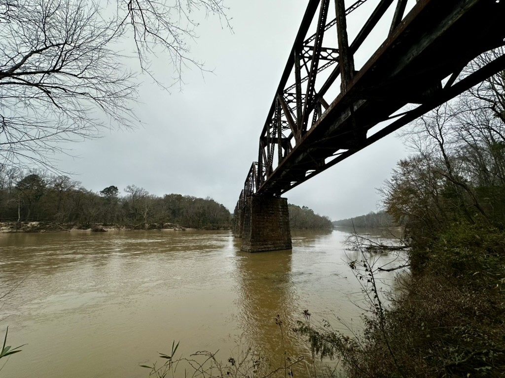
The river was muddy and the current was surprisingly strong. On the other bank it looked like a clear space where Herbertville might have been. Again, another place to explore by kayak when we get the chance.
We started walking back up the hill. Off to the north we spotted a couple of deer stands. As we walked up the embankment we saw tracks that could have been from a four wheel drive vehicle. We walked past the town site down the railroad for a bit.
The topography wasn’t what we expected. On the river side of the railroad it was flat for a few yards, then dropped of steeply into a floodplain next to the river. The floodplain was about a football field’s width out toward the river. Alan and I wondered if the river’s course changed over the course of the year.
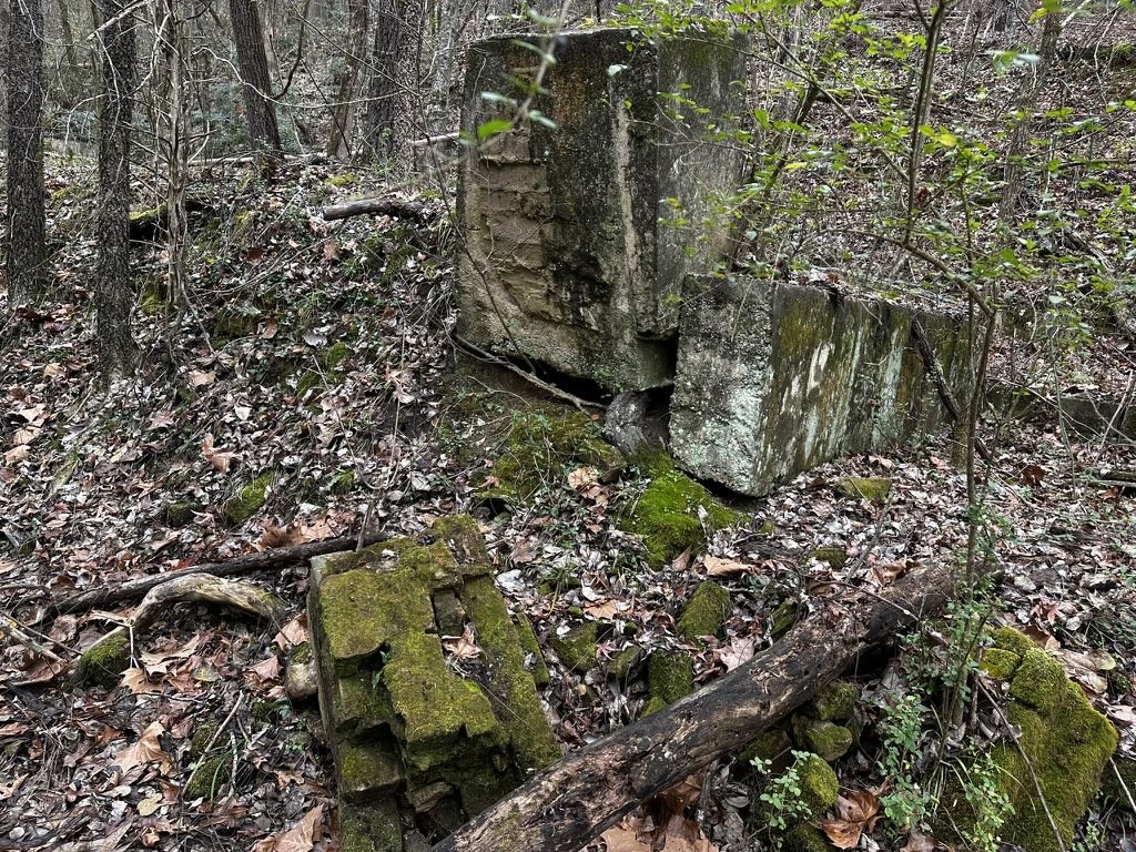
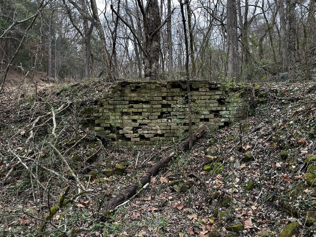
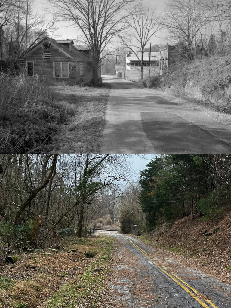
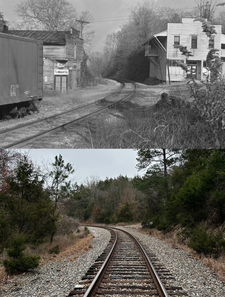
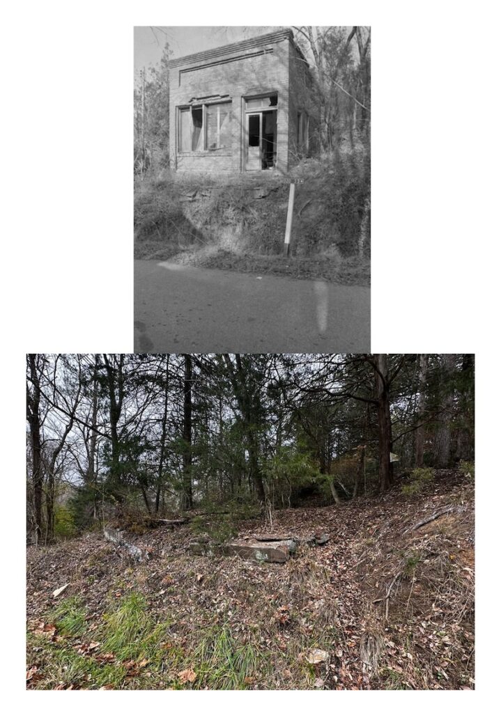
We walked back toward the town site. When Scott and I had visited the ruins were overgrown with vegetation. This time it was winter and the weeds had died back. We could see bricks and foundations along the road leading to the railroad.
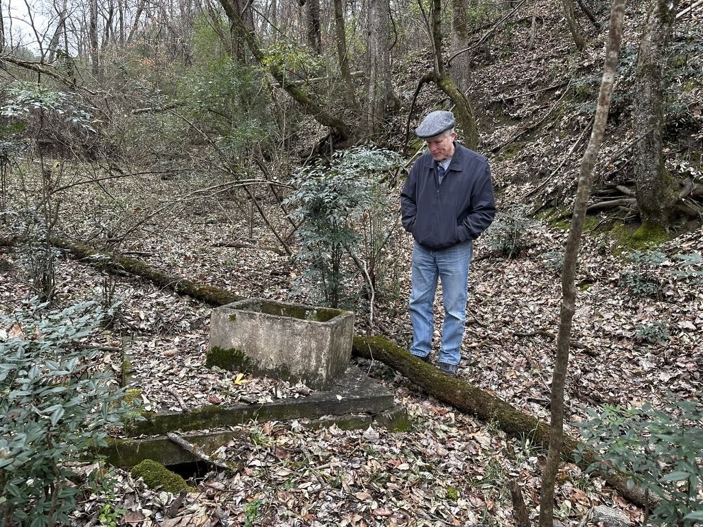
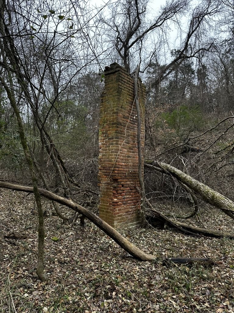
I was able to match up some of the archival photos from Richland Library with the photos that we took.
We left Shelton and drove on down to Clayton Depot Road. We paused briefly at the Shivar Cisterns, but didn’t take any new photos. I had taken photos on previous trips, so I didn’t see the need for any more. As we left the Clayton area we had another surprise.
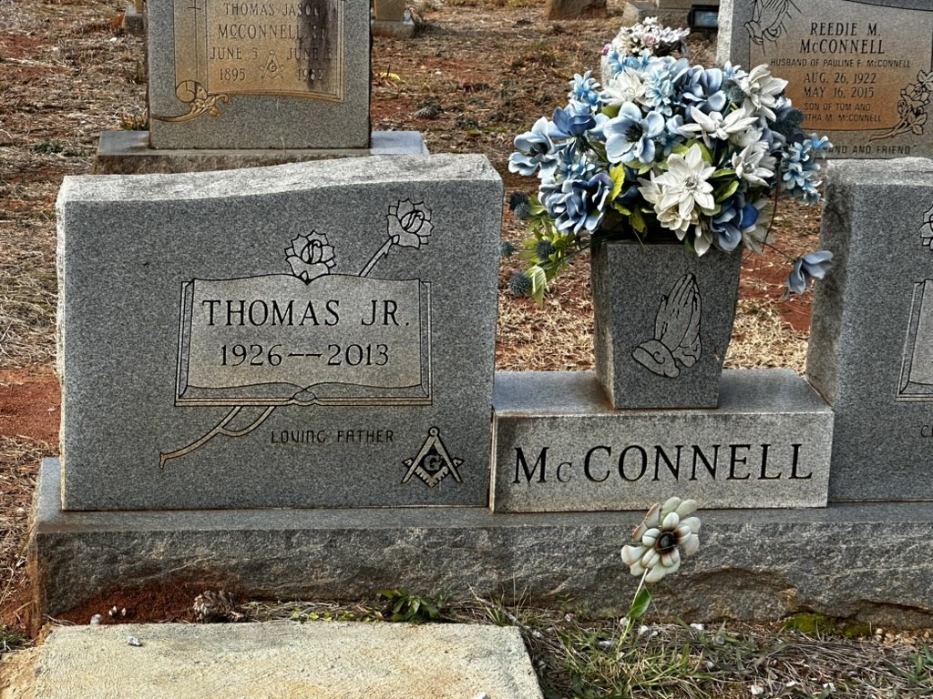
Clayton Road circles around the depot so the only way out is the way you came in. At the entrance to the road is the Silver Hill Masonic Lodge. Across the road is a ball field, and next to that is a cemetery. It’s an odd juxtaposition. The cemetery looks forlorn and abandoned, although there are modern interments there. There is no grass, but just red dirt. It was weird, especially since a foul ball from the field would land in the cemetery.
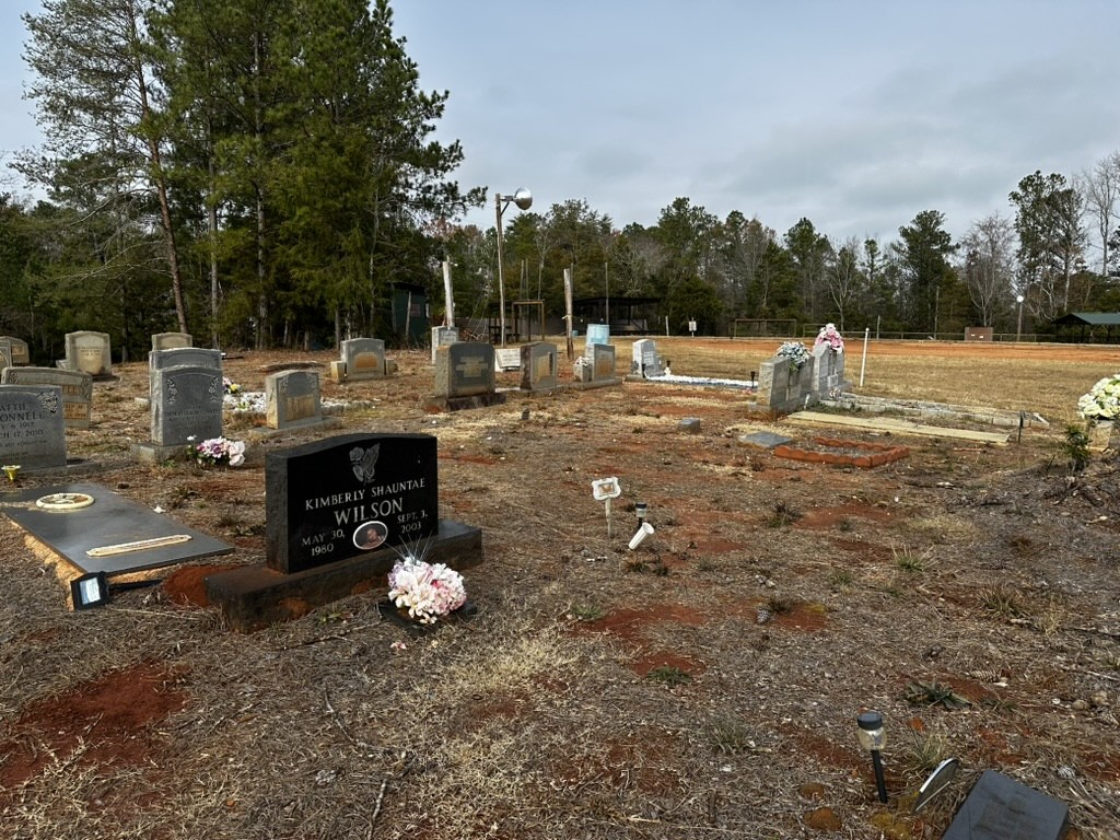
The name McConnell was on many headstones, and this is listed as the McConnell Family Cemetery on Find-a-Grave. I found the grave of Thomas McConnell, the last employee of the Shivar Springs Bottling Company. McConnell was interviewed by historian Andrea L’Hommedieu from USC for an oral history project.
Behind the Masonic lodge across the street we spotted another cemetery and decided to check it out. This was the Saint Elizabeth Church Cemetery. It was an African American congregation that is now long gone. This cemetery, though in need of mowing, was in much better shape than the McConnell cemetery across the street.
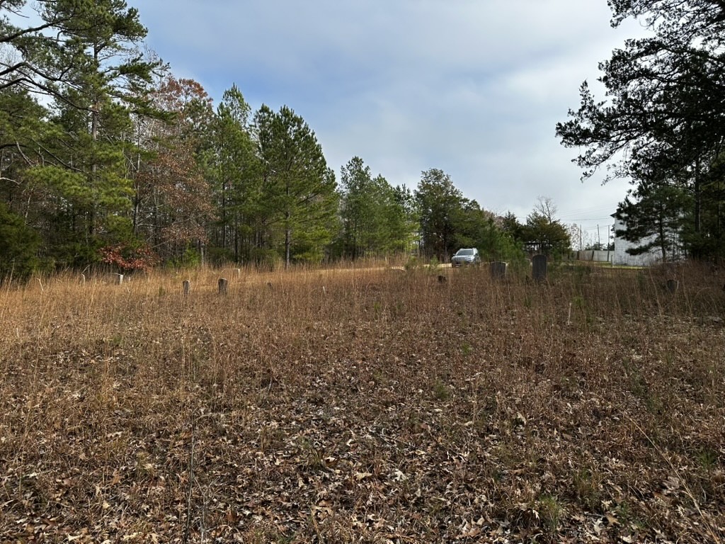
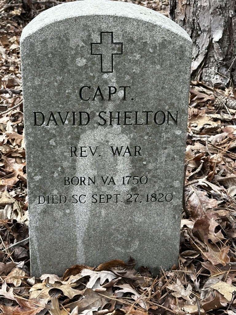
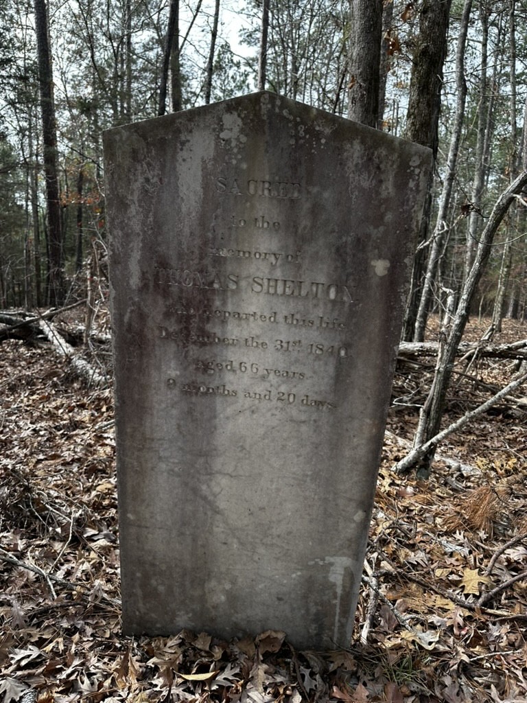
In the woods behind the cemetery we spotted even more headstones. We decided to check them out, and discovered history. These were the graves of the original Shelton family. We found the graves of David Shelton (with a new head stone), Thomas Shelton, and other members of the Shelton family.
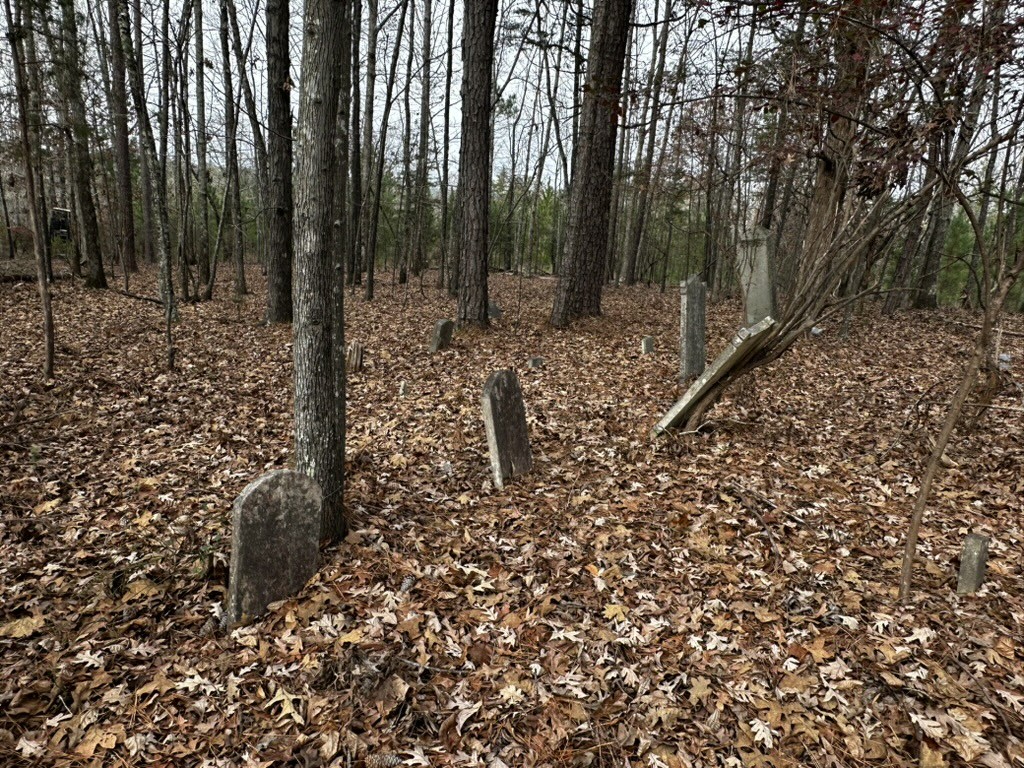
This cemetery arrangement was so opposite from what we normally encounter. Usually there is a large white cemetery with a segregated section for blacks somewhere in the back. In this case, the Shelton cemetery is in the back off in the woods, while the black cemetery is more prominently in front. This is just a function of history. The Shelton cemetery came first down in the woods, and the Saint Elizabeth cemetery later, closer to the road.
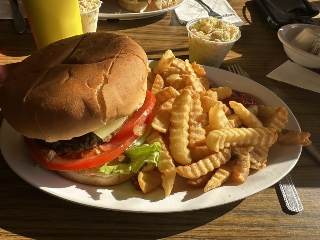
Alan and I left the area and continued south. We paused at Liberty Universalist Church and the Feasterville Academy, but didn’t linger. We decided we wanted to do a more extensive trip later. Our last stop was at one of our favorite haunts in this area, Bill & Fran’s. We normally do breakfast here, but we were pleased to find that they had excellent lunch options. My burger was great.
The Shelton episode comes out on Carolina Ghost Towns in early February. I’m not sure when we will get to do out kayak exploration of the area, but I’m sure I’ll document it here.
I enjoyed your podcast on Shelton, SC. Thank you for crediting my article about the town. It truly is a fascinating history. I am a Trustee and Newsletter Editor for the Coleman-Feaster-Mobley Association which maintains Feasterville and holds an annual Reunion there. I would be happy to add you to our newsletter list if you are interested. Thank you for sharing the rich history of SC’s ghost towns! Please feel free to contact me if you would like more information or just want to talk Southern History.
Thanks for listening! I’m very interested in the history of that region and would love to receive the newsletter. I’d like to do an episode on Feasterville in the future.
You have turned up some really good historical documents. One I would like to find is the hand-drawn map of the Shelton area that you credit to “Winnsboro News and Herald, 1988.”
The Coleman-Feaster-Mobley Association website has our newsletter archive: https://fairfieldgenealogysociety.org/Family-Associations/CFM-Association/CFM-Newsletters.htm
Email me, I will put you on our list.