NOTE: I’m still catching up. All of the snow is now melted and gone, and this weekend is in stark contrast to last weekend.
I actually love snow days. There is an entire ritual of activities, soup, and pursuit of warmth that combine to make our rare winter weather a treat. Even though I no longer work for the schools and snow days have long since lost the same meaning, I still get excited when I see the first sign of flakes. This past week’s blizzard (or what passes for one in these parts) did not disappoint.
Our snow came in two batches. First there was sleet with just a bit of snow covering. That’s the scary kind for us. Ice usually means power outages, and we have large trees with large limbs right over our house. The threat of physical damage is just as real. Back in 2005 we lost power for ten days. It was not fun. This time, fortunately, we were spared. Others lost power around town, but ours never even flickered.
The next night the second back of snow fell, and we got about 6-8 inches of the stuff. It was enough to make the yards beautiful and cover up any neglected lawn maintenance. Another reason I like snow.
My plans were to attend the Church Music Conference at Furman. The sessions on Thursday were good, but the clinicians had to alter their travel plans to get out before the bad weather hit. Everything was rushed and compacted, and Friday’s sessions were cancelled. Furman also called off classes on Friday, so Laura and I spend a leisurely day at home.
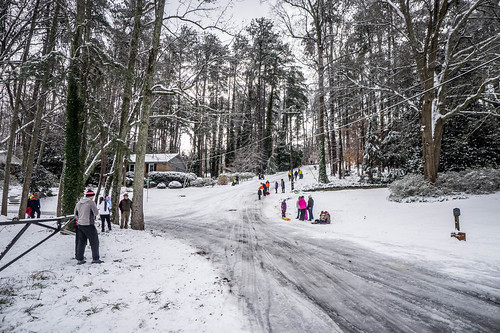
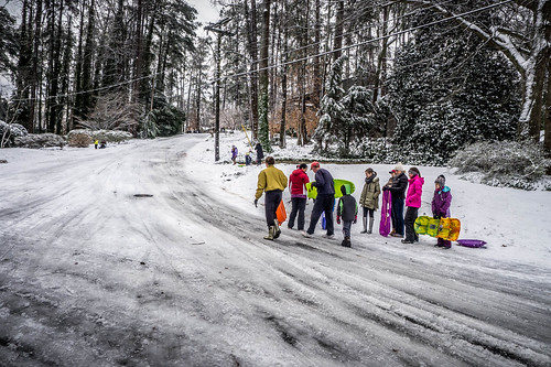
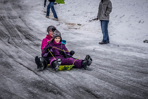
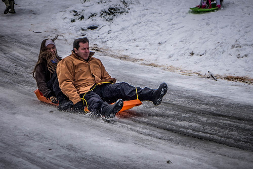
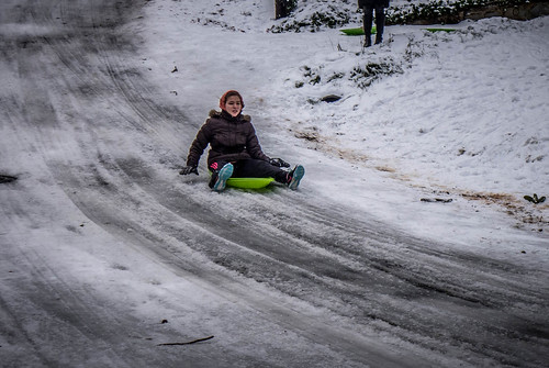
Saturday morning I got up early and headed out around the block with a cup of coffee. My destination was “Suicide Hill,” or “Deadman’s Hill,” depending on whom you ask. It’s our local sledding venue, and lots of people were taking advantage of excellent sledding conditions. I chatted with neighbors and watched awhile.
Sunday we got out and about a bit. Monday roads were fairly clear, but schools were still cancelled. I heard/read lots of comments on Facebook about why schools were called off and not delayed. Having been in on those discussions at the district level as to whether or not to cancel or delay school due to weather, I can tell you that it’s a no-win situation. You will ALWAYS upset someone. Occasionally I’ve had to answer the our district’s phones on snow days, and I’ve had to field lots of calls to the district office on those days from concerned parents. The best thing to do is to err on the side of caution. If even some of the roads aren’t safe, don’t risk it. In this case, I was soon to discover that our local schools had made a wise choice.
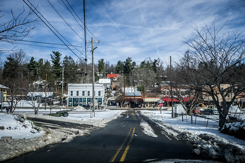
Monday I was going stir crazy – not because I had cabin fever and don’t like hanging around our house, but because the snow presents such wonderful photo ops, and I knew it would be going away soon. I figured that since I had a car with four-wheel drive, I would be OK.
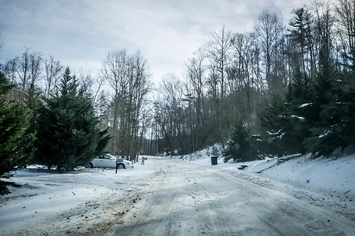
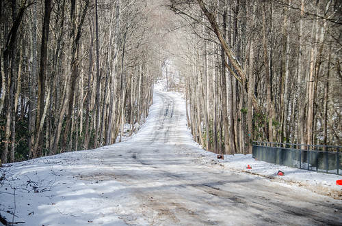
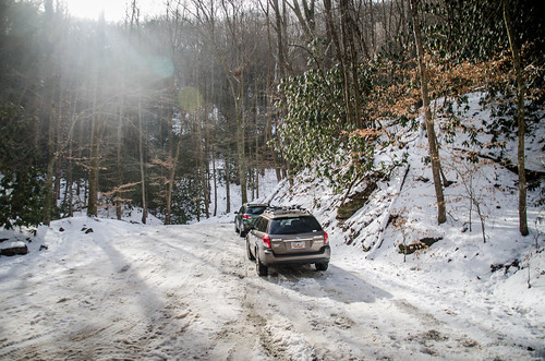
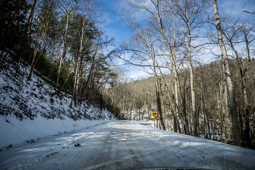
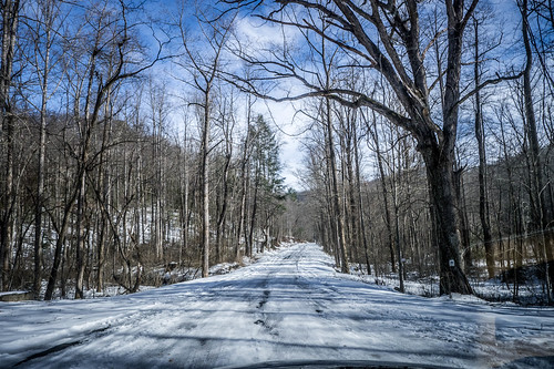
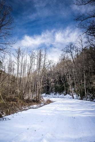
I headed up past Travelers Rest and continued on US 25. I wasn’t quite sure where I was going. On the spur of the moment I took old US 25 up toward the Greenville watershed. Here I found that the roads were still completely covered in snow. Greenville County had certainly made the correct choice. I couldn’t imagine a bus driving these roads.
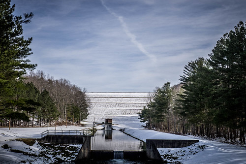
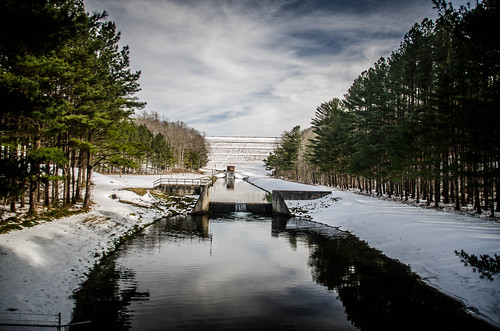
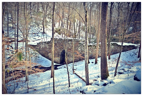
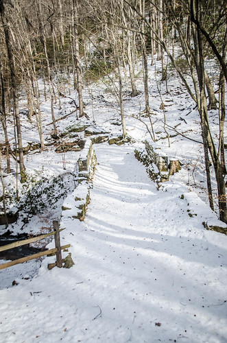
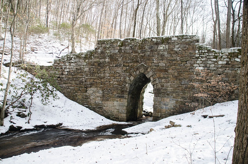
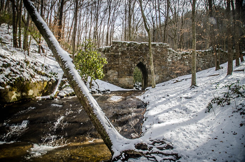
Another spur of the moment choice had me turning onto the Camp Old Indian Road. I decided I wanted to see the old Poinsett Bridge in the snow. The roads were still completely covered, but my Subaru handled it with no problem. The dam for the watershed made for an interesting scene, and the farms along the way were quite picturesque.
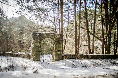
I parked and spent some time photographing the bridge in the snow. There was one other car parked there – another Subaru – but I never saw the car’s occupants.
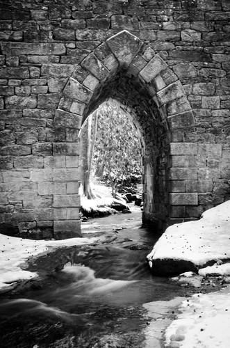
The snow contrasted nicely with the stonework of the old bridge. I tried to shoot it from several angles, and experimented with several post-processing techniques. I think at least one of these will be printed to go on one of our walls.
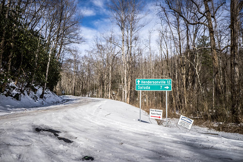
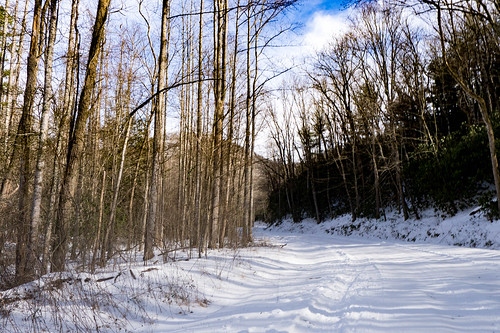
It was still early, and I was in the mood for more exploration. I returned to the Saluda Road, and decided to see if I could get to Saluda. As soon as I turned onto Greenville Watershed property the condition of the roads deteriorated. These had not been plowed, but it looked like they had been traveled.
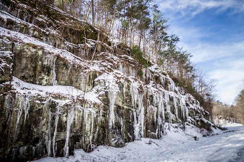
Again, my Subaru handled the snow with no problem, and I drove cautiously. I came across one rock outcrop with massive icicles. The scenery was nothing short of spectacular. I was a bit worried about some of the steeper hills, but even those posed no real challenge. I think if this had been ice instead of snow, it would have been a different story.
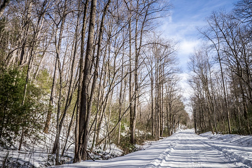
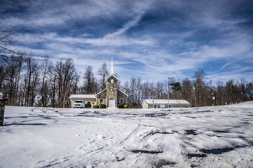
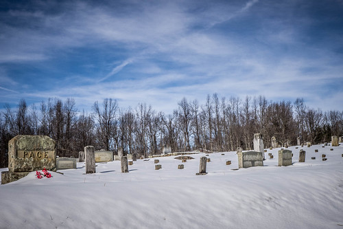
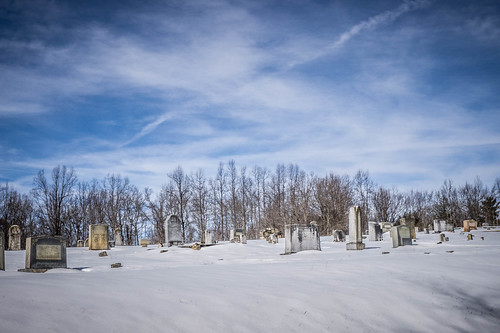
When I reached the SC-NC state line I left watershed property, and the roads cleared…a bit. The Mountain Pace community was still covered with snow, with the old Baptist church and cemetery thrown into stark contrast.
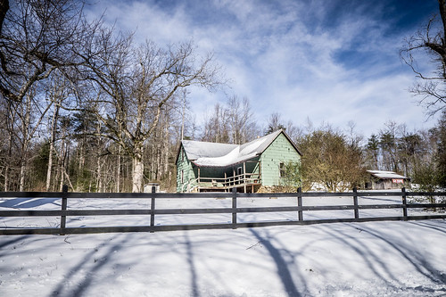
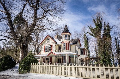
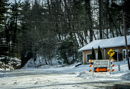
Saluda itself was looking quite Alpine. Some of the old Victorian B&Bs really stood out in the snow. I drove through, planning to get lunch in town, but on my first pass it didn’t look like much was open. I planned to turn south onto Highway 176 and head on down to Tryon. A road closed sign changed those plans, though.
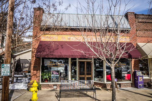
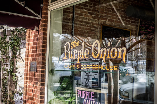
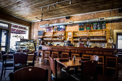
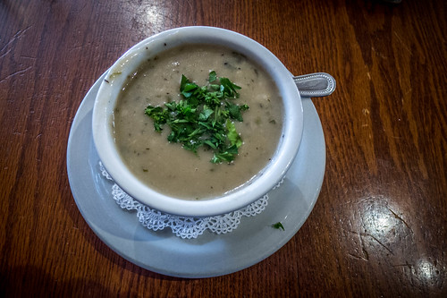
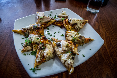
Coming back through town I saw that The Purple Onion was open. I pulled in and had even more soup (mushroom this time) and some chicken flatbread.
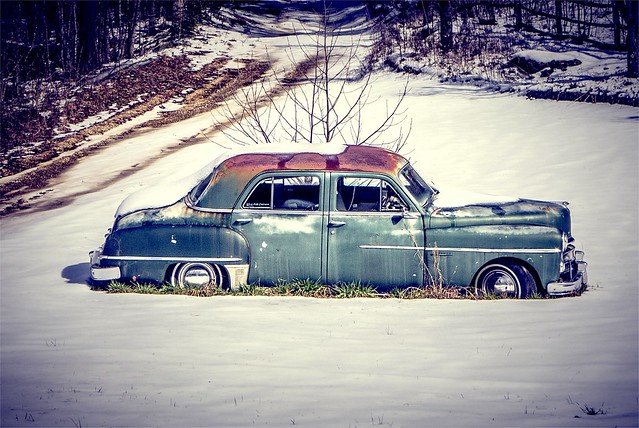
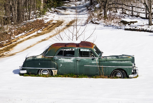
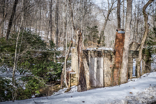
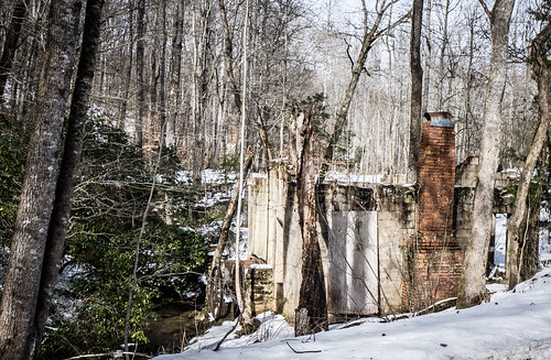
After lunch I headed north on 176, crossing the Green River Gorge. From there I drove pretty much straight back down US 25 toward home. I did pause in the Lima community just south of the Highway 11 bridge to take a photograph of an old car that sits in front of a logging operation. I also drove up and took a couple of photos of the old Trammel Mill. I was hoping that its water wheels would be more visible constrasted against the snow.
So, as blizzards go, this one wasn’t too bad. As usual, we were spared the grief and problems that socked in the northern states. I don’t mind snow when it’s like this.
The sky you got in those pictures was spectacular! Some snow shots look over-exposed or contrasty if the sun is too bright, but these were wonderful.
A funny thought … I like the Poinsett Bridge shots (that’s not the funny thought). But, looking at the close-up of the arch, I thought, “If you were under 12 years old and walked through that arch, would you suddenly find yourself in Narnia during summertime? 🙂