And the rains kept coming. We knew it would be wet when we moved to the Pacific Northwest, but I had no idea the extent of flooding that would occur. Some of it is normal. This past week what we got was quite a bit beyond that.
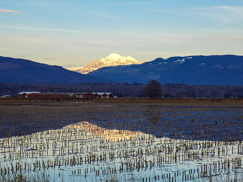
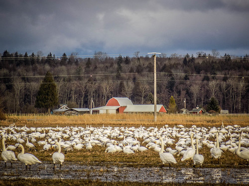
For the past couple of months the farm fields in the Skagit Valley Flats have already been flooded. Farmers worked night and day to get in the potato crops because they knew the rains were coming. Once the fields are harvested the farmers dig trenches across the fields to aid with drainage. For weeks now some of these fields have turned into lakes and ponds and have hosted a wide range of water fowl.
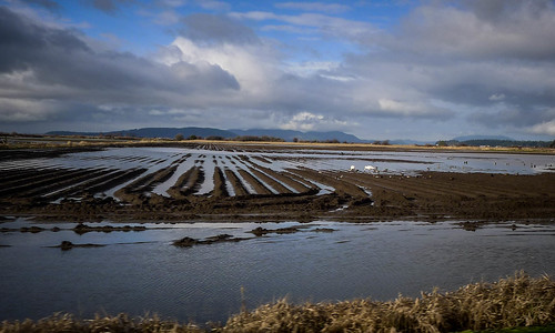
This is all normal. The problem comes when the temperatures rise and the snow pack on the lower slopes of the Cascades starts to melt. Combined with sustained heavy rains, this can get bad. The rivers overflow the dikes and with the already saturated fields, the water has no place to go. That happened this past weekend.
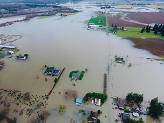
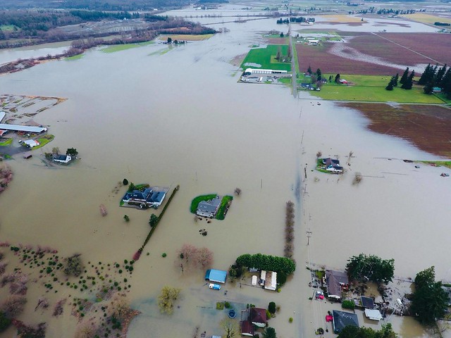
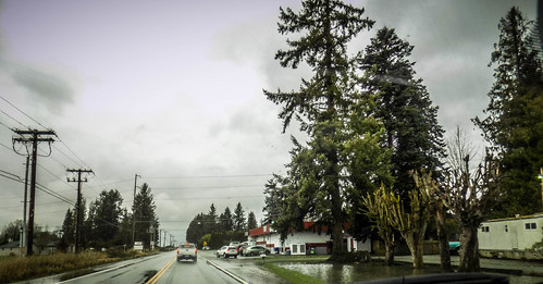
The worst of it began Saturday night. As I mentioned in the previous post, one field flooded and damaged a transformer, causing us to lose power. There was other flooding. Some of the main roads were closed due to water on the roadway and mud/landslides. The aerial photo at the top of this post and the following photo were taken Sunday morning by Paul Grenier.
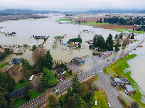
Duff McDaniel explained that most of the houses had been raised and were sitting on islands, but when we were able to drive through it still looked like the water was just inches from the businesses. By Monday morning the water had gone down a bit. The building with the red band around its roof in the photo above is W. D. Groceries. You can see it in the following photo to the right.
All that water has to go somewhere. It makes its way through the rivers and sloughs until it reaches the bays. The rivers and the run-off aren’t really affected by tides, but a high tide can exacerbate the flooding right along the coasts.
Monday wasn’t so bad. Laura and I were even able to take a quick trip to Whidbey Island. Yet, the weather didn’t really improve. Over night it continued to rain. Tuesday we got a call from Duff saying that a dike on the Samish River had broken and that our island might be cut off. He suggested that we make sure we had supplies in case we were stuck with closed roads for a couple of days. We headed into town, not really knowing what to expect or how much time we actually had. As we drove into town the waters were already lapping at the edges of the Bayview-Edison Road and several driveways and side streets were already under water.
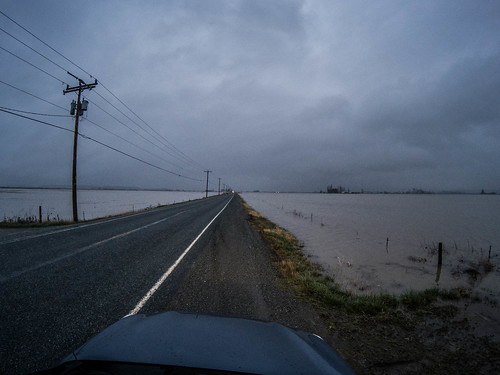
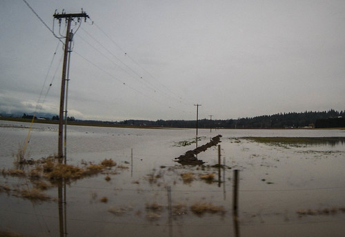
We got our supplies and made it back with no problem. I was even able to head back out later in the evening for a couple of things we had forgotten. Duff explained that the water we were seeing was from Sunday’s flood waters, just now making it out onto the flats. In fact, it looked like those water levels were dropping. Water from the dike would take awhile to get there.
Still, it was bad enough. Here’s some drone footage of the dike by Austin Breckenridge.
More aerial video was provided by KIRO 7 News.
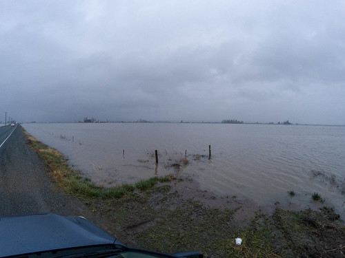
As far as we were concerned, this would just be an inconvenience. Our spot on the island is about 150 feet higher than the flats, so I wasn’t worried about flooding. Our problems would come if the one road to the island were flooded. By Wednesday morning, however, we found that things were still clear. The water was contained within the fields. There was some flooding on some roads, but there were alternate routes. I was able to make it into town for my Bring Your Own Guitar gig Wednesday night with no problem.
Duff said that he’s been trapped on the island three times. Once Linda was trapped off-island and couldn’t return home for several days. The worst flooding occurs when both the Samish and Skagit Rivers flood. This happened in 2009. Several of the residents at the Samish Island Stories a couple of weeks ago talked about this, and I remember hearing about it on the news. The town of Mount Vernon was nearly inundated as the waters of the Skagit almost crested the dikes.
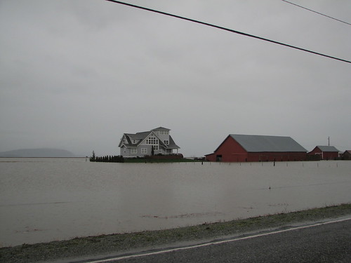
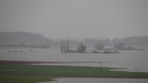
The Skagit Herald reported that the January 8, 2009 Samish River flood was the “worst in 25 years.” I was able to find several photos on Flickr from that event. These are by photographer Shamus McBride and are shots of the roads out to Samish Island.
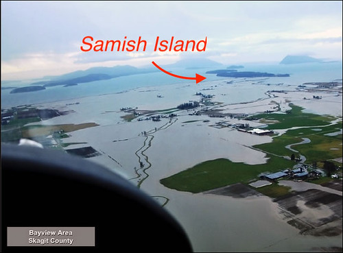
This shot from the Washington Department of Transportation shows our island completely isolated. I’ve labeled Samish Island in this shot.
NOAA has more information and photos from the 2009 flood on their Flood Safety website.
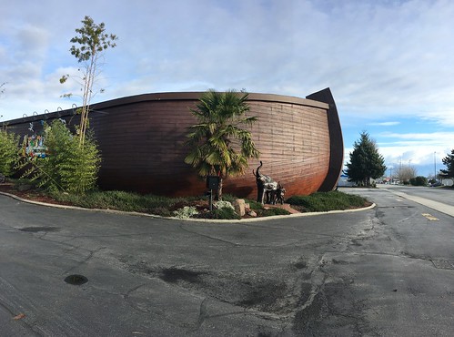
So, it seems that flooding is a natural way of life here in Skagit Valley. Sometimes it’s just the fields that flood, and sometimes it’s worse. Now I understand why one congregation in Burlington built their church building like this.