…and other towns that don’t start with “P”
Saturday morning my sister Glynda and I headed down to Prosperity to visit the parents. Mom and dad were in the mood to get out and explore. We decided to hit some of our favorite places – the communities just to the east of Prosperity. Even though I had visited these places with the parents, Glynda had never been out this way.
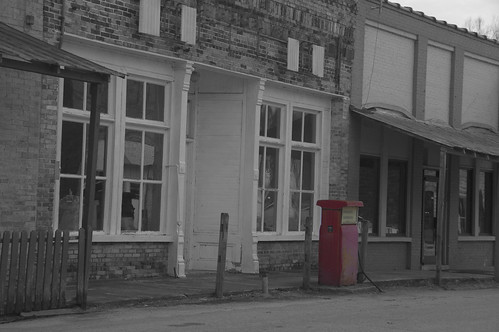
First stop, Pomaria. The central business district of this little place is pretty much a ghost town, although there is still a lively community surrounding it. We stopped on Main Street to take some shots.
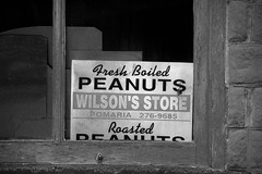
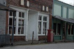
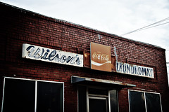
Interestingly enough, most of the businesses had the name “Wilson.”
From Pomaria we headed south to Peak. This has always been an intersting, somewhat isolated little community on the banks of the Broad River. I had always thought that the town got its name because of the hilly terrain, sort of like the nearby Little Mountain. However, it was named for the railroad superintendent of the time, Mr. H. T. Peake.
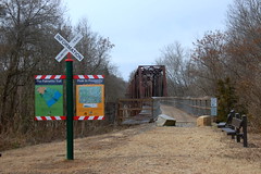
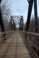
The main draw for Peak (apart from its quaintness) is access to the Palmetto Trail and the spectacular bridge that spans the Broad River. The town’s people initially rejected the plan, fearing strangers wandering through their town. I can only see this as a good thing for the community, as more people come to visit to see the bridge and the other railroad trestles that they are converting into footbridges.
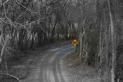
The best access to the Peak Bridge, however, is on the other side of the river, so that’s where we headed. The tiny road twists, then the pavement gives way to dirt. However, a very nice park and access area have been built on this side.
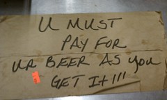
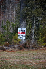
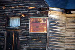
From Peak we continued east on Highway 213, stopping briefly in the town of Jenkinsville. The little quick shop at the corner of 213 and 215 seemed to be the local town gathering spot. However, it looks like they’ve had problems with people gathering a little too frequently.
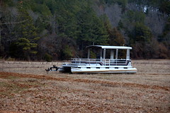
The old commerce center of Jenkinsville is actually 3 or 4 miles southwest of here, but another commerce center sprung up on the shores of the lake with bait and convenience shops. The “town hall”, if it can be called that, is located in the newer area.
We wandered through the countryside through some fairly desolate areas.
Eventually we reached the Anderson Mine where the Winnsboro Blue Granite is mined. I didn’t take any photos because I had done so before, but the area is fascinating. All of the houses and buildings in this area are built from the blue granite. Glynda said that it reminded her of a European community.
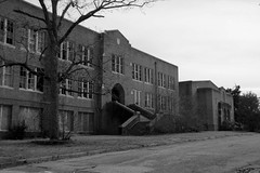
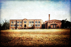
It was past noon at this point, and we were hungry. However, my GPS indicated that the only food around was about 8 miles away in Winnsboro, so we headed that direction. When we got there I ran into the same problem I had the last time I visited this place. The only places to eat were fast food joints. We road through the town, stopping for a moment to take pictures of the abandoned Winnsboro High School, but eventually wound up back on the town’s bypass at a McDonalds.
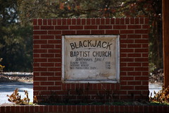
Overall Winnsboro strikes me a depressing place. All of the downtown business seemed to be closed down, and the places out on the bypass don’t seem to be faring much better. I was ready to head back. We had planned to take Highway 34 so that we could see some different country, but the route was blocked by a deputy sherrif’s car with lights flashing. Apparently there was a bad accident, so we headed back roughly the way we came. Of course, on the outskirts of town I had to stop by my favorite church sign at Blackjack Baptist Church.
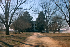
We quickly retraced our steps back down 213 to the 213-215 intersection. Here we turned north on 215 along the lake shore toward Monticello. Just south of Monticello is the impressive Davis Plantation, with a huge manor house and rolling pastures down to the lake shore. There were signs indicating that the house and 82 acres of land were for sale. If I won the lottery, I’d love to buy it. However, that’s the only way I think I could afford it. I’m sure some developer will snatch it up and chop it up into lakeside lots.
We stopped briefly at Monticello Methodist Church next door, then headed into the community where we paused at the General Mercantile.
By this time we were all getting tired, so we headed back south on 215, then took 213 west across the Broad River, and across I-26 to the town of Little Mountain, then headed back to Prosperity. It was a good day out.
View P Towns in a larger map
Every summer, various combinations of folks from our church drive up to Lake Monticello to go swimming at the “little lake” (north of the causeway). I always enjoy the drive through the countryside. I’ll have to check out the Davis plantation next time. (BTW: the sunfish in Lake Monticello always bite the daylights out of my legs. What’s up with that?)