Conditions were ideal for a photo trek. I had a day of vacation I needed to use before the madness of summer system installations started up. Laura had left town for a conference, so I was on my own. And I had gotten new information about an interesting place to visit. My main target for the day would be the old railroad trestle that crosses the Broad River near Peak, SC.
Jay Hope had e-mailed me earlier in the week with a link to a story in The State newspaper about completion of the aforementioned bridge and opening of a new section of the Palmetto Trail. Jay’s family has been working to restore the nearby Hope School, which is one of the historic Rosenwald schools. The trail passes through Jay’s family land and close to the school, and he knew that I had an in the area, so he tries to keep me informed. I followed up on his suggestion, and after getting Laura off to the airport, headed south.
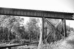
As usual with my photo treks, there are always a few distractions along the way. First there was breakfast at a smoke-filled Waffle House, then a detour through Taylors to try to catch morning fog over the Enoree River. I tried to take a few shots of the railroad trestle, but traffic on the narrow road was nightmarish. Lighting also was not ideal, so I didn’t get the shots I wanted.
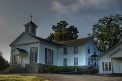
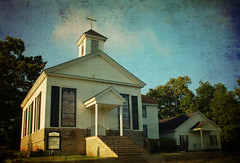
From Taylors I headed southish and connected with Batesville Road. Still wanting to use the morning light, I stopped at Ebenezer Methodist Church and took a few shots.
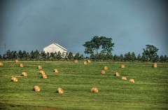
I continued on to Woodruff Road, and took a brief side trip into the community of Crescent. There is some beautiful farmland in this area. Much to my dismay, over development is rearing its ugly head even this far away from Greenville. However, there is still quite a bit of family-owned rolling pastures.
The problem with my photo treks is that often I’ll get distracted along the way and won’t make it to my target destination until much later than I’d like. I saw that this was a danger today. So I made my way back to the main road, and, much as I might not like it, I took I-26 straight down to Newberry County.
When I got to Peak I found it incredibly crowded. It was hard to figure out what was happening in this tiny little town. There was no where to park at all, and cars were waiting for parking spaces. I finally spotted that they were all going into the little medical clinic there. Many were stepping next door to the pharmacy. It was pretty amazing to see the amount of traffic. With all of the commotion, I couldn’t park and find the trailhead, so I decided to approach it from the other side of the river. I took Highway 215 east and crossed the Broad River.
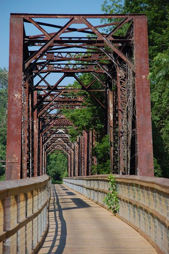
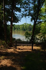
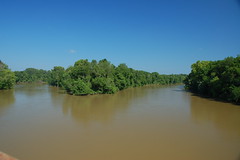
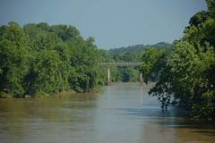
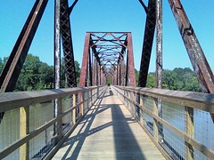
The access point for the new bridge is located in the community of Alston, a former railroad stop on the route from Columbia to Charlotte. A dirt road leads down to the bridge, and through farmland along the banks of the Broad. When I reached the bridge, I found it to be quite different from when I visited back with my parents last year. There were now two nicely developed parking areas – on below the bridge closer to river access, and one on a hill with easier access to the bridge itself. The area under the bridge had been replanted with grass, and park benches and picnic tables had been added.
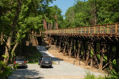
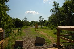
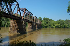
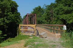
The bridge itself is an old steel girder railroad bridge. In order to make it suitable for foot traffic, a new wooden walkway was “inserted” into the frame, with safety rails and a nice wooden floor. The bridge is about 200 yards long, and crosses the river right below Hampton Island, with spectacular views of the river.

It must be noted that not all of the residents of Peak approve of the Rails to Trails plan. Some don’t like the idea of strangers being so close to their back yards and walking through their town. I think the opening of this new section will only bring positive results to this community. They now have a wonderful tourist attraction, and should capitalize on it.
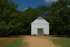
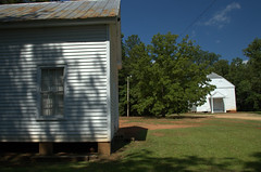
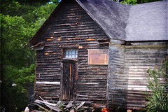
Since I was in the area, I decided to see how things were going with Jay’s project. I drove over to New Hope Road. First I stopped at St. John Lutheran, one of the oldest churches in the area. Across the street from the current church are two old white frame buildings. One I assume to be an old school, and the other is the old church.
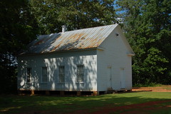
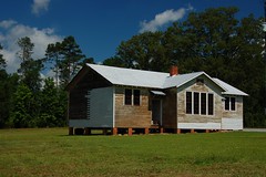
The Hope School itself looks like it’s still undergoing renovations. Even now I’m kicking myself for not just pulling in and walking into the building. Should anyone have asked, I could have invoked Jay’s name and things would have been fine. As it was, I just shot a couple of photos from the road.
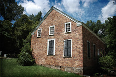
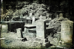
On my last trip through this area it was misty and threatening rain. Having reached my main objective, I decided to revisit some of those locations. My first stop was back at the old Brick Church, with its cemetery.
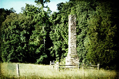
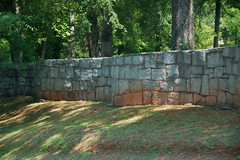
I also popped back by the Anderson Blue Granite Mine, then on up to Monticello…

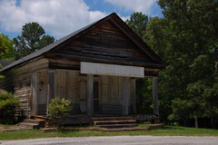
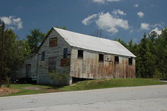
From Monticello I crossed the lake, then headed toward the town of Blair. The antique store in the old general store was open, so I went in and browsed through their extensive collection of artifacts. I also took a few shots from around the community.
I decided to check on a couple of my fire towers to see if there were any nearby. I was able to confirm that the Shelton Tower north of Blair is no longer standing. Leed Tower and and Kelly Tower were still standing.
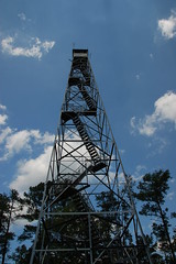
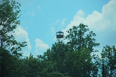
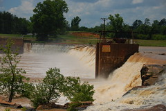
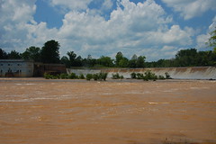
Leed Tower was actually in the Woods Ferry Recreational Area, which is part of the Sumter National Forest. I drove on into the area, and took a dirt road that led me to the Neal Shoals Dam. With all of the recent rain, the flow over the dam was nothing short of amazing.
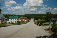
I continued north and reached the community of Lockhart. As in many of these southern towns, the textile mill is now gone, but the community remains. I had a late lunch at the Lockhart Cafe, then drove through the town taking a couple of photos.
By this time I was getting quite tired of traveling. I took the most direct path I could back toward home. As I drove, and amazing lenticular cloud formation loomed large in the western sky.

I grew up in fairfeild county Tom, Shelton to be exact. Now living in Maryland. Beautiful pictures, I know all these places well please post more I miss sc