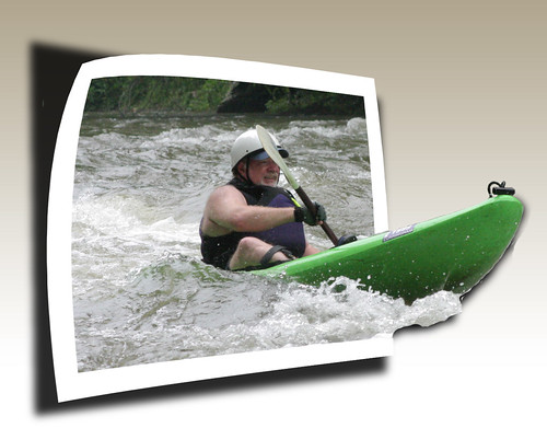
In case you haven’t noticed, I love to paddle. My preference is for moving water, but a nice flatwater paddle on a river or lake can be fun, too. I started this obsession when I was about fifteen, running the Enoree River with my high school buddies in an army surplus inflatable raft that had more patches than original material. College years were more adventurous trips in large whitewater rafts, or lazy floats in inner tubes. When I started teaching I could afford a cheap Coleman canoe (which I still have), and now I paddle a Perception Torrent sit-in-top whitewater kayak. This being said, I have now put together my paddling resume’ in Google Earth KMZ format.
This all got started as I was planning for our upcoming Edisto River run in a couple of weeks. On a whim, I did a search for Google Earth files that might show river routes, and came up with zilch. This seems like an obviously perfect use for Google Earth – showing the put-ins, take-outs, and important rapids along the way. I was already using Google Earth to scout rivers in advance, marking the locations of bridges, possible hazards and rapids, then uploading those into my GPS. Why had no one made this available online? The closest anyone has come to this is American Whitewater’s River Database, which includes Google Maps for the put-ins and take-outs, as well as user-submitted comments about the rivers. They do make this available in KML format, but it’s not as detailed as I would like.
The standard print references for rivers in our area are Carolina Whitewater by Bob and David Benner and Paddling South Carolina by Gene Able and Jack Horan. Also useful are Paddling Asheville by Betsy Mayers and Kayak Charleston by Ralph Earhart. I’ve got many other guide books, but these four cover most of the rivers I’m likely to run.
What I wanted to do was to take the information in these books and put it into KML format. That seemed a bit overly ambitious, since I’m not sure where the rapids actually are on the rivers I haven’t run. So, I decided to do just the rivers that I’ve run. I didn’t include any flatwater paddles. I’ve done many of those on lakes and rivers all the way from Florida to Washington State, including the Puget Sound, Lakes Jocassee, Hartwell, Keowee, Murray, and Greenwood, Lake Oolenoy, Charleston Harbor, Indian River, and our little local lakes. I just included river trips with a specific put-in and take-out. There are a couple of omissions, such as the Yadkin River in North Carolina, which were done so long ago that I can’t even remember where we put in.
To me, my resume’ looks rather paltry – just eleven rivers. However this includes different sections on these rivers, and some I’ve run many, many times. So, without further ado, here’s my paddling resume’ in interative Google Earth format…
[tags]paddling, kayaking, rivers, KML, KMZ Google Earth, whitewater[/tags]
