Saturday Laura had to meet with new advisees at Furman, so Alan and I decided to do some paddling. We wanted to find a place that was fairly close to Greenville, and that we hadn’t paddled before. I’ve had my eye on Parr Shoals, just east of Prosperity, for some time now and that’s where we decided to go.
Parr Shoals is on the Broad River, and is just north of where we put in on our marathon paddle from Peak to Harbison State Forest. Parr Shoals, along with its sister reservoir, Monticello, are often overlooked. While Parr Shoals is fed by the Broad River, water is pumped from the river into Monticello, then returned to Parr Shoals via tailrace. Both reservoirs serve as impoundments for the V. C. Summer nuclear power plant, one of the first nuclear power plants in the Southeast. Construction is currently underway for additional reactors.
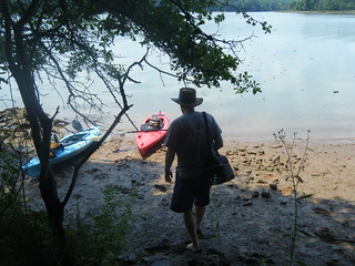
We were joined by Alan’s son, Joshua, a recent Furman graduate himself. We met early Saturday and Alan and Josh followed me down I-26 to the Pomaria exit, then on across country to the Cannon Creek Landing on Parr Shoals.
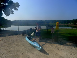
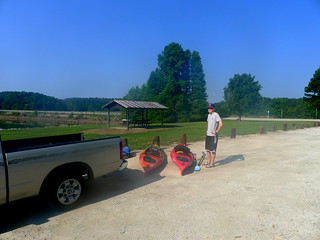
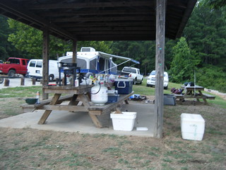
The landing was hopping. There were already several boat trailers parked, and a couple of boats were arriving at the ramp as we were getting ready to launch. A pop-up camper was parked right next to a picnic shelter, probably where it shouldn’t have been. The occupants were just getting up and getting started on the day.
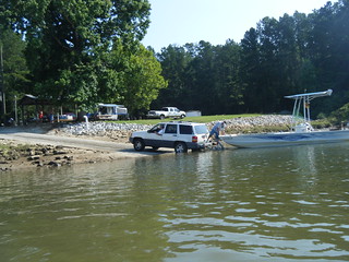
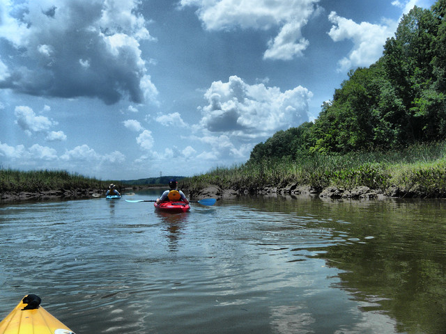
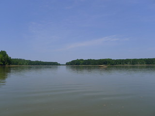
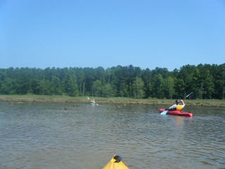
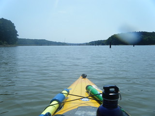
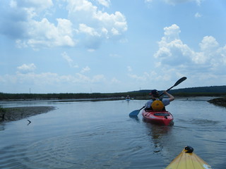
We launched and headed toward the Broad River Road Bridge. The plan was first explore the Cannon Creek Branch, then paddle back out to the main body on the Broad River.
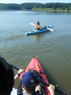
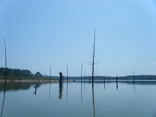
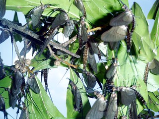
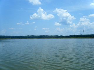
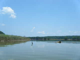
Out on the water it was blazing hot. It also looked like the water was quite a bit lower than normal. Not only was it lower, but it was muddy and full of the skeletal remains of some weird insects. Alan and Josh first thought that these were the bones of fish. The Swimming Advisory sign at the landing didn’t help allay those fears. We paddled on, though.
We saw quite a few herons and some turtles out on the lake. There were a few cattle egrets off to the north. Other wildlife appeared to be keeping out of the sun.
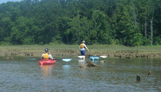
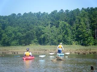
After a couple of miles of paddling we got to where we thought Cannon Creek should be entering the lake. We were hoping to paddling on up the creek a bit, also hoping that a narrower channel might mean some welcome shade. However, a weird optical illusion obscured the creek entrance. Even though we were right on top of it, we couldn’t spot the channel.
Eventually we did find it, but getting there was next to impossible. The short tree stumps clearly visible should have been a dead give-away. We quickly ran out of water, and found ourselves grounded in the mud. No amount of rocking could free us. Alan attempted a portage, but it looked like the effort was futile.
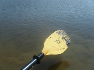
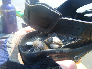
We turned back, but I found myself just as stuck. I had to get out and pull my boat, my feet sinking up to my shins in the thick mud. My boat and paddle was covered in mud (as was I), and when I pulled my feet back into the boat my sandals were full of shells. The mud completely pulled the soles off the bottom of my sandals, ruining them.
We made it back to water where we could paddle normally, but by this time we were hot, muddy, and miserable. It was only 11:00 and I was exhausted.
Perhaps it was the heat. Perhaps it was exhaustion. Regardless, I had several encounters with F. O. U. S.’s (cue Princess Bride reference.) I saw several flashes of silver from what looked like enormous fish, nearly 3 ft or longer. These would occasional splash and jump. One nearly gave me a heart attack when it splashed and hit the bottom of my kayak. These FOUSs spawned jokes about mutants from the nearby nuclear plant. Of course, I never had a camera ready when one of these fish jumped.
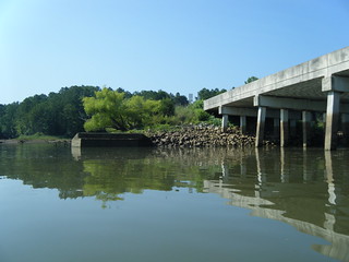
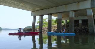
We paddled back downstream, pausing for awhile in the shade of the Broad River Road Bridge.
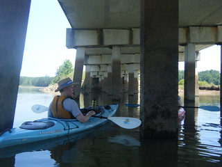
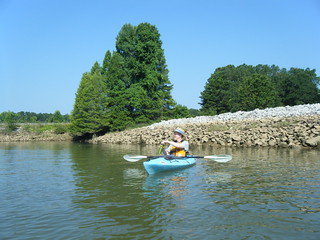
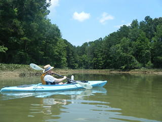
Having rested a bit, we decided to try to make it on out to the Broad River. The water was still shallow, but navigable. We clung to the northern bank of the creek. Large cranes from the construction site at the nuclear plant loomed on the horizon.
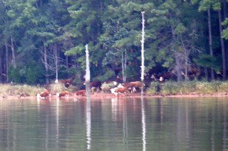
As we continued along we saw one osprey and one bald eagle. The north bank appeared to have a clearing, and turned out to be a pasture. A herd of cows were making their way down to the lake.
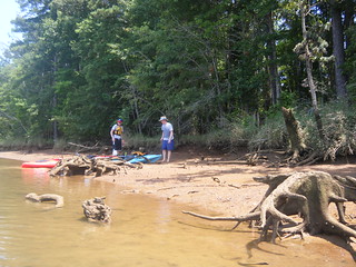
Even though it was earlier than we normally eat, we started looking for a place for lunch. The muddy banks made everything look uninviting, and I wasn’t sure that even the “3 Minute Rule” would apply. (There’s always a better lunch spot 3 minutes downstream from where you stopped.) We finally decided upon a point right at the confluence with the Broad River, near the cattle.
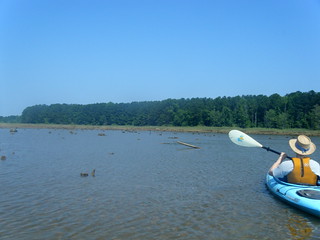
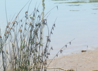
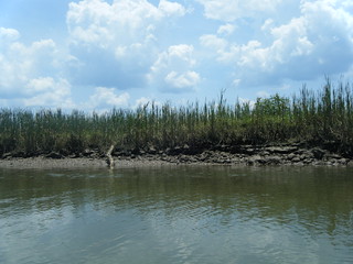
The landing was still very muddy, and our feet sank deeply as we made our way to drier ground. To make matters worse, the flying insects whose skeletal remains we had seen upcreek were all hanging out here. Disturbing them created a plaguing swarm of Biblical proportions. The bushes were covered with them. These appeared to be leaves, but were actually the wings of the insects.
Lunch under the shade of trees was a nice respite, despite the insects. They had settled down once we stopped moving. Alan had brought fresh cold peaches, which made things even better.
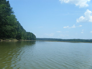
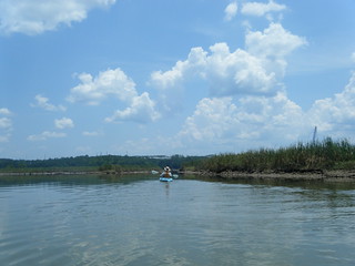
After lunch we launched again, and headed toward the Broad. At this point we weren’t sure where we needed to be. There was a marshy ridge and we could hear boats on the other side. We weren’t sure if we needed to paddle toward to the dam then back upstream to get to the main channel or not. That seemed like a long way, so we just turned north along the wooded bank.
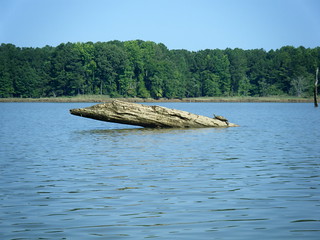
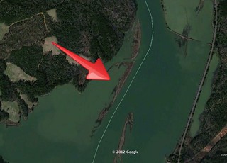
I had seen in Google Earth that there were several ridges lining the main river channel. I wasn’t sure what these would look like when we actually got there. The low water made the ridges stand out more than they do in this Google Earth image.
With the low water we felt like we were paddling through salt marshes at low tide. We eventually did find a route through the marshes and out onto the main channel.
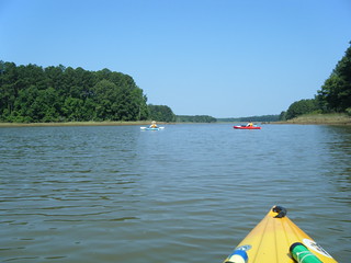
We paddled along the open water for a bit. I spotted a train trestle about a mile upstream and decided that might make a good endpoint for a paddle, so we headed that way. The water was calm and flat, so we were making good time.
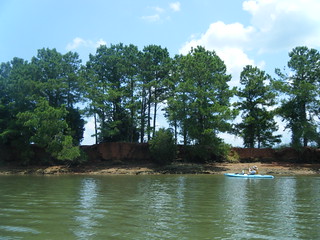
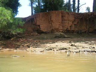
We spotted another ridge on the other side of the lake and decided to cross over. From a distance it almost looked like a brick wall. However, closer inspection revealed it to be eroded red mud.
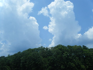
By this time I was more than exhausted. My head was pounding from the heat, and that railroad trestle didn’t look like it was getting any closer. Furthermore, angry clouds had popped up, and were threatening storms. We decided to head back.
We took another route into the “marshes.” The route was a bit narrower, but was still navigable.

The trip back to the landing went fairly quickly. The landing had picked up even more traffic, as boats launched and returned. We waited a bit for a couple of them before coming in.
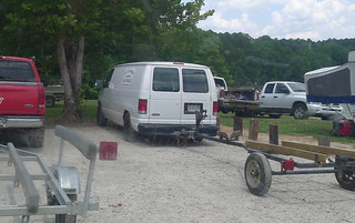
Of course, we weren’t done, yet. As I was loading the boats into my truck, somehow I managed to lock my keys in it. After several fruitless attempts to get into the back sliding window, I looked over and spotted a fisherman near the picnic shelter. I asked if he had a coat hanger, and his reply was, “Apparently you haven’t seen the side of my van.” The side of his van read “A-1 Locksmith.” He had us in the truck in no time flat. My reply to Alan was that it was “clean living.”
Loaded up for departure, we drove north on Broad River Road to Heller’s Creek, where there was another boat ramp. This area looked more sheltered than the previous one, and there were two kayaks down by the water. I don’t know if this would have been a better launch site or not. We may have to try again.
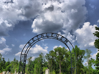
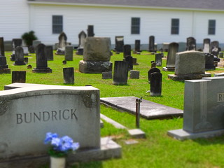
On the way back out we passed by Bethlehem Lutheran Church, established in the late 1700’s. We had to stop and take a couple of photographs of the old church and its cemetery.
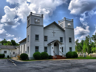
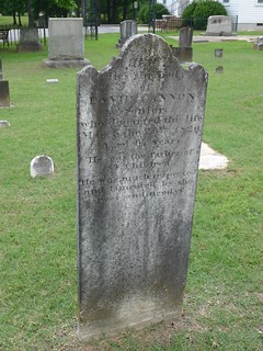
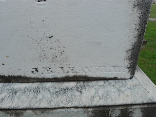
There were several classic slab headstones and some common funerary art, including one signed headstone by J. Leavell…
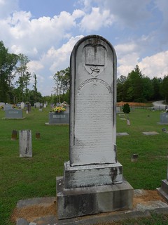
…and some not-so-common art, such as this guy who obviously loved his tractor…
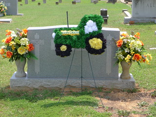
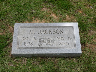
It was an interesting mix of old and new. It was obvious that this cemetery still has regular plantings.
…but back to the kayaking…
In all, we paddled about 7 miles. That’s surprising because I didn’t think we had gone that far. As a paddle venue it wasn’t one of my favorites. The mud and heat were a bit overwhelming, and the scenery was so-so. However, I’d like to come back and focus on the main river channel, preferably on a cooler day. Here’s the map of our travels…

…as well as the rest of the photos from the trip…
Alan’s photos can be seen here…
I’ve looked at this reservoir on GoogleEarth for a while, and got the impression that it’s very badly silted. Looks like it’s storage capacity is badly compromised by this.