Last week I was going to write a post about the new imagery for the city of Greenville in Google Earth. Things got busy over the weekend, and I had to delay writing about it. In the meantime, I learned that Google Earth was releasing version 4.3 this week, so I decided to hold off so that I could write about both of them.
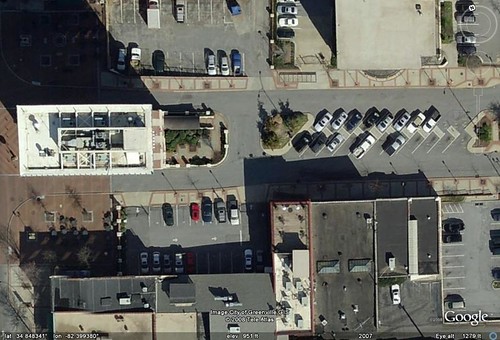
First the imagery for Greenville. I was blown away by the level of detail, as can be seen in the view of the Court Street area in downtown Greenville. In the larger view, you can make out the types of automobiles parked there and see other amazing details. Here’s a view of our house with the new imagery.
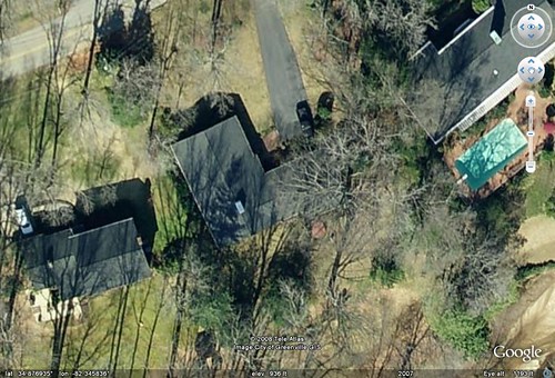
You can clearly see my pickup truck in the driveway and even make out the hot tub in the back yard. It’s a very good thing that our neighbors weren’t skinny-dipping in their pool, because you can see it very clearly, as well.
These images were obtained by Google from the City of Greenville GIS offices. The images were taken sometime in the winter of 2007. I’m guessing that it was early February, because the leaves are off the trees and the lake had been lowered for maintenance. Also, the houses in the flood plain that were removed are still there, as are the streets that run through that area.
This level of detail isn’t available outside of Greenville. While still impressive, the rest of the county and the Upstate aren’t anything like this. The thing is, I haven’t seen any other city in South Carolina with this much detail. I’ve come across one other region near Jackson, Mississippi, but haven’t really looked anywhere else.
As for the new version of Google Earth, it looks very, very slick. There is a new navigation console which will take some getting used to. It’s fairly straightforward, but I wish it still had the feature to click to set the default view to overhead. As you zoom in close, the system automatically tilts your view.
GE 4.3 has added a day/night viewer as a tool icon. By clicking this icon, you will see the area shaded according to the amount of daylight. A slider bar also appears that will let you move back and forth over a 24 hour period from the user’s current time. This would be great for teaching concepts of time zones to students.
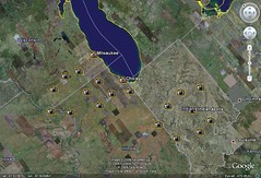
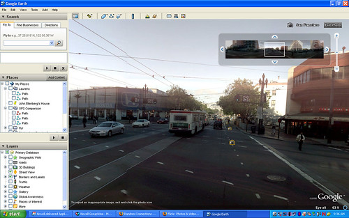
Probably the most impressive addition to version 4.3 is the incorporation of Street View into the GE engine. This appears as a new content layer. If you zoom out so that you can see the entire United States, you will see camera icons on the cities that have Street View images available. As you zoom closer to these cities, the number of camera icons increase until you get to the street level, where you will see a row of images all along the street, as seen in the images from the Chicago area below:
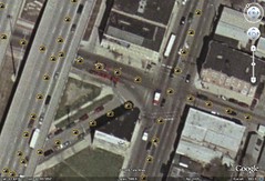
If you double click on one of these icons it will take you into a spherical realm created by the image. You can then navigate around the images with the same level of detail that is available in the Google Maps version of Street View. Here’s a generic view from San Francisco:
Unfortunately, the timing of this new release couldn’t be worse. Next week I’m scheduled to conduct a series of workshops on Google Earth for SCETV. Now I’ve got to go back and redo ALL of my handouts.
[tags]Google Earth, Google Maps, Street View[/tags]