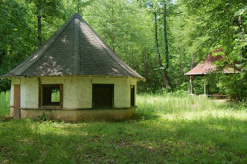
Photo by Flickr photographer markemark4
I have yet another location-based obsession, possibly even several more. First it was fire towers, then old schools, and lately it’s been ghost towns. You would think I’d have enough abandoned historic stuff to go traipsing about the countryside to photograph and document. But wait! There’s still more!
While visiting Laurens County recently we stopped by Stomp Springs, and this past weekend we found the Shivar Springs bottling cisterns near Shelton in Fairfield County. That got me thinking about mineral springs, and where these might be located.
A 2004 Department of Natural Resources report by H. Lee Mitchell (PDF) gives some of the background of the springs and their locations. The report mentions the historical significance of springs, as well as the development of resorts and bottling facilities. These dot the state, but most are located inland of the Fall Line, as indicated by the map in the report (which I’ve imported into Google Earth as an overlay.)
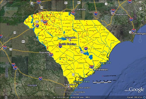
Springs can be found pretty much everywhere in the state. According to the GNIS data there are no less than 228 place names in South Carolina with the word “spring” or “springs” in them. This next graph shows a heat distribution of those names. Red indicates a higher concentration.

In order to pare this down a bit, I think I would concentrate on either mineral springs resorts or mineral springs bottling plants. Several come to mind immediately – Chick Springs, Glenn Springs, Harris Springs, Stomp Springs, and others. These were popular up until about the time of the Great Depression, and before the purported medicinal benefits were really studied. The rare bottles from these springs have become collectors items, but in most cases there is nothing left of the resorts but an occasional spring house, as seen at the top of this post.
Other ideas for map-related obsessions might include the following:
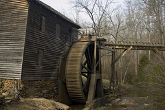
- Historic Mills – such as Hagood Mill, Gilreath Mill, and Edwards Mill.
- Railroad Depots – I’ve found and photographed several of these already, some of which are no longer standing
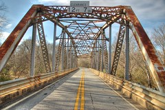
- Steel Girder Bridges – there is something elegant about the old steel trusses

Should I desire to chase these phantoms, I’ve got a new tool at my disposal. I spoken before of the GNIS data and how useful it is for these searches. The problem is that their search interface is a bit unwieldy (IMHO). So, I had downloaded the data for South Carolina and created my own searchable database of place names. It has direct links to Google Maps, and will even generate a KML file from selected data. Unfortunately, it also puts a hefty load on my service provider’s servers, and I’ve had it crash and burn several times when the search results returned a large number of hits – something about it not liking too many recursive ASP scripts.
Enter Google Fusion Tables. This does everything my old placenames database did, and then some. However, I did have to prepare the data ahead of time.
First I downloaded a fresh set of the GNIS data for the state. I also found an auxiliary table that has descriptive and historic data for some of the locations. I imported everything into MS-Access, then ran a query that merged the auxiliary table with the state data, and also generated a lat-long coordinate and html link to a Google Map. That data was then cleaned up a bit more to removed anything with missing coordinates, then extracted as a CSV file. I imported the CSV data into Fusion Tables, and I was ready to rock and roll.
The imported data can be viewed as a table…
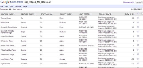
If there are fields that contain geographic data, such as lat-long coordinates or a place name, you can hover over a cell and a little globe icon will appear.
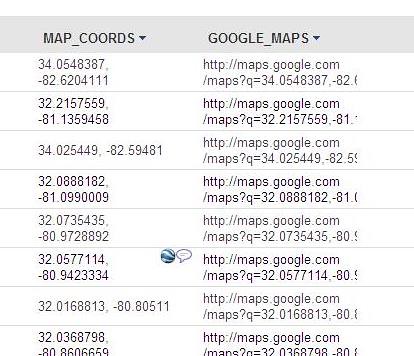
Clicking on that globe will bring up a map showing the location.

Fusion Tables provides multiple ways to view the data, including bar graphs, pie charts, and intensity graphs. Of course, what WE want to see is the data plotted on a map…
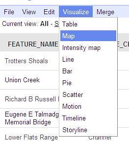
Selecting Map from the Visualize menu brings up a Google Map. You can select the field that contains the actual coordinate data.
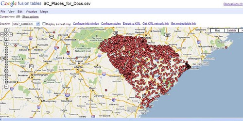
Clicking on any of the points will bring up information that includes data in the other fields.
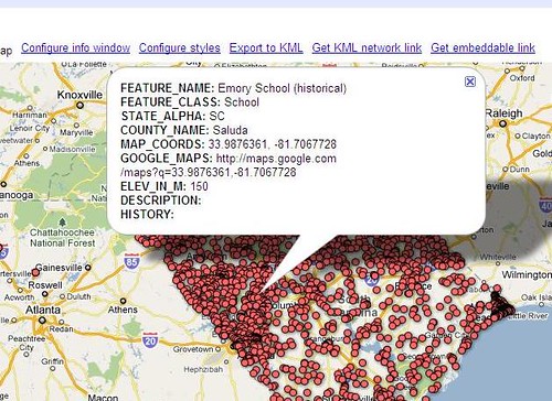
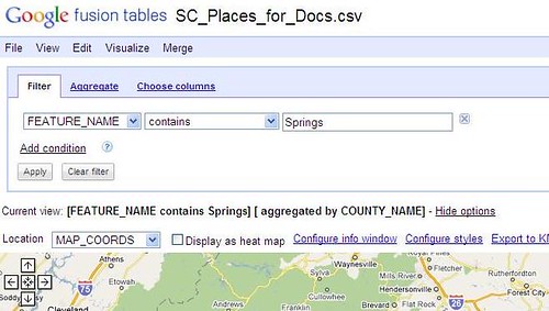
If you don’t want to view all of the data, there is a way to filter it. You can query any field using any common operator (=, not =, <, >, contains, etc). In the example below I’ve queried the Feature Name field for any place name containing the word “Springs.”
You can export any of this data as a Google Earth KML file. The placemarks would contain the same information found in the table’s fields.
One of the coolest things, however, is the ability to embed Fusion Table maps, just as you would a Google Map. Here’s a map of those locations with the word “Springs” in the place name…
So, I can get Fusion Tables to do everything my old SC Placenames application did, plus some. There’s also the added benefit that it won’t crash my servers. With all that at my disposal, who knows what other geographical obsession I’ll be able to find!