For our last full day in the Bahamas I had booked a kayaking tour and trip to the Lucayan National Park. Laura had been fighting a bad cough all week and didn’t feel like going, so I was on my own. After watching another stunning Bahamian sunrise, I began gathering my gear and headed down to meet the group.
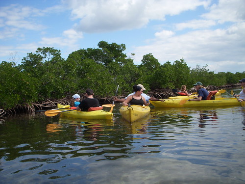
I was the only one from our resort going on the tour, but there were nine others that had already been picked up, and we stopped for four more on the way out. Along with our guide, we had a party of fifteen.
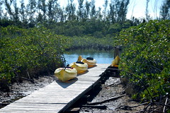
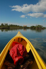
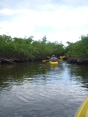
We drove to the entrance of Lucayan National Park and disembarked. Since I was the only one by myself I got my own kayak. Everyone else was paired up with someone in the tandem boats we were paddling. That was fine with me. I did have to laugh that the boats we were using were Perception Jocassee kayaks – a boat build less than 30 miles from my home and named for a lake about 60 miles away.
We set out on Gold Rock Creek, paddling through mostly mangroves. Along some stretches the passagway narrowed such that we actually separated our paddles so that we could continue to paddle through the dense undergrowth.
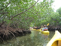
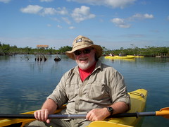
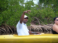
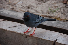
Along the way our guide, Chad, told us about the the history and nature of the area. A group like this tends to make too much noise to see wildlife, but I did manage to spot a couple of crowned herons and one prothonotary warbler.
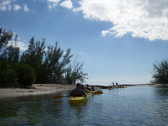
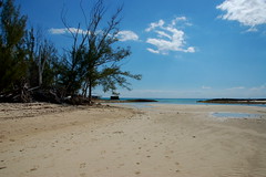
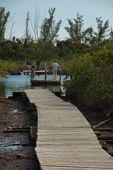
The paddling trip was fairly short, and after an hour and a half we found ourselves at the takeout, where Gold Rock Creek empties into the ocean.
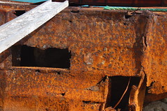
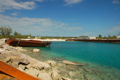
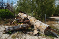
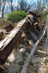
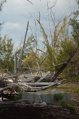
As it turns out, we were at the place where Disney’s “Pirates of the Caribbean” was filmed. We were told we could explore the area until the shuttle van came to pick us up. Most of what’s left there is rusted and abandoned. I was able to find the rusted hull that had been one of the ships and the remains of a mast. The mast was a steel beam surrounded with wooden strips to make it look like a solid wood piece. Other than that and the general remote surroundings, it looked nothing like the movie.
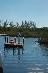
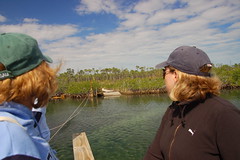
The van took us back to the entrance of Lucayan National Park where we followed the same boardwalk down to where we had launched the kayaks. This time, however, we boarded a rickity wooden raft to ferry across the creek. The ferry was pulled across the creek with a rope. One of our group managed to lose his footing and fall into the creek as he tried to board. I think the kayaks would have been safer.
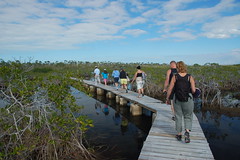
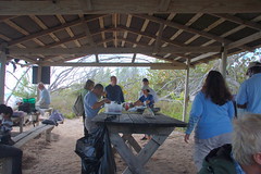
Somehow we all managed to get across the creek with no one else taking a dip. We followed another boardwalk until we came to a picnic area on Gold Rock Beach. Other tour groups had also gathered there, so in addition to our kayaking group there was jeep tour group and a general tour group.
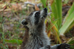
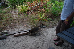
Our lunch was light sandwiches shared with begging critters – birds and raccoons. There are no rabies on the island, so a closely approaching raccoon doesn’t mean the animal is sick as in the US. The tour leaders tossed food out to the beasts who eagerly come up expecting more.
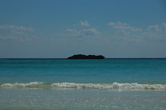
We had about an hour and a half to explore the beach area. The Gold Rock Beach is named for a coral island about 300 yards out from the beach. The area has historical significance, first as home of the Lucayan Indians, and more recently as the home of Gold Rock Missle Base, which serve both as a deterrent to the Cuban missles and as a recovery point for the capsules of the Mercury Space Program.
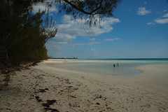
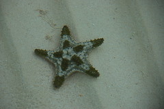
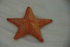
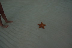
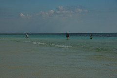
The beach was wide, isolated, and absolutely stunning. The tide was out, so tidal pools had formed with sea stars and other creatures. I waded into the pools and on out into the warm ocean waters.
I could have stayed at this beach all afternoon, but we still had more to see. I noticed that it was already long past the time I’d told Laura we would return. We were certainly on “island time.” We retraced our route back to the boardwalks and rickity ferry, back to the entrance of the Lucayan National Park.
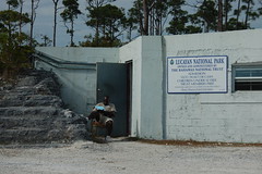
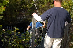
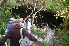
In addition to the pristine beach and Gold Rock Creek area, the main attraction of Lucayan National Park is the extensive cave system. Grand Bahama Island is mostly coral deposits, so limestone caverns riddle the area. Since the island is so flat almost all of these caverns are underwater. We would only be allowed into the entrances where there were boardwalks.
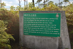
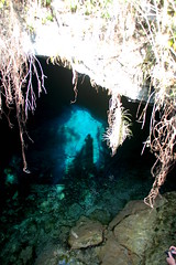
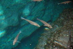
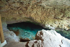
Our first stop was Ben’s Cave, named for one of the first guides who led scuba groups into the caverns. A spiral staircase led into the hole, which held some of the bluest water I have ever seen. Fish swam in the filtered sunlight. It was very tempting to jump into the cool waters, but I resisted.
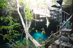
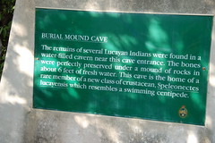
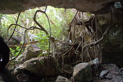
The next cave was Burial Mound Cavern, just a few yards away. It is so named because of Lucayan Indian remains found in the cavern, then only such remains ever found. The cave is actually part of the same cavern system as Ben’s Cave – just a different entrance. In this case a large hardwood tree provided a way into the cave before the stairs were built as part of the park.
The cave exploration wrapped up our trip. We loaded back up into the van and one by one were dropped off at our various hotels. I had thought we would be back around 2:00, but it was well after 4:00 when I left our guide. It was a good trip, but I was exhausted.