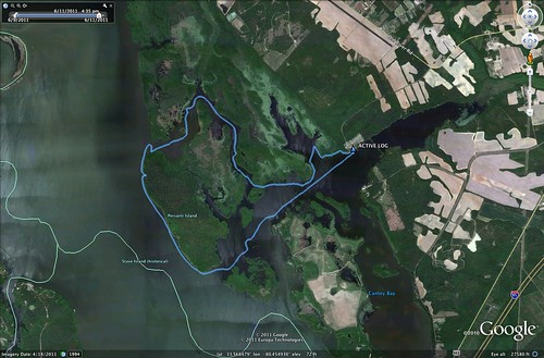
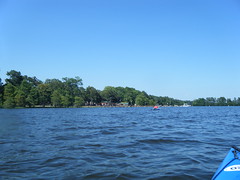
Another second Saturday, and it was time for another epic paddling trip with Lowcountry Unfiltered. This one was truly epic. This time our explorations took us to the eastern part of Lake Marion to do some geocaching around Persanti Island.
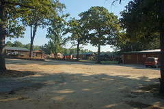
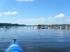
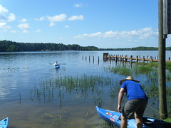
Our launching point was Carolina King Landing, just north of the Santee National Wildlife Refuge. It’s a private landing with cabins for rent, and was quite the happening place when I arrived. It turns out that this was the day for the Sparkleberry Poker Run up at the north end of the lake. Lots of camouflaged boats were getting ready for departure.
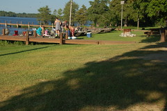
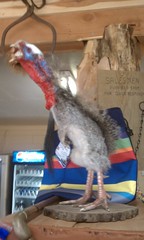
Alan arrived, and we entertained ourselves with Cokes, Moon Pies, and conversation with the proprietors of the local shop. These turned out to be very nice folks, and were very helpful suggesting parking and launch spots for the boats. They also had some interesting taxidermy.
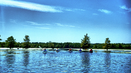
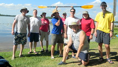
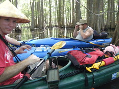
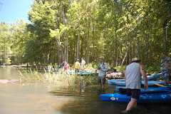
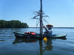
The rest of our Lowcountry friends eventually showed up, and we got the show underway. Of course, we did have to pause for our group shot prior to launch.
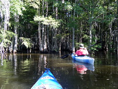
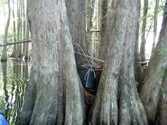
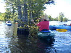
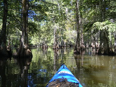
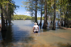
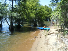
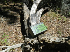
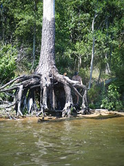
Our first target was a geocache right around the corner from the landing. To reach this one we paddled into dense cypress trees reminiscent of Sparkleberry Swamp. The cache was a full-sized ammo box wedged into a cluster of cypress. We all crowded around the admire the swag and sign the log book.
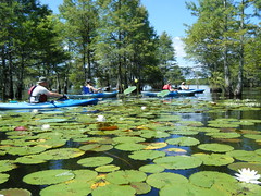
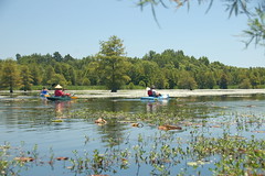
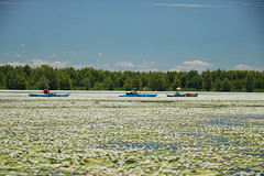
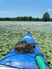
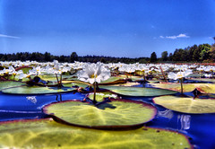
Right away we ran into the water lillies and lilly pads. There seemed to be three main types. There were large pads and huge yellow flowers with an unusual seed pod…
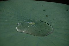

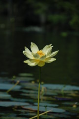
…smaller pads and white lotus-like flowers…
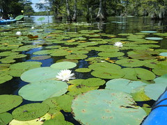
…and an even smaller flower that tended to carpet the waterway.
These were often found together in combination. We felt as if we were paddling through a garden.
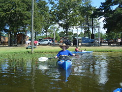
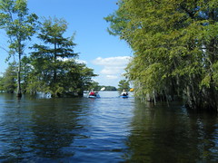
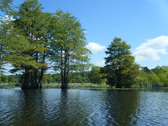
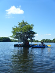
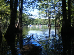
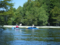
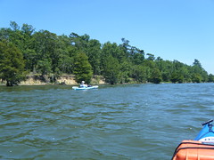
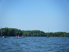
We stuck to the edges of the water, moving from one geocache location to another. We found two more in fairly quick succession – another full-sized on solid land, and a small tube attached to a tree out in the water. The paddling route was a combination of open water and cypress forests.
We cut north looking for a cache called “Cypress Tunnel.” It was aptly named, but we weren’t able to find it. We searched and searched, but to no avail. It turns out that this narrow path was a shortcut for fishing boats to the channel that circles Persanti Island. As we were searching for the cache we were quite surprised to a large pontoon boat come through there.
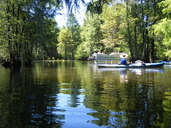
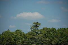
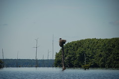
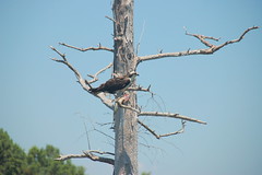
The path opened onto a wider channel. Osprey nests dotted our route, and various types of herons and other birds kept us company along the way.
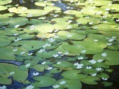
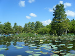
We had one more missed geocache after the Cypress Tunnel, but did find a couple more after that. One of these was the aptly named Lilly Pad Lake. As we paddled along we would look off at what appeared to be white beaches. It turned out these were the smaller white flowers we had seen earlier, covering the ground.
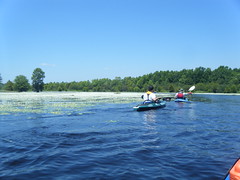
As we got deeper into the lilly pad lake, the channel got narrower and the pads thicker. We found the cache, but I had a hard time pushing through the vegetation to rejoin the rest of the group. Out in the pads there was a chorus of frogs, even in broad daylight.
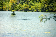
Eventually we rounded the north end of the island and pulled into a sheltered area for lunch. There were excellent sandwiches prepared by Matt’s wife, Cris, accompanied by sweet tea and microbrews. We watched a large alligator circle not too far away, probably wondering how he could get into the action.
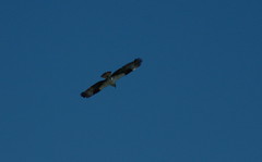
As we pulled away after lunch, we were treated to another sight. A large osprey landed nearby and began feasting on a fish he caught. We were able to get fairly close.
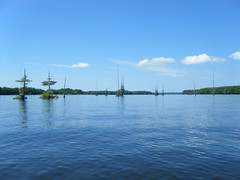
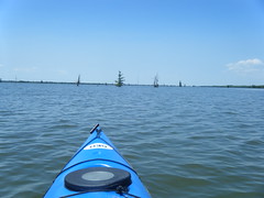
Paddling the western side of the island was totally different from the sheltered cypress forests and lilly lakes. There were scraggly trees, and the headwind had brought up a bit of chop to the water.


We pulled up to find one more geocache – another full-sized one on shore…

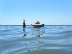
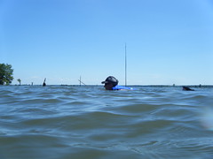
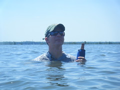
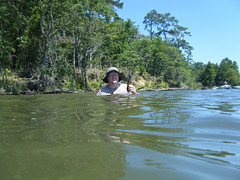
…then we paused further down to kick back and do a bit of swimming.
We continued on along the shore, skipping several geocaches. I think the muggle paddlers amongst us were getting tired of searching for these. We decided that we could leave a few to find the next time around. We continued on down the western side of the island.
When we rounded the southern end of the island our group broke in two. Most of the group stayed to the north side of the channel, but Matt and I went searching for one last geocache. Two bald eagles circled overhead, being chased by another osprey. The guys that didn’t find the geocache instead found an osprey nest with young, and were able to get some great shots.
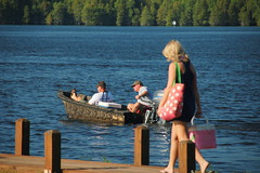
The duck boats were arriving back at the marina after their poker run at about the same time we were. A little bit of wake made the paddling interesting, but soon we reached the landing and were hauling the boats on in.

We decided that this one was a keeper. The wildlife was spectacular, and the scenery nothing short of stunning. It seems we had picked the perfect time to paddle. To be sure, it was hot, but the riot of water lillies made it worthwhile. I’m pretty sure we will be back.
For more photos, here is my entire Flickr set from that trip. I took too many photos to post here. Also, be sure to check out John Ring’s Flickr set and Alan Russell’s Flickr set.