So far I’d had a great day out exploring. I had an interesting visit at the Old Santee Canal Park, and the next day I’d be paddling part of the canal from Lake Moultrie. Now, however, the afternoon sun was sinking and I had to get to my night’s lodgings. Along that route I found some more cool bits of history.
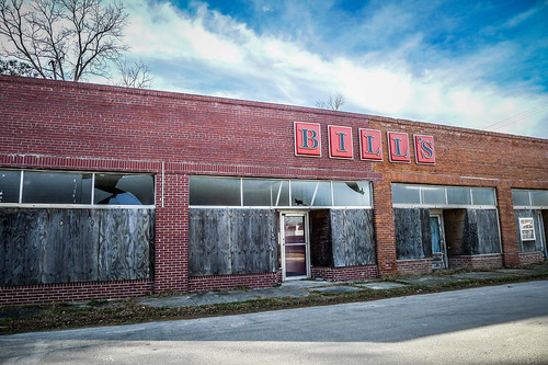
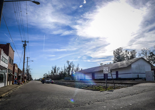
I left the park and headed east on Highway 52, planning to head around Lake Moultrie on the east side of the lake. I passed several brown signs pointing out lake access. At some later point I’d need to check these out. I passed through the community of Bonneau, then arrived in the town of Saint Stephen. The first thing that caught my eye was the old depot, which looked like it was still in use as a warehouse. Across from it was a defunct store called Bill’s.

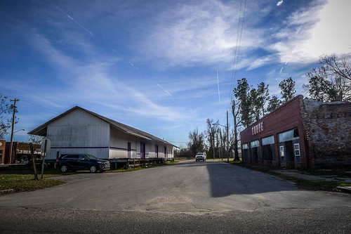
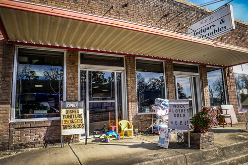
The main street consisted of abandoned buildings interspersed with second-hand shops and storefront churches.
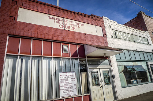
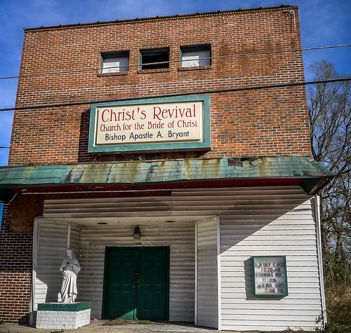
These just reinforced my observation that the length of the name of the church is inversely proportional to the size of the congregation. The corollary is that the honorific for the clergy is also inversely proportional to the size of the congregation. On of these had a pastor, overseer, and apostle. Christ’s Revival Church for the Bride of Christ had a “Bishop Apostle.”
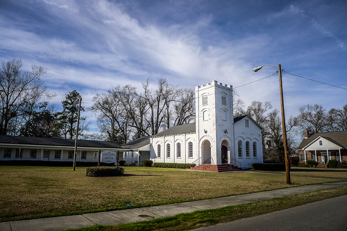
There were some more traditional churches, such as the First Baptist. There were several where I might liked to have explored the cemeteries if I’d had the time.
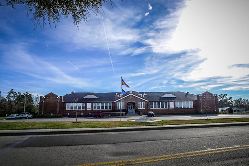
I did notice an old elementary school now in use as town offices.
From Saint Stephen I crossed the re-diversion canal, which was built to put water BACK into the Santee River. Then I took Highway 45 back westward to complete the loop around Lake Moultrie. I hadn’t gone very far when I saw a sign for the Pineville Historic District. I decided I needed to check it out.
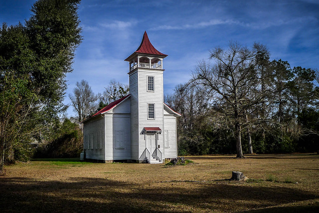
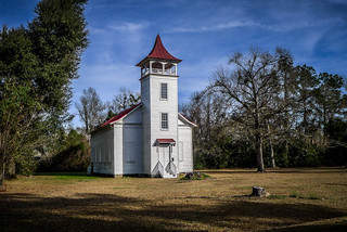
The Pineville Episcopal Chapel was a photogenic little church just off of 45. I paused for a couple of photos until a local resident started eyeing me as if I were going to cause trouble.

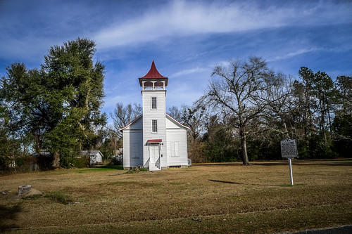
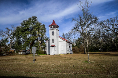
This was a chapel-of-ease for the Pineville community. Pineville was established to provide relief from the heat of Charleston. It was thought living among pines was somehow beneficial. Pinopolis is another example of such a community among the pines. According to the Historical Marker Database…
In the mid to late nineteenth century, Pineville was a densely-settled village that included as many as one hundred buildings, including an academy, racetrack, library, churches, and residences. Much of the town was burned by Union troops at the close of the Civil War in April 1865. In the years following the war, much of the land that made up the village was converted for use as farmland. Since that time, Pineville has remained a small community of less than twenty structures surrounded by open farm and hunting lands.
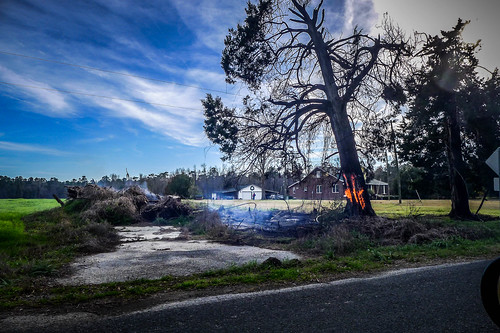
The community is on the National Register of Historic Places. However, the chapel was the only evidence I saw of the community. I drove on past and around a circle of farmland and mostly mobile homes. I did spot a burning tree, perhaps from a brush fire that kind of got out of control.
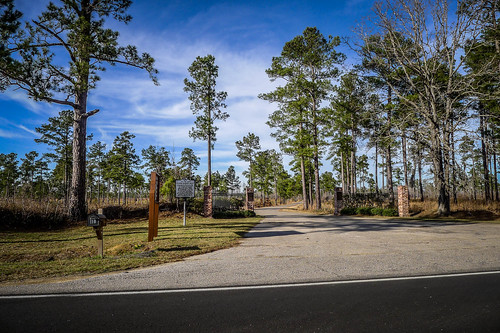
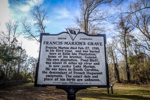
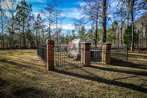
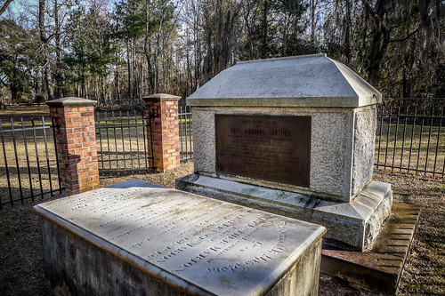
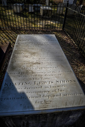
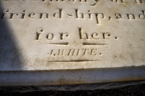
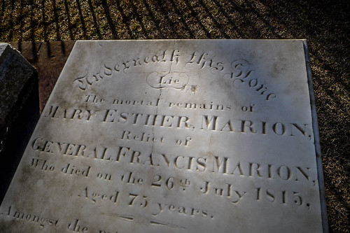
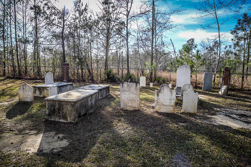
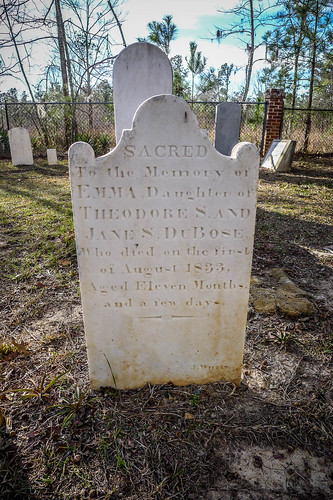
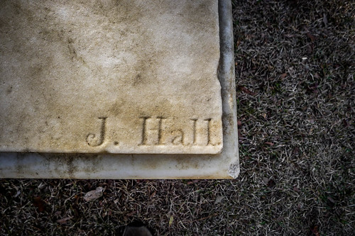
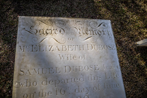
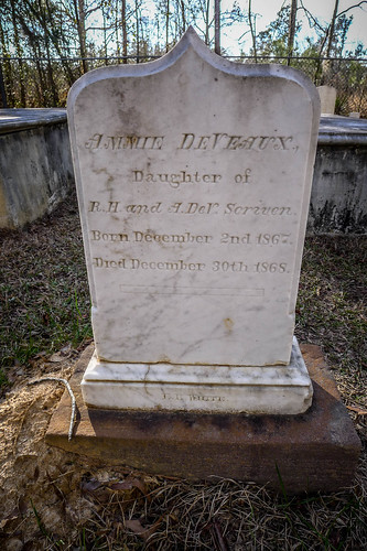
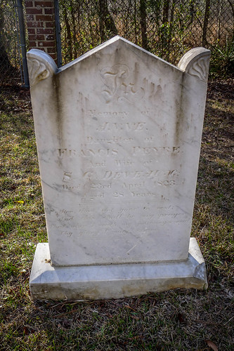
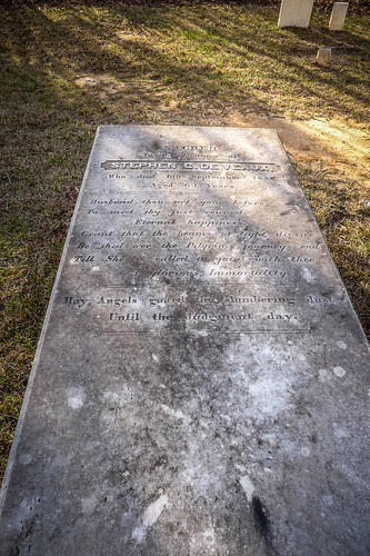
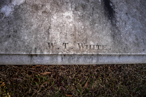
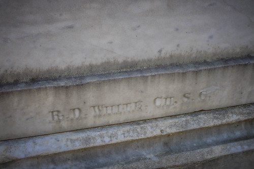
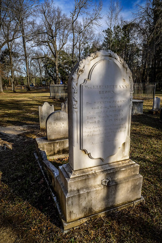
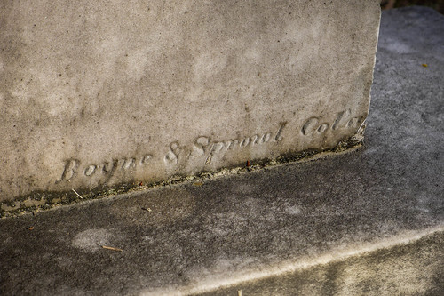
A few miles from Pineville I spotted a set of gates to the north. I had reached Belle Isle, the final resting place of Francis Marion. Belle Isle was Marion’s brother’s plantation. Francis Marion’s home was at Pond Bluff, now under the waters of the lake that bears his name. I drove down the half-mile access road when ends at the cemetery and got out to explore.
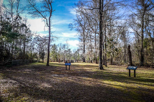
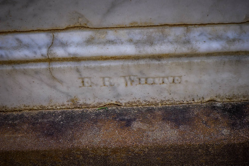
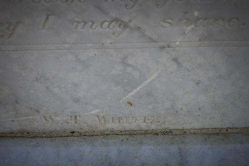
Marion’s grave was damage during storms and was replaced in 1993. The other graves seemed to be in good condition. There were MANY signature stones.
I left Belle Isle and continued westward. I was looking for where 45 crossed the canal. I must of missed it because I never really spotted it. I did spot the access road to our launch site on Angel’s Cove, so I drove down and checked that out for a minute.
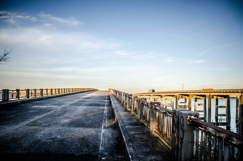
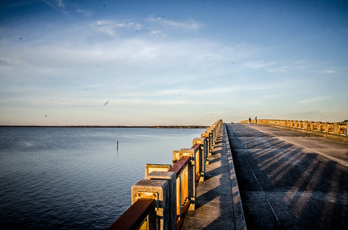
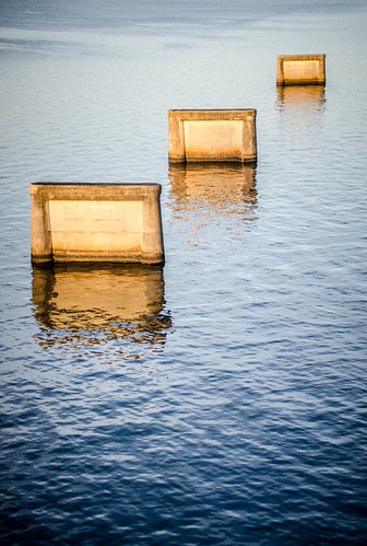
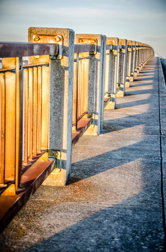
I connected with Highway 6 and headed northward, passing through Eutaw Springs and Eutawville. The motel I had selected was in the town of Santee. I had picked this one for several reasons. It just about the closest reasonably priced place to stay. Also, this night there was to be a penumbrel lunar eclipse AND a comet. I figured that the old US 301 fishing bridge would be a great place to observe these events. After checking into my motel I headed in that direction. I took a few photos in the setting sun.
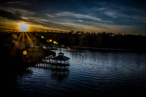
It wasn’t terribly cold, but there was a biting wind. I decided to go in search of dinner.
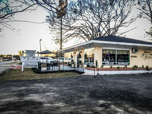
The Santee Seafood Bistro was a new restaurant in an old building associated with one of the US 301 hotels.
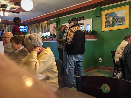
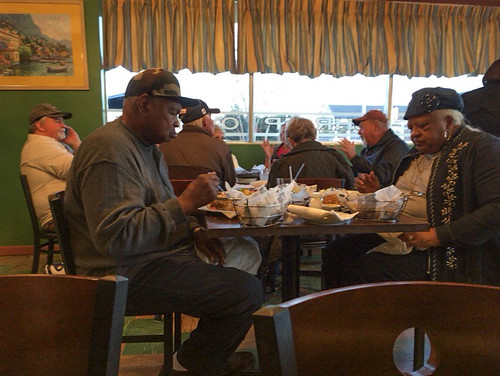
The place was crowded, and I didn’t think there was a seat available. I was prepared to sit and the small counter/bar, but was given a seat at a table that would have accommodated four. Shortly after I was seated several other came in and were made to wait. I could feel their critical eyes watching me squander a large table.
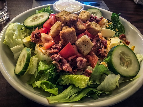
I started with a salad, then ordered lobster mac-n-cheese. The portions were enormous, and the prices quite reasonable. Both had excellent flavors.
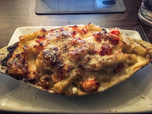
I couldn’t eat it all, but I was still stuffed. Worn out from the day’s explorations I decided not to pursue the astronomical observations/photography, but headed on back to the motel to turn in early.
One final note…
At the table next to me the large group was NOT from here. They had distinctly northern accents. I stopped for gas on my way back to the motel and heard more northern accents and spotted salt-covered vehicles with Ontario license plates. I was scratching my head. Was Santee such a draw for northerners? Then it dawned on me. Duh. We were right on I-95 and this was the first major stop with food and hotels for a LONG stretch.
The next day I’d meet up with m friends from Lowcountry Unfiltered and we would finally paddle this canal I had already researched and explored.
Hi, Tom,
Wish I could have met you when you were in Pineville; would have given you an ear-full of the history of Pineville (having lived here my 77 years, as my family/ancestry has been here on and around the Santee for over 300 years). There’s more history in the Pineville area than anywhere else in Berkeley County, as this was the largest settlement during the early eighteen hundreds. Really enjoying your photos / info. Keep it up. Keith Gourdin, Pineville, SC
Keith, from my brief visit I’ve seen that there is much more to explore. I will return! I’ll try to let you know when I’m back down that way.