Skip to content

Random Connections

A collection of photography and exploration focusing on Upstate South Carolina and beyond.

  • Home
  • About Us
  • Photos
  • Resources
  • Other Voices
  • Post Archives
  • Home
  • 2011
  • April

Month: April 2011

In Search of Blue Ghosts

Posted on April 28, 2011 By Tom 8 Comments on In Search of Blue Ghosts
Local, Science

Fake Blue Ghosts 2

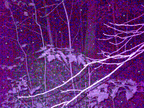
Wednesday evening is normally our night to watch Ghost Hunters.  This evening, however, we decided to hunt for our own ghosts.  Specifically, we were after the elusive Blue Ghost Firefly, Phausis reticulata.

Blue ghost fireflies only glow during mating season, and are only found in isolated areas in the Blue Ridge Mountains.  Both the males and females give off a constant bluish glow, unlike the fireflies in our area, which pulse on a regular basis.  The males hover about head-height off of the forest floor, while the pale, wingless females glow along the bottom of the forest.  The effect is mesmerizing, as these bluish orbs float through the woods.

The fireflies have a very limited range. They are found in undisturbed forested areas, often in the Smokey Mountains and in Dupont State Forest in North Carolina.

Read More “In Search of Blue Ghosts” »

More on Elevation Profiles

Posted on April 27, 2011 By Tom No Comments on More on Elevation Profiles
EdTech, Geocaching and Maps

A couple of posts back I wrote about discovering Elevation Profiles for Paths in Google Earth. I’ve spent a little bit more time working with this, and came up with another neat activity for a classroom.

In the last post I created a path with only two endpoints – basically a straight-line cross section. I also did this across fairly large areas of land, entire states, in fact. This activity focuses in on the details a bit, and uses the directions section of Google Earth.

First, go to the Directions tab and input two locations. These can be addresses, lat-long coordinates, or any other type of locator. For this activity, I suggest keeping the distances fairly short, probably within about 50 miles. Here are some suggestions:

  • From your home to your school, workplace, or church
  • Between two cities
  • Between your house and your best friend’s house

In the example below, I used Greenville and Spartanburg.

Screen shot 2011-04-27 at 6.17.33 AM

When you hit Enter or click on the magnifying glass search icon, you get driving directions between the two cities. For some strange reason Google Earth chose Wade Hampton Boulevard instead of I-85. I guess it went with the shortest route rather than the quickest. No matter – I can still illustrate the point.

Read More “More on Elevation Profiles” »

Easter Weekend 2011

Posted on April 25, 2011 By Tom No Comments on Easter Weekend 2011
Miscellaneous, Photography

Carnival Tilt Shift

Easter was much, much later this year. We had our district’s spring break back at the end of March, but Greenville held fast and had theirs during Holy Week. It seemed a bit strange to have Easter come and go and not get any time off. Even so, I got a chance to do some photography and spend some time with family.

Saturday we spend doing household chores – installing new light fixtures, installing a new AC in the basement, etc. Saturday afternoon/evening Chip called and wanted me to join his family at Haywood Mall’s Spring Carnival. He had just purchased a new DSLR and wanted to give it a test run. The bright lights and garish colors of a carnival always make for fun photography, so I headed on over.

Metaphotography

Little Olivia was mesmerized by all of the colors. It was a bit of sensory overload for an 18-month old, even with her mother and one set of grandparents there to keep things in check. She managed to ride the carousel not once, but twice…

Read More “Easter Weekend 2011” »

Gas Psychology

Posted on April 21, 2011 By Tom No Comments on Gas Psychology
Rants

Week 1 Price – $3.40 Reaction – Yikes! The End of the World! Vote everyone out of office!   Week 3 Price – $3.35 Reaction – Whew!  Breathing Room!  We can take it a bit easy and start driving again.   Week 5 Price – $3.50 Reaction – Yikes! The End of the World! Storm … Read More “Gas Psychology” »

Bad Creek Views

Posted on April 18, 2011 By Tom 2 Comments on Bad Creek Views
Local

The weather Sunday was beautiful, albeit a bit brisk. We decided that we needed to get out of the house for a bit, so Laura, her mother, and I hopped in the car for a drive and a picnic. We started by driving up scenic Highway 11 past Table Rock, then on up toward Lake … Read More “Bad Creek Views” »

Elevation Profiles in Google Earth

Posted on April 18, 2011 By Tom 4 Comments on Elevation Profiles in Google Earth
EdTech, Geocaching and Maps

File this one under “How the heck did I let this one slip past me?” I’ve just discovered Elevation Profiles for Paths in Google Earth. I have no idea when this became a part of Google Earth (years ago?) but I came across this feature as I was plotting my river routes for my Backyard to Ocean post.

For any given path in Google Earth, you can select Elevation Profile and it will display a graph showing the rise and fall of that path from sea level. This works for ANY path, regardless of length or the number of anchor points. For demonstration sake, though, I like to use a path with only two anchor points – a beginning and and end.

Let’s say, for example, that you create a straight line path across the continental United States. You have two anchor points – one on the west coast, and one on the east coast. Your path would look something like this…

US Selection

Once you have saved that path to My Places, you can right click on the path and select Show Elevation Profile from the menu. That would give you a graph like this…

United States

Read More “Elevation Profiles in Google Earth” »

From Backyard to Ocean

Posted on April 16, 2011 By Tom 8 Comments on From Backyard to Ocean
Geocaching and Maps, Paddling

Backyard2Ocean

Last night Laura and I were sitting out on our deck look out over the backyard and down to the lake. I wondered what would happen if I were to put my kayak in the water here and paddle it all the way to the ocean. What would I encounter? What rivers would I paddle?

Actually, I’ve got a pretty darn good idea. I’ve paddled and/or explored some sizeable chunks of that route, so I know a bit about it. My paddle route would take this path…

Lake Fairfield –> Brushy Creek –> Enoree River –> Broad River –> Congaree River –> Santee River –> Atlantic Ocean

I’d love to be able to do that whole route without ever having to leave the boat. Unfortunately, there are a few things like shoals, trees, strainers, and a few dams in the way, not to mention Parr Shoals Reservoir and Lake Marion.

Read More “From Backyard to Ocean” »

A Couple of 3D Favorites

Posted on April 14, 2011 By Tom No Comments on A Couple of 3D Favorites
Photography

I haven’t been doing much with my binocular camera setup lately.  Quite frankly, I find the dual camera system a bit awkward and clumsy.  There is a little carnival set up at Haywood Mall this weekend, and I’m hoping to take it over there for a few shots of the rides, etc. In the meantime, … Read More “A Couple of 3D Favorites” »

Lowcountry Unfiltered Does Ebenezer Creek

Posted on April 11, 2011 By Tom No Comments on Lowcountry Unfiltered Does Ebenezer Creek
Paddling

LCU on Ebenezer Creek

For our April Second Saturday Lowcountry Unfiltered trip, the group decided to head back to Ebenezer Creek. The last time our group had paddled this tributary of the Savannah River was a snowy February in 2010. I had planned to go on that trip, but a rare snowstorm prevented my joining them. I heard tales and saw photos of a cold snow-covered paddle through beautiful cypress cathedrals. I hated missing the first trip, and was really looking forward to this one.

Ebenezer Creek flows into the Savannah River at Ebenezer Landing, about 10 miles above where I-95 crosses the Savannah. The area is overflowing with history, as the site of one of the earliest settlements in Georgia, and the location of one of the worst betrayals of the Civil War.

Ebenezer Creek GPS Track

Our plan was to put in at Log Landing and paddle down to Ebenezer Landing for a 10.4 mile trip. This added about 3 miles to the group’s previous trip.

Read More “Lowcountry Unfiltered Does Ebenezer Creek” »

Port Wentworth Friday Nights

Posted on April 9, 2011 By Tom 2 Comments on Port Wentworth Friday Nights
Restaurants, Travel, Weirdness

For these lowcountry kayaking trips I often come down on Friday night so that I don’t have to get up so early on Saturday.  Wherever I am I like to find some place quirky and local for dinner, and this trip was no exception.

I checked at the front desk of the motel on I-95, and was informed that there were two good restaurants just up the street.  I scooted round the corner to the first, Silverado’s.

DSCN6955

The van, radio station banner, and balloons should have alerted me to trouble.  I walked in the door and was greeted by a plume of smoke, and a boozy greeting from a woman with stringy hair and fewer teeth than I have.

Well, howdy, you sharp-dressed man, and welcome to Silverado’s!  Have a seat on this here bar stool and buy me a drink!

No, thank you.  I had just driven all the way down straight from the office, and my slacks and white shirt stood out from the jeans and cowboy boots.  I glanced around.  Even if I had wanted to stay, none of the sparse tables between the pool tables and dance floor were available.

I guess the sign advertising Lingerie Lunch today should have also tipped me off.  I’d already missed it, and the smoke was more than I could bear, so I left.  I was after quirky, not hazardous.

Read More “Port Wentworth Friday Nights” »

Posts navigation

1 2 Next

Categories

  • EdTech (200)
  • Entertainment (201)
  • Family (120)
  • Gear (115)
  • General Technology (99)
  • Geocaching and Maps (208)
  • History and Genealogy (260)
  • Internet (144)
  • Local (449)
  • Miscellaneous (544)
  • Music (194)
  • Paddling (245)
  • Photography (779)
  • Podcast (6)
  • Rambling (226)
  • Rants (160)
  • Recipes (34)
  • Religion (48)
  • Restaurants (165)
  • Science (48)
  • Things Overheard (29)
  • Travel (410)
  • Uncategorized (129)
  • Washington Sabbatical (113)
  • Weirdness (60)

Recent Posts

  • Wilkinsville and a Mystery Church
  • A Farewell to the Greenville Chorale
  • Edisto River from Good Hope to Sullivan’s Landing
  • Paddling Lake Monticello
  • The Remnants of the City

Recent Comments

  • Kim Atchley on Journey to Nazareth
  • Tom on About Us
  • drew seibert on About Us
  • Doris Street on Orphaned Graveyards and Family Connections in Ninety Six
  • Tim Cathcart on Wilkinsville and a Mystery Church

Tags

blogging cemetery Christmas Columbia Edisto River edtech Entertainment family Flickr Florida Furman Furman University gear Georgia geotagging Ghost Town Ghost Towns Google Earth Google Maps GPS Greenville Greenville Chorale history Instructional Technology kayaking Lake Jocassee LCU Lowcountry Unfiltered maps Music North Carolina Paddling Photography rambling restaurant Restaurants review singing social networking South Carolina time-lapse Travel video Washington Washington State
April 2011
S M T W T F S
 12
3456789
10111213141516
17181920212223
24252627282930
« Mar   May »

Copyright © 2022 Random Connections.

Theme: Oceanly by ScriptsTown